How to get to The Pizza Factory by bus?
Click on the bus route to see step by step directions with maps, line arrival times and updated time schedules.
From Fracc. Lomas del Mirador, Aguascalientes
55 minFrom Anexo Palomino, Aguascalientes
52 minFrom Instituto del Deporte del Estado de Aguascalientes, Aguascalientes
43 minFrom Lomas Del Ajedrez, Aguascalientes
53 minFrom Soriana, Aguascalientes
47 minFrom Fracc. Lomas de Vista Bella, Aguascalientes
53 minFrom Fraccionamiento Olinda, Aguascalientes
53 minFrom Solidaridad III, Aguascalientes
68 minFrom Ojo de Agua, Aguascalientes
36 minFrom Los Juarez, Aguascalientes
60 min
Bus stop near The Pizza Factory in Aguascalientes
- Guadalupe Gonzalez Con Garza Sada, 3 min walk,VIEW
What are the closest stations to The Pizza Factory?
The closest stations to The Pizza Factory are:
- Guadalupe Gonzalez Con Garza Sada is 162 meters away, 3 min walk.
Which bus lines stop near The Pizza Factory?
These bus lines stop near The Pizza Factory: RUTA 19, RUTA 28.
What’s the nearest bus station to The Pizza Factory in Aguascalientes?
The nearest bus station to The Pizza Factory in Aguascalientes is Guadalupe Gonzalez Con Garza Sada. It’s a 3 min walk away.
What time is the first bus to The Pizza Factory in Aguascalientes?
The RUTA 19 is the first bus that goes to The Pizza Factory in Aguascalientes. It stops nearby at 6:16 AM.
What time is the last bus to The Pizza Factory in Aguascalientes?
The RUTA 19 is the last bus that goes to The Pizza Factory in Aguascalientes. It stops nearby at 9:58 PM.
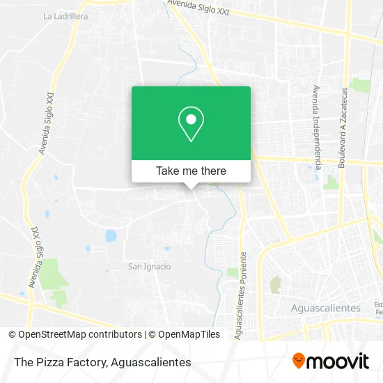
See The Pizza Factory, Aguascalientes, on the map
Public Transit to The Pizza Factory in Aguascalientes
Wondering how to get to The Pizza Factory in Aguascalientes? Moovit helps you find the best way to get to The Pizza Factory with step-by-step directions from the nearest public transit station.
Moovit provides free maps and live directions to help you navigate through your city. View schedules, routes, timetables, and find out how long does it take to get to The Pizza Factory in real time.
Looking for the nearest stop or station to The Pizza Factory? Check out this list of stops closest to your destination: Guadalupe Gonzalez Con Garza Sada.
Bus: RUTA 19, RUTA 28.
Want to see if there’s another route that gets you there at an earlier time? Moovit helps you find alternative routes or times. Get directions from and directions to The Pizza Factory easily from the Moovit App or Website.
We make riding to The Pizza Factory easy, which is why over 1.5 million users, including users in Aguascalientes, trust Moovit as the best app for public transit. You don’t need to download an individual bus app or train app, Moovit is your all-in-one transit app that helps you find the best bus time or train time available.
For information on prices of bus, costs and ride fares to The Pizza Factory, please check the Moovit app.
Use the app to navigate to popular places including to the airport, hospital, stadium, grocery store, mall, coffee shop, school, college, and university.
The Pizza Factory Address: Avenida Eugenio Garza Sada 131D, Cond Res Campestre Club de Golf, 20130 Pocitos, Aguascalientes street in Aguascalientes
- Tercer Anillo,
- Proveedora de Materiales Peña Sucursal Aguascalientes,
- Vidrio y Aluminio Loci,
- Cerrajería La Llave Maestra,
- Parque Industrial Tecnopolo,
- WESTERN UNION,
- Residencial Campestre Los Fresnos,
- Balannce Total Pilates Reformer,
- Casa de Piedra,
- Vintage Bazar,
- Gasol Est Pocitos,
- Classics Burger,
- Buca Express II,
- Panadería La Nueva Ideal Sucursal Garza Sada,
- Ctro de des Educativo Pocitos,
- Centro de Maestros 0102,
- Dimeco,
- Quinta San Joaquín & Los Cascabeles,
- Parque Acuatico Valladolid Oficial,
- Salon de Eventos El Country
Places Near The Pizza Factory (Aguascalientes)
- Hospital Imss No. 3, Aguascalientes,
- La Isla San Marcos, Aguascalientes,
- Imss Clinica 1, Aguascalientes,
- Jesús María, Aguascalientes,
- Ciudad industrial, Aguascalientes,
- Parque Las Tres Centurias, Aguascalientes,
- Blvd. Luis Donaldo Colosio, Aguascalientes,
- Isla San Marcos, Aguascalientes,
- Centro, Aguascalientes,
- Villas de Nuestra Señora de la Asunción, Aguascalientes,
- clinica 3 uaa, Aguascalientes,
- ESPACIOS, Aguascalientes,
- Aeropuerto de Aguascalientes S.A. de C.V., Aguascalientes,
- Universidad Autónoma de Aguascalientes, Aguascalientes,
- Villasuncion, Aguascalientes,
- Agropecuario, Aguascalientes,
- Centro Comercial Altaria, Aguascalientes,
- Central De Autobuses, Aguascalientes,
- Terminal De Combis, Aguascalientes,
- Nuevo Hospital Hidalgo, Aguascalientes
How to get to popular places in Aguascalientes with public transit
Get around Aguascalientes by public transit!
Traveling around Aguascalientes has never been so easy. See step by step directions as you travel to any attraction, street or major public transit station. View bus and train schedules, arrival times, service alerts and detailed routes on a map, so you know exactly how to get to anywhere in Aguascalientes.
When traveling to any destination around Aguascalientes use Moovit's Live Directions with Get Off Notifications to know exactly where and how far to walk, how long to wait for your line, and how many stops are left. Moovit will alert you when it's time to get off — no need to constantly re-check whether yours is the next stop.
Wondering how to use public transit in Aguascalientes or how to pay for public transit in Aguascalientes? Moovit public transit app can help you navigate your way with public transit easily, and at minimum cost. It includes public transit fees, ticket prices, and costs. Looking for a map of Aguascalientes public transit lines? Moovit public transit app shows all public transit maps in Aguascalientes with all bus routes and stops on an interactive map.
Aguascalientes has 1 transit type(s), including: bus, operated by several transit agencies, including Coordinación General de Movilidad