Directions to The Primitive Place (Harrisonburg) with public transportation
The following transit lines have routes that pass near The Primitive Place
 Bus: BRCC NORTH, BLUE, GOLD, GOLD, JMU SUMMER GOLD.
Bus stops near The Primitive Place in Harrisonburg
Bus lines to The Primitive Place in Harrisonburg
- BLUE, JMU Blue Line,VIEW
- GOLD, JMU Gold (Weekdays),VIEW
- GOLD, JMU Gold (Saturday),VIEW
- JMU SUMMER GOLD, JMU Summer Gold,VIEW
- 1, Route 1,VIEW
- 1-B, Route 1-B,VIEW
- EXT 1, Extended Route 1,VIEW
- 2, Route 2,VIEW
- 2-B, Route 2-B,VIEW
- EXT 2, Extended Route 2,VIEW
- SHOP, JMU Sunday Shopper,VIEW
- SHOP, JMU Shopper,VIEW
- PINK, JMU Pink Line,VIEW
- PURPLE, JMU Purple Line,VIEW
- 6, Route 6,VIEW
- 6-B, Route 6-B,VIEW
- EXT 6, Extended Route 6,VIEW
- Bare Minerals,
- Studio,
- Stephen Krech - Financial Advisor, Ameriprise Financial Services,
- Waymont Wealth Advisors - Ameriprise Financial Services,
- Mather Architects,
- Lena's Tailor Shop,
- Primary Residential Mortgage,
- Zirkles,
- Emergicare,
- Ricoh USA,
- Emergicare Of Harrisonburg,
- Stylez Salon,
- Classic Alterations by Lena,
- Evans Driver,
- Ameriprise Financial,
- Parker David L,
- Tatyana Chepelyuk Insurance,
- Lincoln National Insurance,
- Landmark Business Solutions,
- Medical Billing & Management Services
Places Near The Primitive Place (Harrisonburg)
- Warner Theatre, Washington,
- M&T Bank Stadium, Baltimore,
- Museum Of The Bible, Washington,
- National Museum of African American History and Culture, Washington,
- Rock Creek Tennis Center, Washington,
- PG Mall, Prince George's County,
- National Mall, Washington,
- The Anthem, Washington,
- Amazon Hq2, Arlington County,
- Washington National Cathedral, Washington,
- Washington DC VA Medical Center, Washington,
- Georgetown, Washington,
- Camden Yards, Baltimore,
- Marriott Marquis Washington, DC, Washington,
- National Zoo, Washington,
- Pennsylvania Ave NW (3rd st and pennsylvania), Washington,
- Sibley Memorial Hospital, Washington,
- Basilica of the National Shrine, Washington,
- Westfield Montgomery Mall, Montgomery County,
- Capital One Arena, Washington
How to get to popular places in Washington, D.C. - Baltimore, MD with public transit
What are the closest stations to The Primitive Place?
The closest stations to The Primitive Place are:
- Lucy Dr. @ Deyerle Ave. is 173 yards away, 3 min walk.
- Neff Ave. @ Deyerle Ave. is 185 yards away, 3 min walk.
- University Blvd. Across From Deyerle Ave. is 534 yards away, 7 min walk.
- Neff Ave. @ Reservoir St. is 776 yards away, 10 min walk.
- Reservoir St. @ Harrisonburg Family Practice is 864 yards away, 11 min walk.
Which bus line stops near The Primitive Place?
BRCC NORTH (Brcc)
What’s the nearest bus station to The Primitive Place in Harrisonburg?
The nearest bus stations to The Primitive Place in Harrisonburg are Lucy Dr. @ Deyerle Ave. and Neff Ave. @ Deyerle Ave.. The closest one is a 3 min walk away.
What time is the first bus to The Primitive Place in Harrisonburg?
The 1 is the first bus that goes to The Primitive Place in Harrisonburg. It stops nearby at 6:43 AM.
What time is the last bus to The Primitive Place in Harrisonburg?
The 1-B is the last bus that goes to The Primitive Place in Harrisonburg. It stops nearby at 10:32 PM.
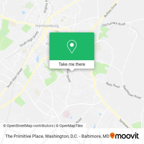
See The Primitive Place, Harrisonburg, on the map
Public Transit to The Primitive Place in Harrisonburg
Wondering how to get to The Primitive Place in Harrisonburg? Moovit helps you find the best way to get to The Primitive Place with step-by-step directions from the nearest public transit station.
Moovit provides free maps and live directions to help you navigate through your city. View schedules, routes, timetables, and find out how long does it take to get to The Primitive Place in real time.
Looking for the nearest stop or station to The Primitive Place? Check out this list of stops closest to your destination: Lucy Dr. @ Deyerle Ave.; Neff Ave. @ Deyerle Ave.; University Blvd. Across From Deyerle Ave.; Neff Ave. @ Reservoir St.; Reservoir St. @ Harrisonburg Family Practice.
Bus: BRCC NORTH, BLUE, GOLD, GOLD, JMU SUMMER GOLD, 1, 2, 2-B, EXT 2, SHOP, SHOP, PINK, PURPLE, 6, 6-B, EXT 6.
Want to see if there’s another route that gets you there at an earlier time? Moovit helps you find alternative routes or times. Get directions from and directions to The Primitive Place easily from the Moovit App or Website.
We make riding to The Primitive Place easy, which is why over 1.5 million users, including users in Harrisonburg, trust Moovit as the best app for public transit. You don’t need to download an individual bus app or train app, Moovit is your all-in-one transit app that helps you find the best bus time or train time available.
For information on prices of train and bus, costs and ride fares to The Primitive Place, please check the Moovit app.
Use the app to navigate to popular places including to the airport, hospital, stadium, grocery store, mall, coffee shop, school, college, and university.
The Primitive Place Address: 353 Neff Ave Harrisonburg, VA 22801 street in Harrisonburg
Get around Harrisonburg by public transit!
Traveling around Harrisonburg has never been so easy. See step by step directions as you travel to any attraction, street or major public transit station. View bus and train schedules, arrival times, service alerts and detailed routes on a map, so you know exactly how to get to anywhere in Harrisonburg.
When traveling to any destination around Harrisonburg use Moovit's Live Directions with Get Off Notifications to know exactly where and how far to walk, how long to wait for your line, and how many stops are left. Moovit will alert you when it's time to get off — no need to constantly re-check whether yours is the next stop.
Wondering how to use public transit in Harrisonburg or how to pay for public transit in Harrisonburg? Moovit public transit app can help you navigate your way with public transit easily, and at minimum cost. It includes public transit fees, ticket prices, and costs. Looking for a map of Harrisonburg public transit lines? Moovit public transit app shows all public transit maps in Harrisonburg with all Bus, Train, Metro, Light Rail and Ferry routes and stops on an interactive map.
Washington, D.C. - Baltimore, MD has 5 transit type(s), including: Bus, Train, Metro, Light Rail and Ferry, operated by several transit agencies, including WMATA, Montgomery County Ride On, Fairfax Connector, TheBus, PRTC, DASH - Alexandria, Arlington Transit (ART), RTA of Central Maryland, MDOT MTA, MDOT MTA Light RailLink, MDOT MTA Commuter Bus, MDOT MTA Local Bus, FXBGO!, Virginia Railway Express (VRE) and MARC