How to get to The Ups Store by bus?
Click on the bus route to see step by step directions with maps, line arrival times and updated time schedules.
From Riverside Square Mall, Hackensack
42 minFrom 11A Bus to Port Authority, Spring Valley
190 minFrom IKEA Paramus, Paramus
46 minFrom Paramus, NJ, Paramus
51 minFrom Hackensack Hospital, Hackensack
54 minFrom Garden State Plaza, Paramus
52 minFrom Hackensack, NJ, Hackensack
40 minFrom Rockland #45 Express Bus to Port Authority Bus Terminal, NYC, Spring Valley
190 minFrom Bergen Community College, Paramus
60 minFrom Teaneck, NJ, Teaneck
56 min
How to get to The Ups Store by train?
Click on the train route to see step by step directions with maps, line arrival times and updated time schedules.
Bus stop near The Ups Store in Westwood
- 3rd Ave at Park Ave, 9 min walk,VIEW
Train station near The Ups Store in Westwood
- Park Ridge, 20 min walk,VIEW
Bus lines to The Ups Store in Westwood
- 165, Westwood,VIEW
What are the closest stations to The Ups Store?
The closest stations to The Ups Store are:
- 3rd Ave at Park Ave is 727 yards away, 9 min walk.
- Park Ridge is 1719 yards away, 20 min walk.
Which bus line stops near The Ups Store?
165 (Westwood)
Which train line stops near The Ups Store?
PVL (Hoboken)
What’s the nearest train station to The Ups Store in Westwood?
The nearest train station to The Ups Store in Westwood is Park Ridge. It’s a 20 min walk away.
What’s the nearest bus station to The Ups Store in Westwood?
The nearest bus station to The Ups Store in Westwood is 3rd Ave at Park Ave. It’s a 9 min walk away.
What time is the first train to The Ups Store in Westwood?
The PVL is the first train that goes to The Ups Store in Westwood. It stops nearby at 5:24 AM.
What time is the last train to The Ups Store in Westwood?
The PVL is the last train that goes to The Ups Store in Westwood. It stops nearby at 12:35 AM.
What time is the first bus to The Ups Store in Westwood?
The 165 is the first bus that goes to The Ups Store in Westwood. It stops nearby at 3:59 AM.
What time is the last bus to The Ups Store in Westwood?
The 165 is the last bus that goes to The Ups Store in Westwood. It stops nearby at 2:16 AM.
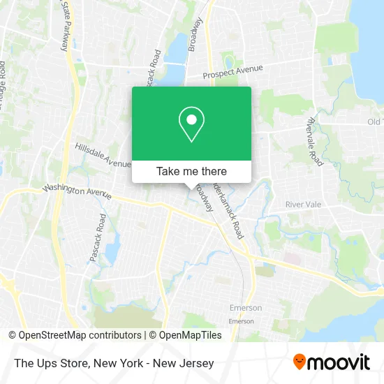
See The Ups Store, Westwood, on the map
Public Transit to The Ups Store in Westwood
Wondering how to get to The Ups Store in Westwood? Moovit helps you find the best way to get to The Ups Store with step-by-step directions from the nearest public transit station.
Moovit provides free maps and live directions to help you navigate through your city. View schedules, routes, timetables, and find out how long does it take to get to The Ups Store in real time.
Looking for the nearest stop or station to The Ups Store? Check out this list of stops closest to your destination: 3rd Ave at Park Ave; Park Ridge.
Bus: 165.Train: PVL.
Want to see if there’s another route that gets you there at an earlier time? Moovit helps you find alternative routes or times. Get directions from and directions to The Ups Store easily from the Moovit App or Website.
We make riding to The Ups Store easy, which is why over 1.5 million users, including users in Westwood, trust Moovit as the best app for public transit. You don’t need to download an individual bus app or train app, Moovit is your all-in-one transit app that helps you find the best bus time or train time available.
For information on prices of bus and train, costs and ride fares to The Ups Store, please check the Moovit app.
Use the app to navigate to popular places including to the airport, hospital, stadium, grocery store, mall, coffee shop, school, college, and university.
The Ups Store Address: 700 Broadway street in Westwood
- Gnc,
- Payless Shoesource,
- Supercuts,
- Bondpanel Garage Door Repair,
- Broadway Pizzeria,
- European Wax Center,
- Just-A-Buck and Beyond,
- Keyme Locksmiths,
- Judy's Nails,
- Firewood Asap,
- Let’S Wire It,
- Maag Studios,
- Winemartnj,
- Rca Capital,
- Nugent Park,
- Kmart Westwood #3202,
- Western Union,
- Jimmy Nails,
- Sears Home Services,
- Westwood
Places Near The Ups Store (Westwood)
- Queens Center Mall, Queens,
- Wall Street, Manhattan,
- 111 Centre New York City Supreme Court, Manhattan,
- Katz's Deli, Manhattan,
- 376 Hudson Street, Manhattan,
- Rockefeller Center, Manhattan,
- 66 John Street, Manhattan,
- Times Square, Manhattan,
- Mountainside Hospital, Glen Ridge,
- 1 Police Plaza, Manhattan,
- 911 Memorial, Manhattan,
- San Gennaro Feast, Manhattan,
- Bellevue Hospital, Manhattan,
- Pier 83, Manhattan,
- Chinatown, Manhattan,
- Hudson Yards, Manhattan,
- SoHo, Manhattan,
- qqqq, Manhattan,
- 3 Stone St, Manhattan,
- 26 Federal Plaza, Manhattan
How to get to popular places in New York - New Jersey with public transit
Get around Westwood by public transit!
Traveling around Westwood has never been so easy. See step by step directions as you travel to any attraction, street or major public transit station. View bus and train schedules, arrival times, service alerts and detailed routes on a map, so you know exactly how to get to anywhere in Westwood.
When traveling to any destination around Westwood use Moovit's Live Directions with Get Off Notifications to know exactly where and how far to walk, how long to wait for your line, and how many stops are left. Moovit will alert you when it's time to get off — no need to constantly re-check whether yours is the next stop.
Wondering how to use public transit in Westwood or how to pay for public transit in Westwood? Moovit public transit app can help you navigate your way with public transit easily, and at minimum cost. It includes public transit fees, ticket prices, and costs. Looking for a map of Westwood public transit lines? Moovit public transit app shows all public transit maps in Westwood with all Bus, Train, Subway, Light Rail, Ferry and Cable Car routes and stops on an interactive map.
New York - New Jersey has 6 transit type(s), including: Bus, Train, Subway, Light Rail, Ferry and Cable Car, operated by several transit agencies, including MTA Subway, Metro-North Railroad, LIRR, PATH, MTA New York City Transit - Express routes, MTA Bus, NJ Transit, NYC Ferry, NICE bus, Bee-Line Bus, NJ Transit Rail, Norwalk Transit District, Hartford Line, River Valley Transit and HART