How to get to The Ups Store by bus?
Click on the bus route to see step by step directions with maps, line arrival times and updated time schedules.
Bus stop near The Ups Store in Saint Mary's County
- Park Ave. And Washington St., 8 min walk,VIEW
Bus lines to The Ups Store in Saint Mary's County
What are the closest stations to The Ups Store?
The closest stations to The Ups Store are:
- Park Ave. And Washington St. is 605 yards away, 8 min walk.
Which bus line stops near The Ups Store?
2 (Leonardtown)
What’s the nearest bus station to The Ups Store in Saint Mary's County?
The nearest bus station to The Ups Store in Saint Mary's County is Park Ave. And Washington St.. It’s a 8 min walk away.
What time is the first bus to The Ups Store in Saint Mary's County?
The 2 is the first bus that goes to The Ups Store in Saint Mary's County. It stops nearby at 5:53 AM.
What time is the last bus to The Ups Store in Saint Mary's County?
The 3 is the last bus that goes to The Ups Store in Saint Mary's County. It stops nearby at 6:13 PM.
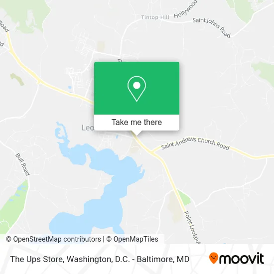
See The Ups Store, Saint Mary's County, on the map
Public Transit to The Ups Store in Saint Mary's County
Wondering how to get to The Ups Store in Saint Mary's County? Moovit helps you find the best way to get to The Ups Store with step-by-step directions from the nearest public transit station.
Moovit provides free maps and live directions to help you navigate through your city. View schedules, routes, timetables, and find out how long does it take to get to The Ups Store in real time.
Looking for the nearest stop or station to The Ups Store? Check out this list of stops closest to your destination: Park Ave. And Washington St..
Bus: 2, 3, 12.
Want to see if there’s another route that gets you there at an earlier time? Moovit helps you find alternative routes or times. Get directions from and directions to The Ups Store easily from the Moovit App or Website.
We make riding to The Ups Store easy, which is why over 1.7 million users, including users in Saint Mary's County, trust Moovit as the best app for public transit. You don’t need to download an individual bus app or train app, Moovit is your all-in-one transit app that helps you find the best bus time or train time available.
For information on prices of bus, costs and ride fares to The Ups Store, please check the Moovit app.
Use the app to navigate to popular places including to the airport, hospital, stadium, grocery store, mall, coffee shop, school, college, and university.
The Ups Store Address: 22650 Cedar Lane Ct street in Saint Mary's County
- St Mary's Medical Arts Building,
- Medstar Shah Medical Group at St. Mary's Medical Arts,
- Avani D Shah Md,
- Cedar Lane Pharmacy,
- Np Family Practice,
- Flavaz Catering & Food Services,
- Regent Healthcare, Inc.,
- Cedar Lane Apartments - Colton-Weinberg Building,
- Oasis Hair Studios,
- Beauty by Monnie,
- St Mary's Ryken High School,
- Jcfit Kids,
- Master Chan Sung's Black Belt Academy,
- Linear Surveys Inc,
- Chief Season,
- I Can Handyman Llc,
- The Trend,
- A And M Glass And Home Improvement Company,
- The Fenwick Inn,
- Gathered Roots Boutique
Places Near The Ups Store (Saint Mary's County)
- Westfield Montgomery Mall, Montgomery County,
- Capital One Arena, Washington,
- Rock Creek Tennis Center, Washington,
- Georgetown, Washington,
- Amazon Hq2, Arlington County,
- Washington National Cathedral, Washington,
- Basilica of the National Shrine, Washington,
- M&T Bank Stadium, Baltimore,
- Warner Theatre, Washington,
- National Zoo, Washington,
- Camden Yards, Baltimore,
- The Anthem, Washington,
- Museum Of The Bible, Washington,
- Washington DC VA Medical Center, Washington,
- National Theatre, Washington,
- National Museum of African American History and Culture, Washington,
- Pennsylvania Ave NW (3rd st and pennsylvania), Washington,
- Sibley Memorial Hospital, Washington,
- Marriott Marquis Washington, DC, Washington,
- PG Mall, Prince George's County
How to get to popular places in Washington, D.C. - Baltimore, MD with public transit
Get around Saint Mary's County by public transit!
Traveling around Saint Mary's County has never been so easy. See step by step directions as you travel to any attraction, street or major public transit station. View bus and train schedules, arrival times, service alerts and detailed routes on a map, so you know exactly how to get to anywhere in Saint Mary's County.
When traveling to any destination around Saint Mary's County use Moovit's Live Directions with Get Off Notifications to know exactly where and how far to walk, how long to wait for your line, and how many stops are left. Moovit will alert you when it's time to get off — no need to constantly re-check whether yours is the next stop.
Wondering how to use public transit in Saint Mary's County or how to pay for public transit in Saint Mary's County? Moovit public transit app can help you navigate your way with public transit easily, and at minimum cost. It includes public transit fees, ticket prices, and costs. Looking for a map of Saint Mary's County public transit lines? Moovit public transit app shows all public transit maps in Saint Mary's County with all Bus, Train, Metro, Light Rail and Ferry routes and stops on an interactive map.
Washington, D.C. - Baltimore, MD has 5 transit type(s), including: Bus, Train, Metro, Light Rail and Ferry, operated by several transit agencies, including WMATA, Montgomery County Ride On, Fairfax Connector, TheBus, PRTC, DASH - Alexandria, Arlington Transit (ART), RTA of Central Maryland, MDOT MTA, MDOT MTA Light RailLink, MDOT MTA Commuter Bus, MDOT MTA Local Bus, FXBGO!, Virginia Railway Express (VRE) and MARC