How to get to The Vector Student Newspaper by bus?
Click on the bus route to see step by step directions with maps, line arrival times and updated time schedules.
From Walmart, Jersey City
75 minFrom IKEA Elizabeth Shuttle Bus To Manhattan, Elizabeth
39 minFrom Community Lines, Jersey City
42 minFrom Saint Barnabas Medical Center, Livingston
43 minFrom Jersey City, NJ, Jersey City
65 minFrom John F Kennedy Blvd, Jersey City
56 minFrom Journal Square, Jersey City
57 minFrom The Mills At Jersey Gardens, Elizabeth
65 minFrom Orange, NJ, City Of Orange
31 minFrom Hudson County Courthouse, Jersey City
65 min
How to get to The Vector Student Newspaper by train?
Click on the train route to see step by step directions with maps, line arrival times and updated time schedules.
Bus stops near The Vector Student Newspaper in Newark
Light Rail stations near The Vector Student Newspaper in Newark
- Washington Street Light Rail Station, 5 min walk,VIEW
Bus lines to The Vector Student Newspaper in Newark
- 24, E Eliz Jrsy Gardens Via Scotland & Eliz Av,VIEW
- 44, Nwk Penn Station,VIEW
- 29, X Newark Penn Sta - Express,VIEW
- 41, Newark Penn Station,VIEW
- 71, Fairfield Loop Via Henderson,VIEW
- 73, I-280 Express Newark Via Eisenhower Parkway,VIEW
- 108, New York Via Union City,VIEW
- 11, Newark - Willowbrook,VIEW
- 28, Newark - Montclair State - Willowbrook,VIEW
- 30, North Arlington-Kearny-Newark,VIEW
- 72, Paterson - Bloomfield - Newark,VIEW
- 76, Newark - Hackensack,VIEW
- 78, Newark - Secaucus,VIEW
- 79, X Newark,VIEW
- 99, Clifton Ave Newark Lt Rail Branch Brook Park Station,VIEW
What are the closest stations to The Vector Student Newspaper?
The closest stations to The Vector Student Newspaper are:
- Central Ave at Colden St is 59 yards away, 1 min walk.
- Central Ave at D.M.L. King Blvd is 268 yards away, 4 min walk.
- Washington Street Light Rail Station is 386 yards away, 5 min walk.
- University Ave at Central Ave is 479 yards away, 6 min walk.
- Warren St at Cornerstone Ln is 606 yards away, 8 min walk.
- Orange St at Boyden St is 657 yards away, 8 min walk.
Which bus lines stop near The Vector Student Newspaper?
These bus lines stop near The Vector Student Newspaper: 108, 24, 73.
Which train lines stop near The Vector Student Newspaper?
These train lines stop near The Vector Student Newspaper: MEL, RED.
Which light rail line stops near The Vector Student Newspaper?
NLR (Grove Street)
What’s the nearest light rail station to The Vector Student Newspaper in Newark?
The nearest light rail station to The Vector Student Newspaper in Newark is Washington Street Light Rail Station. It’s a 5 min walk away.
What’s the nearest bus station to The Vector Student Newspaper in Newark?
The nearest bus station to The Vector Student Newspaper in Newark is Central Ave at Colden St. It’s a 1 min walk away.
What time is the first light rail to The Vector Student Newspaper in Newark?
The NLR is the first light rail that goes to The Vector Student Newspaper in Newark. It stops nearby at 4:25 AM.
What time is the last light rail to The Vector Student Newspaper in Newark?
The NLR is the last light rail that goes to The Vector Student Newspaper in Newark. It stops nearby at 1:20 AM.
What time is the first bus to The Vector Student Newspaper in Newark?
The 29 is the first bus that goes to The Vector Student Newspaper in Newark. It stops nearby at 4:55 AM.
What time is the last bus to The Vector Student Newspaper in Newark?
The 108 is the last bus that goes to The Vector Student Newspaper in Newark. It stops nearby at 1:56 AM.
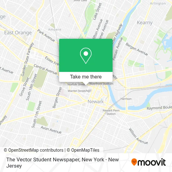
See The Vector Student Newspaper, Newark, on the map
Public Transit to The Vector Student Newspaper in Newark
Wondering how to get to The Vector Student Newspaper in Newark? Moovit helps you find the best way to get to The Vector Student Newspaper with step-by-step directions from the nearest public transit station.
Moovit provides free maps and live directions to help you navigate through your city. View schedules, routes, timetables, and find out how long does it take to get to The Vector Student Newspaper in real time.
Looking for the nearest stop or station to The Vector Student Newspaper? Check out this list of stops closest to your destination: Central Ave at Colden St; Central Ave at D.M.L. King Blvd; Washington Street Light Rail Station; University Ave at Central Ave; Warren St at Cornerstone Ln; Orange St at Boyden St.
Bus: 108, 24, 73, 44, 29, 41, 71, 11, 28, 30, 72, 76, 79, 99.Train: MEL, RED.Light Rail: NLR.
Want to see if there’s another route that gets you there at an earlier time? Moovit helps you find alternative routes or times. Get directions from and directions to The Vector Student Newspaper easily from the Moovit App or Website.
We make riding to The Vector Student Newspaper easy, which is why over 1.5 million users, including users in Newark, trust Moovit as the best app for public transit. You don’t need to download an individual bus app or train app, Moovit is your all-in-one transit app that helps you find the best bus time or train time available.
For information on prices of bus, train and light rail, costs and ride fares to The Vector Student Newspaper, please check the Moovit app.
Use the app to navigate to popular places including to the airport, hospital, stadium, grocery store, mall, coffee shop, school, college, and university.
The Vector Student Newspaper Address: 150 Bleeker St street in Newark
- Njit Mail Box,
- Highlander Pub at Njit,
- Gourmet Sandwich Shop,
- Njit Office Of Student Life,
- NJIT Campus Center,
- Pro Chimney Services,
- NJIT Campus Center Atrium,
- Highlander Pub,
- One Fifty Bleeker Stre,
- The Learning Center - Tlc,
- New & Used Tire,
- Njit Murray Center For Women In Technology,
- Njit Office Of Global Initiatives,
- Jim Wise Theatre at Njit,
- Sigma Pi Fraternity Alpha Mu,
- Kappa Eta Tke - Njit,
- Walgreens Specialty Pharmacy,
- Qunnections Management Group,
- Njit Multicultural Greek Council,
- Njit Parking
Places Near The Vector Student Newspaper (Newark)
- 376 Hudson Street, Manhattan,
- San Gennaro Feast, Manhattan,
- Queens Center Mall, Queens,
- 911 Memorial, Manhattan,
- Katz's Deli, Manhattan,
- Wall Street, Manhattan,
- SoHo, Manhattan,
- 111 Centre New York City Supreme Court, Manhattan,
- Bellevue Hospital, Manhattan,
- Pier 83, Manhattan,
- 26 Federal Plaza, Manhattan,
- Mountainside Hospital, Glen Ridge,
- 3 Stone St, Manhattan,
- qqqq, Manhattan,
- 66 John Street, Manhattan,
- Chinatown, Manhattan,
- Rockefeller Center, Manhattan,
- 1 Police Plaza, Manhattan,
- Hudson Yards, Manhattan,
- Times Square, Manhattan
How to get to popular places in New York - New Jersey with public transit
Get around Newark by public transit!
Traveling around Newark has never been so easy. See step by step directions as you travel to any attraction, street or major public transit station. View bus and train schedules, arrival times, service alerts and detailed routes on a map, so you know exactly how to get to anywhere in Newark.
When traveling to any destination around Newark use Moovit's Live Directions with Get Off Notifications to know exactly where and how far to walk, how long to wait for your line, and how many stops are left. Moovit will alert you when it's time to get off — no need to constantly re-check whether yours is the next stop.
Wondering how to use public transit in Newark or how to pay for public transit in Newark? Moovit public transit app can help you navigate your way with public transit easily, and at minimum cost. It includes public transit fees, ticket prices, and costs. Looking for a map of Newark public transit lines? Moovit public transit app shows all public transit maps in Newark with all Bus, Train, Subway, Light Rail, Ferry and Cable Car routes and stops on an interactive map.
New York - New Jersey has 6 transit type(s), including: Bus, Train, Subway, Light Rail, Ferry and Cable Car, operated by several transit agencies, including MTA Subway, Metro-North Railroad, LIRR, PATH, MTA New York City Transit - Express routes, MTA Bus, NJ Transit, NYC Ferry, NICE bus, Bee-Line Bus, NJ Transit Rail, Norwalk Transit District, Hartford Line, River Valley Transit and HART