How to get to The Week by bus?
Click on the bus route to see step by step directions with maps, line arrival times and updated time schedules.
How to get to The Week by train?
Click on the train route to see step by step directions with maps, line arrival times and updated time schedules.
How to get to The Week by subway?
Click on the subway route to see step by step directions with maps, line arrival times and updated time schedules.
Bus stops near The Week in Manhattan
Subway stations near The Week in Manhattan
Bus lines to The Week in Manhattan
- BXM7, Co-Op City Dreiser Loop Via Bruckner Exy,VIEW
- BXM8, Pelham Bay Westchester Ave Via Bruckner Bl,VIEW
- BXM10, Williamsbridge Boston Rd Via Morris Pk Av Via Eastchstr Rd,VIEW
- SIM23, Annadale - Midtown Manhattan Express,VIEW
- SIM24, Prince's Bay - Midtown Manhattan Express,VIEW
- M3, 125 St St. Nicholas Av,VIEW
- M4, Broadway-135 St,VIEW
- M1, Limited Harlem 147 St Via Madison Av,VIEW
- M2, Limited Washington Hts Broadway-168 St,VIEW
- Q32, Jackson Heights,VIEW
- BXM6, Parkchester Met Oval Via Metro Av,VIEW
- BXM9, Throgs Neck Layton Av Via Tremont Av Via Harding Av,VIEW
- BXM18, Riverdale 263 St Via Madison Av Via H. Hudson Pky,VIEW
- M42, East Side U N-1 Av Crosstown,VIEW
- X27, Bay Ridge - Manhattan Express,VIEW
- X28, Sea Gate / Bensonhurst - Manhattan Express,VIEW
- X37, Bay Ridge - Midtown Manhattan Express,VIEW
- X38, Sea Gate / Bensonhurst - Midtown Manhattan Express,VIEW
- 42ND ST, E 42nd St & 3rd Ave,VIEW
- BXM1, East Midtown 34 St Via Lex Av,VIEW
What are the closest stations to The Week?
The closest stations to The Week are:
- Madison Av/E 44 St is 67 yards away, 1 min walk.
- Madison Av/E 43 St is 81 yards away, 2 min walk.
- Madison Av/E 42 St is 83 yards away, 2 min walk.
- E 42 St/Park Av is 161 yards away, 3 min walk.
- E 42nd St & Park Ave is 175 yards away, 3 min walk.
- Lexington Av/E 42 St is 215 yards away, 4 min walk.
- Lexington Av/E 45 St is 219 yards away, 3 min walk.
- 42 St-Bryant Pk is 569 yards away, 7 min walk.
- Grand Central-42 St is 640 yards away, 8 min walk.
Which bus lines stop near The Week?
These bus lines stop near The Week: BM2, BM5, BXM8, M103, M4, M42, QM34, QM42.
Which train lines stop near The Week?
These train lines stop near The Week: 1, 2, BABYLON BRANCH, RONKONKOMA BRANCH, YEL.
Which subway lines stop near The Week?
These subway lines stop near The Week: 4, 5, 6, 6X, M, S.
What’s the nearest subway station to The Week in Manhattan?
The nearest subway station to The Week in Manhattan is 42 St-Bryant Pk. It’s a 7 min walk away.
What’s the nearest bus station to The Week in Manhattan?
The nearest bus station to The Week in Manhattan is Madison Av/E 44 St. It’s a 1 min walk away.
What time is the first subway to The Week in Manhattan?
The 6 is the first subway that goes to The Week in Manhattan. It stops nearby at 3:04 AM.
What time is the last subway to The Week in Manhattan?
The D is the last subway that goes to The Week in Manhattan. It stops nearby at 3:52 AM.
What time is the first bus to The Week in Manhattan?
The M101 is the first bus that goes to The Week in Manhattan. It stops nearby at 3:04 AM.
What time is the last bus to The Week in Manhattan?
The M103 is the last bus that goes to The Week in Manhattan. It stops nearby at 3:14 AM.
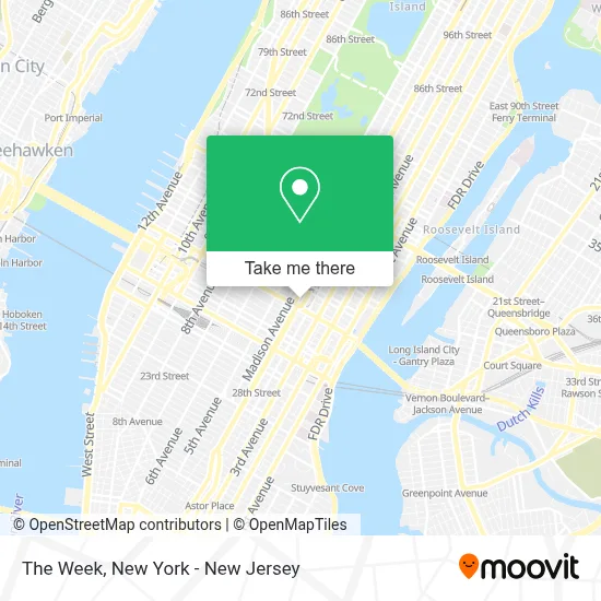
See The Week, Manhattan, on the map
Public Transit to The Week in Manhattan
Wondering how to get to The Week in Manhattan? Moovit helps you find the best way to get to The Week with step-by-step directions from the nearest public transit station.
Moovit provides free maps and live directions to help you navigate through your city. View schedules, routes, timetables, and find out how long does it take to get to The Week in real time.
Looking for the nearest stop or station to The Week? Check out this list of stops closest to your destination: Madison Av/E 44 St; Madison Av/E 43 St; Madison Av/E 42 St; E 42 St/Park Av; E 42nd St & Park Ave; Lexington Av/E 42 St; Lexington Av/E 45 St; 42 St-Bryant Pk; Grand Central-42 St.
Bus: BM2, BM5, BXM8, M103, M4, M42, QM34, QM42, BXM7, BXM10, SIM23, SIM24, M3, M1, M2, Q32.Train: 1, 2, BABYLON BRANCH, RONKONKOMA BRANCH, YEL.Subway: 4, 5, 6, 6X, M, S, B, D, F, FX.
Want to see if there’s another route that gets you there at an earlier time? Moovit helps you find alternative routes or times. Get directions from and directions to The Week easily from the Moovit App or Website.
We make riding to The Week easy, which is why over 1.5 million users, including users in Manhattan, trust Moovit as the best app for public transit. You don’t need to download an individual bus app or train app, Moovit is your all-in-one transit app that helps you find the best bus time or train time available.
For information on prices of bus, subway and train, costs and ride fares to The Week, please check the Moovit app.
Use the app to navigate to popular places including to the airport, hospital, stadium, grocery store, mall, coffee shop, school, college, and university.
The Week Address: 55 E 44th St street in Manhattan
- Joey Bats Café,
- Main Concourse,
- Apple Grand Central,
- Dirty Taco Gct,
- Apple,
- Grand Central Terminal Station,
- Usa Guided Tours NY,
- Western Union,
- Paper Source - Grand Central Terminal,
- Grand Central Station,
- Eli's Farm To Table,
- Prova Pizza Bar - Gct,
- Palladino’S Steak & Seafood,
- Shake Shack Grand Central Terminal,
- Van Leeuwen Ice Cream,
- 625 8th Avenue,
- Wonderen Stroopwafels Café,
- Marky's Caviar Grand Central Market,
- Joe Coffee Company: Grand Central Terminal Graybar,
- Eli's Bread & Pastry at Grand Central Market
Places Near The Week (Manhattan)
- 911 Memorial, Manhattan,
- Rockefeller Center, Manhattan,
- SoHo, Manhattan,
- 1 Police Plaza, Manhattan,
- Hudson Yards, Manhattan,
- Pier 83, Manhattan,
- Times Square, Manhattan,
- Mountainside Hospital, Glen Ridge,
- Chinatown, Manhattan,
- Wall Street, Manhattan,
- Katz's Deli, Manhattan,
- 111 Centre New York City Supreme Court, Manhattan,
- 3 Stone St, Manhattan,
- 376 Hudson Street, Manhattan,
- 66 John Street, Manhattan,
- Bellevue Hospital, Manhattan,
- qqqq, Manhattan,
- San Gennaro Feast, Manhattan,
- 26 Federal Plaza, Manhattan,
- Queens Center Mall, Queens
How to get to popular places in New York - New Jersey with public transit
Get around Manhattan by public transit!
Traveling around Manhattan has never been so easy. See step by step directions as you travel to any attraction, street or major public transit station. View bus and train schedules, arrival times, service alerts and detailed routes on a map, so you know exactly how to get to anywhere in Manhattan.
When traveling to any destination around Manhattan use Moovit's Live Directions with Get Off Notifications to know exactly where and how far to walk, how long to wait for your line, and how many stops are left. Moovit will alert you when it's time to get off — no need to constantly re-check whether yours is the next stop.
Wondering how to use public transit in Manhattan or how to pay for public transit in Manhattan? Moovit public transit app can help you navigate your way with public transit easily, and at minimum cost. It includes public transit fees, ticket prices, and costs. Looking for a map of Manhattan public transit lines? Moovit public transit app shows all public transit maps in Manhattan with all Bus, Train, Subway, Light Rail, Ferry and Cable Car routes and stops on an interactive map.
New York - New Jersey has 6 transit type(s), including: Bus, Train, Subway, Light Rail, Ferry and Cable Car, operated by several transit agencies, including MTA Subway, Metro-North Railroad, LIRR, PATH, MTA New York City Transit - Express routes, MTA Bus, NJ Transit, NYC Ferry, NICE bus, Bee-Line Bus, NJ Transit Rail, Norwalk Transit District, Hartford Line, River Valley Transit and HART