Directions to Threadings Palace (Hempstead) with public transportation
The following transit lines have routes that pass near Threadings Palace
 Bus: N15, N32, N35, N40, N6.
- Train: HEMPSTEAD BRANCH, WEST HEMPSTEAD BRANCH.
How to get to Threadings Palace by bus?
Click on the bus route to see step by step directions with maps, line arrival times and updated time schedules.
From Walmart, Valley Stream
65 minFrom Elmont, NY, Elmont
48 minFrom Westbury, NY, Westbury
33 minFrom Queens Village, Queens
55 minFrom Manhasset, NY, Manhasset
69 minFrom Saint Albans, NY, Queens
63 minFrom Belmont Park, Elmont
50 minFrom Springfield Gardens, NY, Queens
67 minFrom Long Island Jewish Hospital, North New Hyde Park
62 minFrom Roy Wilkins Park, Queens
78 min
How to get to Threadings Palace by train?
Click on the train route to see step by step directions with maps, line arrival times and updated time schedules.
Bus stops near Threadings Palace in Hempstead
Train stations near Threadings Palace in Hempstead
Bus lines to Threadings Palace in Hempstead
- N16, Rockville Ctr,VIEW
- N16C, Ncc,VIEW
- N31X/M, Far Rockaway Exp,VIEW
- N35, Grand Av / Clinton Rd,VIEW
- N40, Nassau Rd / Franklin Av,VIEW
- N41, Nassau Rd,VIEW
- N54, Jerusalem Av / Washington Av,VIEW
- N55, Jerusalem Av / Broadway,VIEW
- N6, Hempstead Tp Local,VIEW
- N15, Woodfield Rd / Long Beach Rd,VIEW
- N31, Hempstead Av / W Broadway,VIEW
- N32, Hempstead Av / Broadway,VIEW
- N6X, Jamaica Exp,VIEW
- GREYHOUND US0250, Hempstead Bus Station,VIEW
- N40X, Baldwin Exp,VIEW
What are the closest stations to Threadings Palace?
The closest stations to Threadings Palace are:
- Franklin St / Fulton is 128 yards away, 2 min walk.
- Main St + Fulton Ave is 160 yards away, 2 min walk.
- Centre St / Franklin is 184 yards away, 3 min walk.
- Terrace Av / Fulton is 259 yards away, 4 min walk.
- Garden City is 265 yards away, 4 min walk.
- Hempstead Bus Station is 430 yards away, 6 min walk.
- Columbia St / Franklin is 436 yards away, 6 min walk.
- Hempstead Gardens is 3246 yards away, 38 min walk.
Which bus lines stop near Threadings Palace?
These bus lines stop near Threadings Palace: N15, N32, N35, N40, N6, N6X.
Which train lines stop near Threadings Palace?
These train lines stop near Threadings Palace: HEMPSTEAD BRANCH, WEST HEMPSTEAD BRANCH.
What’s the nearest train station to Threadings Palace in Hempstead?
The nearest train station to Threadings Palace in Hempstead is Garden City. It’s a 4 min walk away.
What’s the nearest bus station to Threadings Palace in Hempstead?
The nearest bus stations to Threadings Palace in Hempstead are Franklin St / Fulton and Main St + Fulton Ave. The closest one is a 2 min walk away.
What time is the first train to Threadings Palace in Hempstead?
The HEMPSTEAD BRANCH is the first train that goes to Threadings Palace in Hempstead. It stops nearby at 3:22 AM.
What time is the last train to Threadings Palace in Hempstead?
The HEMPSTEAD BRANCH is the last train that goes to Threadings Palace in Hempstead. It stops nearby at 3:29 AM.
What time is the first bus to Threadings Palace in Hempstead?
The N41 is the first bus that goes to Threadings Palace in Hempstead. It stops nearby at 3:00 AM.
What time is the last bus to Threadings Palace in Hempstead?
The N41 is the last bus that goes to Threadings Palace in Hempstead. It stops nearby at 3:00 AM.
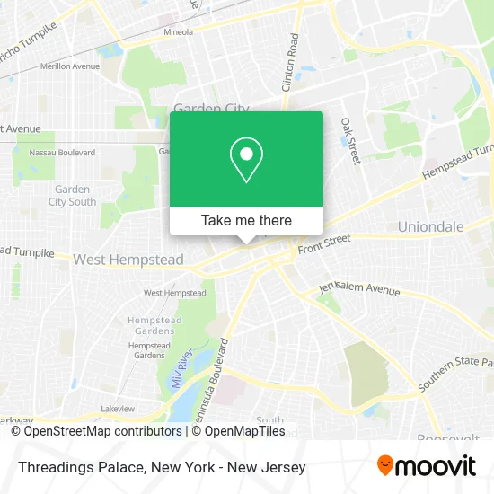
See Threadings Palace, Hempstead, on the map
Public Transit to Threadings Palace in Hempstead
Wondering how to get to Threadings Palace in Hempstead? Moovit helps you find the best way to get to Threadings Palace with step-by-step directions from the nearest public transit station.
Moovit provides free maps and live directions to help you navigate through your city. View schedules, routes, timetables, and find out how long does it take to get to Threadings Palace in real time.
Looking for the nearest stop or station to Threadings Palace? Check out this list of stops closest to your destination: Franklin St / Fulton; Main St + Fulton Ave; Centre St / Franklin; Terrace Av / Fulton; Garden City; Hempstead Bus Station; Columbia St / Franklin; Hempstead Gardens.
Bus: N15, N32, N35, N40, N6, N6X, N16, N16C, N31X/M, N41, N54, N55, N31.Train: HEMPSTEAD BRANCH, WEST HEMPSTEAD BRANCH.
Want to see if there’s another route that gets you there at an earlier time? Moovit helps you find alternative routes or times. Get directions from and directions to Threadings Palace easily from the Moovit App or Website.
We make riding to Threadings Palace easy, which is why over 1.5 million users, including users in Hempstead, trust Moovit as the best app for public transit. You don’t need to download an individual bus app or train app, Moovit is your all-in-one transit app that helps you find the best bus time or train time available.
For information on prices of bus and train, costs and ride fares to Threadings Palace, please check the Moovit app.
Use the app to navigate to popular places including to the airport, hospital, stadium, grocery store, mall, coffee shop, school, college, and university.
Threadings Palace Address: 223 Fulton Ave street in Hempstead
- Vigo,
- Mision Cristiana Elim Long Island New York,
- Centro Espiritual Los Pastors,
- Metro Vision Optical,
- Iglesia Pentecostal Getsemani,
- Kick Place,
- Tax and Accounting Service,
- El Shaddai Express,
- Oak Street Health Hempstead Primary Care Clinic,
- Ruby Barclay, Np,
- El Mango Deli Corporation,
- Quantum Legacy Solutions,
- Yesi’S Beuty Salon Inc.,
- Pollos Mario Hempstead,
- Royal Care,
- A.N Roberts Heating and Cooling,
- Tracfone Wireless Store,
- Oak Street Health,
- The Inn,
- Kayla Boutique
Places Near Threadings Palace (Hempstead)
- 376 Hudson Street, Manhattan,
- 66 John Street, Manhattan,
- 911 Memorial, Manhattan,
- Queens Center Mall, Queens,
- 3 Stone St, Manhattan,
- Katz's Deli, Manhattan,
- San Gennaro Feast, Manhattan,
- Rockefeller Center, Manhattan,
- 111 Centre New York City Supreme Court, Manhattan,
- SoHo, Manhattan,
- Hudson Yards, Manhattan,
- Mountainside Hospital, Glen Ridge,
- Pier 83, Manhattan,
- Chinatown, Manhattan,
- Wall Street, Manhattan,
- Times Square, Manhattan,
- 26 Federal Plaza, Manhattan,
- 1 Police Plaza, Manhattan,
- qqqq, Manhattan,
- Bellevue Hospital, Manhattan
How to get to popular places in New York - New Jersey with public transit
Get around Hempstead by public transit!
Traveling around Hempstead has never been so easy. See step by step directions as you travel to any attraction, street or major public transit station. View bus and train schedules, arrival times, service alerts and detailed routes on a map, so you know exactly how to get to anywhere in Hempstead.
When traveling to any destination around Hempstead use Moovit's Live Directions with Get Off Notifications to know exactly where and how far to walk, how long to wait for your line, and how many stops are left. Moovit will alert you when it's time to get off — no need to constantly re-check whether yours is the next stop.
Wondering how to use public transit in Hempstead or how to pay for public transit in Hempstead? Moovit public transit app can help you navigate your way with public transit easily, and at minimum cost. It includes public transit fees, ticket prices, and costs. Looking for a map of Hempstead public transit lines? Moovit public transit app shows all public transit maps in Hempstead with all Bus, Train, Subway, Light Rail, Ferry and Cable Car routes and stops on an interactive map.
New York - New Jersey has 6 transit type(s), including: Bus, Train, Subway, Light Rail, Ferry and Cable Car, operated by several transit agencies, including MTA Subway, Metro-North Railroad, LIRR, PATH, MTA New York City Transit - Express routes, MTA Bus, NJ Transit, NYC Ferry, NICE bus, Bee-Line Bus, NJ Transit Rail, Norwalk Transit District, Hartford Line, River Valley Transit and HART