How to get to Three Arts Club by bus?
Click on the bus route to see step by step directions with maps, line arrival times and updated time schedules.
From Light Rail-Timonium Fairgrounds, Baltimore County
54 minFrom Baltimore Marriott Inner Harbor at Camden Yards, Baltimore
37 minFrom Port of Baltimore - Cruise Maryland Terminal, Baltimore
70 minFrom I-695 @ Exit 18 (Liberty Rd/MD 26), Baltimore County
70 minFrom Coppin State University, Baltimore
52 minFrom Oriole Park at Camden Yards, Baltimore
41 minFrom Social Security Administration (Robert M. Ball Building), Baltimore County
72 minFrom Baltimore Marriott Waterfront, Baltimore
43 minFrom Ravens Walk @ M&T Bank Stadium, Baltimore
43 minFrom Eastern Ave (eastern avenue and dundalk av), Baltimore
68 min
Bus stops near Three Arts Club in Baltimore
Light Rail stations near Three Arts Club in Baltimore
- Cold Spring Lane, 17 min walk,VIEW
Bus lines to Three Arts Club in Baltimore
What are the closest stations to Three Arts Club?
The closest stations to Three Arts Club are:
- Northern Pkwy & Charles St Wb is 435 yards away, 6 min walk.
- Roland Ave & Wyndhurst Ave Nb is 487 yards away, 7 min walk.
- Charles St & Northern Pkwy Nb is 506 yards away, 6 min walk.
- Due Deepdene Nb is 677 yards away, 9 min walk.
- Cold Spring Lane is 1400 yards away, 17 min walk.
Which bus line stops near Three Arts Club?
51 (Towson Town Center)
What’s the nearest light rail station to Three Arts Club in Baltimore?
The nearest light rail station to Three Arts Club in Baltimore is Cold Spring Lane. It’s a 17 min walk away.
What’s the nearest bus station to Three Arts Club in Baltimore?
The nearest bus stations to Three Arts Club in Baltimore are Northern Pkwy & Charles St Wb and Charles St & Northern Pkwy Nb. The closest one is a 6 min walk away.
What time is the first light rail to Three Arts Club in Baltimore?
The LIGHT RAILLINK is the first light rail that goes to Three Arts Club in Baltimore. It stops nearby at 4:26 AM.
What time is the last light rail to Three Arts Club in Baltimore?
The LIGHT RAILLINK is the last light rail that goes to Three Arts Club in Baltimore. It stops nearby at 1:09 AM.
What time is the first bus to Three Arts Club in Baltimore?
The 30 is the first bus that goes to Three Arts Club in Baltimore. It stops nearby at 4:14 AM.
What time is the last bus to Three Arts Club in Baltimore?
The 30 is the last bus that goes to Three Arts Club in Baltimore. It stops nearby at 1:48 AM.
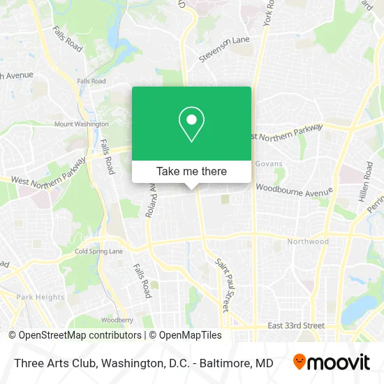
See Three Arts Club, Baltimore, on the map
Public Transit to Three Arts Club in Baltimore
Wondering how to get to Three Arts Club in Baltimore? Moovit helps you find the best way to get to Three Arts Club with step-by-step directions from the nearest public transit station.
Moovit provides free maps and live directions to help you navigate through your city. View schedules, routes, timetables, and find out how long does it take to get to Three Arts Club in real time.
Looking for the nearest stop or station to Three Arts Club? Check out this list of stops closest to your destination: Northern Pkwy & Charles St Wb; Roland Ave & Wyndhurst Ave Nb; Charles St & Northern Pkwy Nb; Due Deepdene Nb; Cold Spring Lane.
Bus: 51, 30, 33, 95, 94.
Want to see if there’s another route that gets you there at an earlier time? Moovit helps you find alternative routes or times. Get directions from and directions to Three Arts Club easily from the Moovit App or Website.
We make riding to Three Arts Club easy, which is why over 1.7 million users, including users in Baltimore, trust Moovit as the best app for public transit. You don’t need to download an individual bus app or train app, Moovit is your all-in-one transit app that helps you find the best bus time or train time available.
For information on prices of bus and light rail, costs and ride fares to Three Arts Club, please check the Moovit app.
Use the app to navigate to popular places including to the airport, hospital, stadium, grocery store, mall, coffee shop, school, college, and university.
Three Arts Club Address: 4 Wyndhurst Ave street in Baltimore
- City Church Baltimore,
- Steve & Kate's Camp - Baltimore,
- Wow Café,
- Notre Dame Of Maryland University,
- Bold Business Works,
- M&T Bank Atm,
- Reliance Counseling And Consulting,
- Dudley Roan Home Team,
- Ashley L. Realty,
- Emilee Carpenter,
- Roslyn Quarles Realtor,
- Selling Or Buying Next Home,
- David Knight,
- Beth K.Vincent,
- Helia Health & Beauty,
- Jennifer Buerger Psychotherapy,
- Edwin Terrence Alspaugh,
- Bodies In Resonance,
- Millbrook Communication,
- The Beacon Clinic Llc
Places Near Three Arts Club (Baltimore)
- Museum Of The Bible, Washington,
- Capital One Arena, Washington,
- Marriott Marquis Washington, DC, Washington,
- Basilica of the National Shrine, Washington,
- Sibley Memorial Hospital, Washington,
- Westfield Montgomery Mall, Montgomery County,
- Rock Creek Tennis Center, Washington,
- Warner Theatre, Washington,
- National Museum of African American History and Culture, Washington,
- M&T Bank Stadium, Baltimore,
- Washington National Cathedral, Washington,
- National Theatre, Washington,
- Amazon Hq2, Arlington County,
- Camden Yards, Baltimore,
- The Anthem, Washington,
- National Zoo, Washington,
- Washington DC VA Medical Center, Washington,
- PG Mall, Prince George's County,
- Pennsylvania Ave NW (3rd st and pennsylvania), Washington,
- Georgetown, Washington
How to get to popular places in Washington, D.C. - Baltimore, MD with public transit
Get around Baltimore by public transit!
Traveling around Baltimore has never been so easy. See step by step directions as you travel to any attraction, street or major public transit station. View bus and train schedules, arrival times, service alerts and detailed routes on a map, so you know exactly how to get to anywhere in Baltimore.
When traveling to any destination around Baltimore use Moovit's Live Directions with Get Off Notifications to know exactly where and how far to walk, how long to wait for your line, and how many stops are left. Moovit will alert you when it's time to get off — no need to constantly re-check whether yours is the next stop.
Wondering how to use public transit in Baltimore or how to pay for public transit in Baltimore? Moovit public transit app can help you navigate your way with public transit easily, and at minimum cost. It includes public transit fees, ticket prices, and costs. Looking for a map of Baltimore public transit lines? Moovit public transit app shows all public transit maps in Baltimore with all Bus, Train, Metro, Light Rail and Ferry routes and stops on an interactive map.
Washington, D.C. - Baltimore, MD has 5 transit type(s), including: Bus, Train, Metro, Light Rail and Ferry, operated by several transit agencies, including WMATA, Montgomery County Ride On, Fairfax Connector, TheBus, PRTC, DASH - Alexandria, Arlington Transit (ART), RTA of Central Maryland, MDOT MTA, MDOT MTA Light RailLink, MDOT MTA Commuter Bus, MDOT MTA Local Bus, FXBGO!, Virginia Railway Express (VRE) and MARC