How to get to Tienda de Ropa by bus?
Click on the bus route to see step by step directions with maps, line arrival times and updated time schedules.
From San Francisco, Aguascalientes
77 minFrom Edificio Fraya, Aguascalientes
59 minFrom Fracc. Lomas del Mirador, Aguascalientes
47 minFrom Avenida Arroyo el Molino, Aguascalientes
60 minFrom Avenida Guadalupe González, Aguascalientes
70 minFrom Fraccionamiento La Rioja, Aguascalientes
58 minFrom 5 de Mayo S/N, Aguascalientes
39 minFrom Avenida Guadalupe Gonzalez, Aguascalientes
42 minFrom Ignacio Zaragoza, Aguascalientes
45 minFrom Col. Vicente Guerrero, Aguascalientes
52 min
Bus stops near Tienda de Ropa in Aguascalientes
Bus lines to Tienda de Ropa in Aguascalientes
What are the closest stations to Tienda de Ropa?
The closest stations to Tienda de Ropa are:
- Avenida Rodolfo Landeros Gallegos, 107 is 23 meters away, 1 min walk.
- Del Laurel Poniente, 106 is 382 meters away, 6 min walk.
Which bus lines stop near Tienda de Ropa?
These bus lines stop near Tienda de Ropa: RUTA 16, RUTA 45, RUTA 48.
What’s the nearest bus station to Tienda de Ropa in Aguascalientes?
The nearest bus station to Tienda de Ropa in Aguascalientes is Avenida Rodolfo Landeros Gallegos, 107. It’s a 1 min walk away.
What time is the first bus to Tienda de Ropa in Aguascalientes?
The RUTA 48 is the first bus that goes to Tienda de Ropa in Aguascalientes. It stops nearby at 5:59 AM.
What time is the last bus to Tienda de Ropa in Aguascalientes?
The RUTA 45 is the last bus that goes to Tienda de Ropa in Aguascalientes. It stops nearby at 10:27 PM.
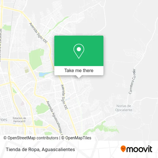
See Tienda de Ropa, Aguascalientes, on the map
Public Transit to Tienda de Ropa in Aguascalientes
Wondering how to get to Tienda de Ropa in Aguascalientes? Moovit helps you find the best way to get to Tienda de Ropa with step-by-step directions from the nearest public transit station.
Moovit provides free maps and live directions to help you navigate through your city. View schedules, routes, timetables, and find out how long does it take to get to Tienda de Ropa in real time.
Looking for the nearest stop or station to Tienda de Ropa? Check out this list of stops closest to your destination: Avenida Rodolfo Landeros Gallegos; Del Laurel Poniente.
Bus: RUTA 16, RUTA 45, RUTA 48, RUTA 09.
Want to see if there’s another route that gets you there at an earlier time? Moovit helps you find alternative routes or times. Get directions from and directions to Tienda de Ropa easily from the Moovit App or Website.
We make riding to Tienda de Ropa easy, which is why over 1.5 million users, including users in Aguascalientes, trust Moovit as the best app for public transit. You don’t need to download an individual bus app or train app, Moovit is your all-in-one transit app that helps you find the best bus time or train time available.
For information on prices of bus, costs and ride fares to Tienda de Ropa, please check the Moovit app.
Use the app to navigate to popular places including to the airport, hospital, stadium, grocery store, mall, coffee shop, school, college, and university.
Tienda de Ropa Address: Tienda de Ropa, Avenida Rodolfo Landeros Gallegos 1231, Los Pericos, 20174 Aguascalientes, Aguascal street in Aguascalientes
- Gorditas Ely,
- Centro de Acopio,
- Comercio al por Menor de Dulces y Materias Primas para Reposteria,
- Bella Florencia Bisuteria,
- Estética Ross de la Rosa,
- Aguas Frescas y Raspados,
- Transmisiones Automaticas,
- Carniceria Santa Lucia,
- Vulcanizadora Soto,
- Plaza Rome,
- Bae Rodolfo Landeros,
- WESTERN UNION,
- Los Pericos,
- Iglesia Cristiana Pentecostés Jesucristo es El Camino,
- La Cabaña,
- Tortilleria Los Pericos,
- Pinturas Banocen,
- El 7 Mares,
- Centro Regional de Desarrollo Infantil Ags - Ceredi,
- Panificadora Delgado
Places Near Tienda de Ropa (Aguascalientes)
- Jesús María, Aguascalientes,
- Central De Autobuses, Aguascalientes,
- Parque Las Tres Centurias, Aguascalientes,
- Aeropuerto de Aguascalientes S.A. de C.V., Aguascalientes,
- Universidad Autónoma de Aguascalientes, Aguascalientes,
- clinica 3 uaa, Aguascalientes,
- Terminal De Combis, Aguascalientes,
- Blvd. Luis Donaldo Colosio, Aguascalientes,
- Agropecuario, Aguascalientes,
- Villasuncion, Aguascalientes,
- Isla San Marcos, Aguascalientes,
- Nuevo Hospital Hidalgo, Aguascalientes,
- Hospital Imss No. 3, Aguascalientes,
- Centro Comercial Altaria, Aguascalientes,
- Villas de Nuestra Señora de la Asunción, Aguascalientes,
- La Isla San Marcos, Aguascalientes,
- Ciudad industrial, Aguascalientes,
- ESPACIOS, Aguascalientes,
- Centro, Aguascalientes,
- Imss Clinica 1, Aguascalientes
How to get to popular places in Aguascalientes with public transit
Get around Aguascalientes by public transit!
Traveling around Aguascalientes has never been so easy. See step by step directions as you travel to any attraction, street or major public transit station. View bus and train schedules, arrival times, service alerts and detailed routes on a map, so you know exactly how to get to anywhere in Aguascalientes.
When traveling to any destination around Aguascalientes use Moovit's Live Directions with Get Off Notifications to know exactly where and how far to walk, how long to wait for your line, and how many stops are left. Moovit will alert you when it's time to get off — no need to constantly re-check whether yours is the next stop.
Wondering how to use public transit in Aguascalientes or how to pay for public transit in Aguascalientes? Moovit public transit app can help you navigate your way with public transit easily, and at minimum cost. It includes public transit fees, ticket prices, and costs. Looking for a map of Aguascalientes public transit lines? Moovit public transit app shows all public transit maps in Aguascalientes with all bus routes and stops on an interactive map.
Aguascalientes has 1 transit type(s), including: bus, operated by several transit agencies, including Coordinación General de Movilidad