How to get to Tim Architecture by bus?
Click on the bus route to see step by step directions with maps, line arrival times and updated time schedules.
From Rue du Ballon, Lille
87 minFrom Rue de Menin, Marcq-En-Barœul
63 minFrom Saint-André-lez-Lille, Saint-André-Lez-Lille
108 minFrom Le Croise Laroche, Marcq-En-Barœul
86 minFrom Hôpital Privé De Villeneuve D'Ascq, Villeneuve-D'Ascq
370 minFrom Wambrechies, Wambrechies
86 minFrom Rue du Pré Catelan, La Madeleine
87 minFrom La Madeleine, La Madeleine
83 minFrom Lycée Valentine Labbé, La Madeleine
79 min
How to get to Tim Architecture by train?
Click on the train route to see step by step directions with maps, line arrival times and updated time schedules.
How to get to Tim Architecture by metro?
Click on the metro route to see step by step directions with maps, line arrival times and updated time schedules.
Bus stops near Tim Architecture in Tourcoing
Light Rail stations near Tim Architecture in Tourcoing
- Victoire, 9 min walk,VIEW
Metro station near Tim Architecture in Tourcoing
- Tourcoing Centre, 13 min walk,VIEW
Train stations near Tim Architecture in Tourcoing
- Tourcoing, 47 min walk,VIEW
Bus lines to Tim Architecture in Tourcoing
What are the closest stations to Tim Architecture?
The closest stations to Tim Architecture are:
- Les Arcades is 161 meters away, 3 min walk.
- Calais is 472 meters away, 7 min walk.
- Victoire is 677 meters away, 9 min walk.
- Hotel De Ville is 768 meters away, 11 min walk.
- Tourcoing Centre is 876 meters away, 12 min walk.
- Tourcoing is 3678 meters away, 47 min walk.
Which bus lines stop near Tim Architecture?
These bus lines stop near Tim Architecture: 78, 84, 87.
Which train lines stop near Tim Architecture?
These train lines stop near Tim Architecture: K80, P80.
Which metro line stops near Tim Architecture?
M2 (Tourcoing C.H. Dron)
Which light rail line stops near Tim Architecture?
TRAM (Tourcoing Tourcoing Centre)
What’s the nearest light rail station to Tim Architecture in Tourcoing?
The nearest light rail station to Tim Architecture in Tourcoing is Victoire. It’s a 9 min walk away.
What’s the nearest metro station to Tim Architecture in Tourcoing?
The nearest metro station to Tim Architecture in Tourcoing is Tourcoing Centre. It’s a 13 min walk away.
What’s the nearest bus station to Tim Architecture in Tourcoing?
The nearest bus station to Tim Architecture in Tourcoing is Les Arcades. It’s a 3 min walk away.
What time is the first light rail to Tim Architecture in Tourcoing?
The TRAM is the first light rail that goes to Tim Architecture in Tourcoing. It stops nearby at 5:28 AM.
What time is the last light rail to Tim Architecture in Tourcoing?
The TRAM is the last light rail that goes to Tim Architecture in Tourcoing. It stops nearby at 1:05 AM.
What time is the first metro to Tim Architecture in Tourcoing?
The M2 is the first metro that goes to Tim Architecture in Tourcoing. It stops nearby at 5:06 AM.
What time is the last metro to Tim Architecture in Tourcoing?
The M2 is the last metro that goes to Tim Architecture in Tourcoing. It stops nearby at 12:58 AM.
What time is the first train to Tim Architecture in Tourcoing?
The 261B is the first train that goes to Tim Architecture in Tourcoing. It stops nearby at 5:20 AM.
What time is the last train to Tim Architecture in Tourcoing?
The 261B is the last train that goes to Tim Architecture in Tourcoing. It stops nearby at 11:42 PM.
What time is the first bus to Tim Architecture in Tourcoing?
The Z1 is the first bus that goes to Tim Architecture in Tourcoing. It stops nearby at 4:25 AM.
What time is the last bus to Tim Architecture in Tourcoing?
The 24R is the last bus that goes to Tim Architecture in Tourcoing. It stops nearby at 12:30 AM.
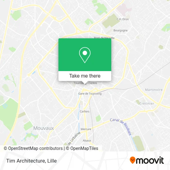
See Tim Architecture, Tourcoing, on the map
Public Transit to Tim Architecture in Tourcoing
Wondering how to get to Tim Architecture in Tourcoing? Moovit helps you find the best way to get to Tim Architecture with step-by-step directions from the nearest public transit station.
Moovit provides free maps and live directions to help you navigate through your city. View schedules, routes, timetables, and find out how long does it take to get to Tim Architecture in real time.
Looking for the nearest stop or station to Tim Architecture? Check out this list of stops closest to your destination: Les Arcades; Calais; Victoire; Hotel De Ville; Tourcoing Centre; Tourcoing.
Bus: 78, 84, 87, Z1, Z4, 978, C8.Train: K80, P80, 261B.Metro: M2.Light Rail: TRAM.
Want to see if there’s another route that gets you there at an earlier time? Moovit helps you find alternative routes or times. Get directions from and directions to Tim Architecture easily from the Moovit App or Website.
We make riding to Tim Architecture easy, which is why over 1.5 million users, including users in Tourcoing, trust Moovit as the best app for public transit. You don’t need to download an individual bus app or train app, Moovit is your all-in-one transit app that helps you find the best bus time or train time available.
For information on prices of bus, metro, light rail and train, costs and ride fares to Tim Architecture, please check the Moovit app.
Use the app to navigate to popular places including to the airport, hospital, stadium, grocery store, mall, coffee shop, school, college, and university.
Tim Architecture Address: 26 Rue Faidherbe 59200 Tourcoing street in Tourcoing
- Laforet Immobilier,
- Chapelle Catholique du Vu,
- Deboosere Olivia,
- Pôle Emploi,
- Nguyen Sophie,
- Auchan,
- Espace Commercial Saint-Christophe,
- Cabinet Orl,
- Complexe Léo Lagrange,
- Avenue Gustave Dron 25,
- Rue d'Havre 1,
- Complexe Sportif Léo Lagrange,
- Scm Soduvi,
- Cabinet Médical Victoire,
- Rue Chanzy 38,
- Place du Docteur Roux 14,
- Caquant Vianney,
- Agence Ilévia – Toucoing Centre,
- Isabelle M Ins,
- Version Originale
Places Near Tim Architecture (Tourcoing)
- Hôpital Claude Huriez, Lille,
- Zénith Arena, Lille,
- Consulat General D'Algerie, Lille,
- Euratechnologies, Lille,
- Kinepolis Lomme, Lille,
- Centre Commercial V2, Villeneuve-D'Ascq,
- Auchan Englos, Englos,
- Marché De Wazemmes, Lille,
- Zoo De Lille, Lille,
- Champ De Mars, Lille,
- Saint-André-Lez-Lille, Saint-André-Lez-Lille,
- Théâtre Sébastopol, Lille,
- L'Usine, Roubaix,
- Hôpital Salengro, Lille,
- Ffffff, Lezennes,
- Rue de la Porte d'Ypres 1, Lille,
- Clinique du Bois, Lille,
- Ikea, Lille,
- Hôpital Saint-Vincent De Paul, Lille,
- Université Catholique, Lille
How to get to popular places in Lille with public transit
Get around Tourcoing by public transit!
Traveling around Tourcoing has never been so easy. See step by step directions as you travel to any attraction, street or major public transit station. View bus and train schedules, arrival times, service alerts and detailed routes on a map, so you know exactly how to get to anywhere in Tourcoing.
When traveling to any destination around Tourcoing use Moovit's Live Directions with Get Off Notifications to know exactly where and how far to walk, how long to wait for your line, and how many stops are left. Moovit will alert you when it's time to get off — no need to constantly re-check whether yours is the next stop.
Wondering how to use public transit in Tourcoing or how to pay for public transit in Tourcoing? Moovit public transit app can help you navigate your way with public transit easily, and at minimum cost. It includes public transit fees, ticket prices, and costs. Looking for a map of Tourcoing public transit lines? Moovit public transit app shows all public transit maps in Tourcoing with all Bus, Train, Metro and Light Rail routes and stops on an interactive map.
Lille has 4 transit type(s), including: Bus, Train, Metro and Light Rail, operated by several transit agencies, including TRANSPOLE and SNCF VOYAGEURS