Directions to Tim Catching (Las Vegas) with public transportation
The following transit lines have routes that pass near Tim Catching
 Bus: 210.
How to get to Tim Catching by bus?
Click on the bus route to see step by step directions with maps, line arrival times and updated time schedules.
From Desert, Las Vegas
61 minFrom Imperial Sushi & Seafood Buffet, Spring Valley
59 minFrom Burlington, Las Vegas
87 minFrom Santa Fe Station, Las Vegas
65 minFrom Goodwill, Las Vegas
80 minFrom Victor & Teresa Oliva, Las Vegas
44 minFrom Trader Joe's, Las Vegas
74 minFrom Smoke Ranch & Tenaya, Las Vegas
41 minFrom Spring Valley Memory Care, Spring Valley
58 minFrom Indian Springs, Las Vegas
60 min
Bus stop near Tim Catching in Las Vegas
- Wb Village Center After Hills Ctr, 3 min walk,VIEW
Bus lines to Tim Catching in Las Vegas
- 210, 210 Lake Mead Blvd Eastbound,VIEW
What are the closest stations to Tim Catching?
The closest stations to Tim Catching are:
- Wb Village Center After Hills Ctr is 209 yards away, 3 min walk.
Which bus line stops near Tim Catching?
210 (210 Lake Mead Blvd Westbound)
What’s the nearest bus station to Tim Catching in Las Vegas?
The nearest bus station to Tim Catching in Las Vegas is Wb Village Center After Hills Ctr. It’s a 3 min walk away.
What time is the first bus to Tim Catching in Las Vegas?
The 210 is the first bus that goes to Tim Catching in Las Vegas. It stops nearby at 3:01 AM.
What time is the last bus to Tim Catching in Las Vegas?
The 210 is the last bus that goes to Tim Catching in Las Vegas. It stops nearby at 3:03 AM.
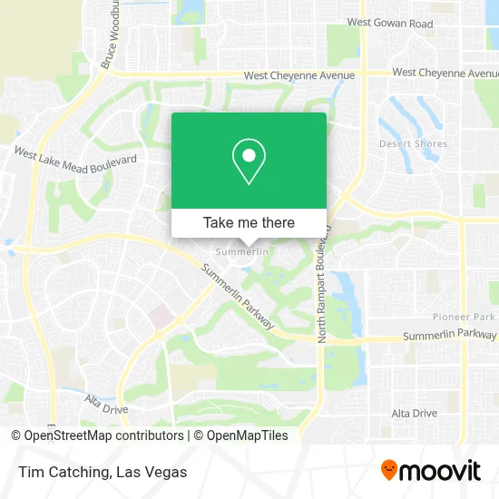
See Tim Catching, Las Vegas, on the map
Public Transit to Tim Catching in Las Vegas
Wondering how to get to Tim Catching in Las Vegas? Moovit helps you find the best way to get to Tim Catching with step-by-step directions from the nearest public transit station.
Moovit provides free maps and live directions to help you navigate through your city. View schedules, routes, timetables, and find out how long does it take to get to Tim Catching in real time.
Looking for the nearest stop or station to Tim Catching? Check out this list of stops closest to your destination: Wb Village Center After Hills Ctr.
Bus: 210.
Want to see if there’s another route that gets you there at an earlier time? Moovit helps you find alternative routes or times. Get directions from and directions to Tim Catching easily from the Moovit App or Website.
We make riding to Tim Catching easy, which is why over 1.7 million users, including users in Las Vegas, trust Moovit as the best app for public transit. You don’t need to download an individual bus app or train app, Moovit is your all-in-one transit app that helps you find the best bus time or train time available.
For information on prices of bus, costs and ride fares to Tim Catching, please check the Moovit app.
Use the app to navigate to popular places including to the airport, hospital, stadium, grocery store, mall, coffee shop, school, college, and university.
Tim Catching Address: 1735 Village Center Cir street in Las Vegas
- The Piggott Elementary School,
- Summerlin,
- Doreen Devine, Washington National Agent,
- Nevada DMV,
- Summerlin Parkway & Town Center Drive,
- Becker Middle School,
- Ernest Becker Middle School,
- Derosa, Tim,
- Andre Agassi Foundation,
- Kapina Spoon Arissa SH,
- The Meadows School,
- Lake Mead/Rampart,
- Quest Diagnostics- Summerlin,
- Rampart Casino,
- Summerlin Hospital EMS Room,
- CCCN Town Center,
- Summerlin Diagnostic and Surgical Center,
- JW Marriott Las Vegas Resort & Spa,
- Summerlin Hospital Medical Center,
- Rampart Casino (Casino at JW Marriott Las Vegas Resort)
Places Near Tim Catching (Las Vegas)
- Welcome To Fabulous Las Vegas Sign, Paradise,
- Area15, Las Vegas,
- Walmart, Las Vegas,
- Gold & Silver Pawn Shop, Las Vegas,
- Town Square, Enterprise,
- Trump International Hotel Las Vegas, Paradise,
- The Palms Casino Resort, Paradise,
- Las Vegas Premium Outlets-North, Enterprise,
- Las Vegas South Premium Outlets, Enterprise,
- The Deuce Bus Stop at Fremont St, Las Vegas,
- Zak Bagans Haunted Museum, Las Vegas,
- Lee Canyon, Las Vegas,
- Meow Wolf - Las Vegas (Meow Wolf's Omega Mart), Las Vegas,
- Las Vegas North Premium Outlets, Las Vegas,
- Koolsville Tattoos, Las Vegas,
- The Neon Museum, Las Vegas,
- Allegiant Stadium, Paradise,
- Arte Museum Las Vegas, Paradise,
- Walmart Supercenter, Las Vegas,
- Omega Mart, Las Vegas
How to get to popular places in Las Vegas with public transit
Get around Las Vegas by public transit!
Traveling around Las Vegas has never been so easy. See step by step directions as you travel to any attraction, street or major public transit station. View bus and train schedules, arrival times, service alerts and detailed routes on a map, so you know exactly how to get to anywhere in Las Vegas.
When traveling to any destination around Las Vegas use Moovit's Live Directions with Get Off Notifications to know exactly where and how far to walk, how long to wait for your line, and how many stops are left. Moovit will alert you when it's time to get off — no need to constantly re-check whether yours is the next stop.
Wondering how to use public transit in Las Vegas or how to pay for public transit in Las Vegas? Moovit public transit app can help you navigate your way with public transit easily, and at minimum cost. It includes public transit fees, ticket prices, and costs. Looking for a map of Las Vegas public transit lines? Moovit public transit app shows all public transit maps in Las Vegas with all Bus and Monorail routes and stops on an interactive map.
Las Vegas has 2 transit type(s), including: Bus and Monorail, operated by several transit agencies, including RTCSNV, City of Las Vegas, Alvand Transportation, Vegas Airporter, Las Vegas Monorail, FlixBus-us and Greyhound-us