How to get to Tim Soder Physical Therapy by bus?
Click on the bus route to see step by step directions with maps, line arrival times and updated time schedules.
From Darling Tennis Center, Las Vegas
107 minFrom Kapina Spoon Arissa SH, Las Vegas
91 minFrom Ernest Becker Middle School, Las Vegas
81 minFrom Becker Middle School, Las Vegas
81 minFrom Brian And Teri Cram Middle School, North Las Vegas
61 minFrom WinCo Foods, Las Vegas
58 minFrom Ross Dress for Less, Las Vegas
55 minFrom Medical Building @ 7200 Cathedral Rock, Las Vegas
48 minFrom Burlington, North Las Vegas
48 minFrom Trader Joe's, Las Vegas
75 min
Bus stop near Tim Soder Physical Therapy in Las Vegas
- Nb Grand Montecito After Cent Ctr, 14 min walk,VIEW
Bus lines to Tim Soder Physical Therapy in Las Vegas
What are the closest stations to Tim Soder Physical Therapy?
The closest stations to Tim Soder Physical Therapy are:
- Nb Grand Montecito After Cent Ctr is 1134 yards away, 14 min walk.
Which bus lines stop near Tim Soder Physical Therapy?
These bus lines stop near Tim Soder Physical Therapy: 106, 220.
What’s the nearest bus station to Tim Soder Physical Therapy in Las Vegas?
The nearest bus station to Tim Soder Physical Therapy in Las Vegas is Nb Grand Montecito After Cent Ctr. It’s a 14 min walk away.
What time is the first bus to Tim Soder Physical Therapy in Las Vegas?
The 106 is the first bus that goes to Tim Soder Physical Therapy in Las Vegas. It stops nearby at 4:43 AM.
What time is the last bus to Tim Soder Physical Therapy in Las Vegas?
The 106 is the last bus that goes to Tim Soder Physical Therapy in Las Vegas. It stops nearby at 2:37 AM.
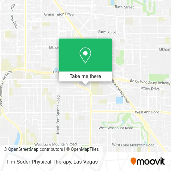
See Tim Soder Physical Therapy, Las Vegas, on the map
Public Transit to Tim Soder Physical Therapy in Las Vegas
Wondering how to get to Tim Soder Physical Therapy in Las Vegas? Moovit helps you find the best way to get to Tim Soder Physical Therapy with step-by-step directions from the nearest public transit station.
Moovit provides free maps and live directions to help you navigate through your city. View schedules, routes, timetables, and find out how long does it take to get to Tim Soder Physical Therapy in real time.
Looking for the nearest stop or station to Tim Soder Physical Therapy? Check out this list of stops closest to your destination: Nb Grand Montecito After Cent Ctr.
Bus: 106, 220.
Want to see if there’s another route that gets you there at an earlier time? Moovit helps you find alternative routes or times. Get directions from and directions to Tim Soder Physical Therapy easily from the Moovit App or Website.
We make riding to Tim Soder Physical Therapy easy, which is why over 1.7 million users, including users in Las Vegas, trust Moovit as the best app for public transit. You don’t need to download an individual bus app or train app, Moovit is your all-in-one transit app that helps you find the best bus time or train time available.
For information on prices of bus, costs and ride fares to Tim Soder Physical Therapy, please check the Moovit app.
Use the app to navigate to popular places including to the airport, hospital, stadium, grocery store, mall, coffee shop, school, college, and university.
Tim Soder Physical Therapy Address: 6170 N Durango Dr street in Las Vegas
- Jim Marsh Kia,
- N Durango Dr / W Centennial Pkwy,
- Northwest Career & Technical Academy,
- Burlington,
- Deer Springs/Durango,
- T-Mobile,
- Centennial Auto,
- CENTENNIAL TOYOTA,
- Sam's Club,
- Kohl's Department Store #0669,
- Walmart Supercenter,
- Centennial Center Shopping,
- Lee Canyon,
- Durango / Deer Springs,
- Mount Charleston Resort,
- Siri Gadde, MD,
- Wok 4 U,
- Sephora,
- Centennial Hospital,
- Centennial Hills Hospital Medical Center
Places Near Tim Soder Physical Therapy (Las Vegas)
- Lee Canyon, Las Vegas,
- Meow Wolf - Las Vegas (Meow Wolf's Omega Mart), Las Vegas,
- Trump International Hotel Las Vegas, Paradise,
- Las Vegas South Premium Outlets, Enterprise,
- Walmart, Las Vegas,
- Gold & Silver Pawn Shop, Las Vegas,
- Welcome To Fabulous Las Vegas Sign, Paradise,
- Las Vegas Premium Outlets-North, Enterprise,
- The Deuce Bus Stop at Fremont St, Las Vegas,
- The Palms Casino Resort, Paradise,
- Area15, Las Vegas,
- Town Square, Enterprise,
- Allegiant Stadium, Paradise,
- Koolsville Tattoos, Las Vegas,
- The Neon Museum, Las Vegas,
- Las Vegas North Premium Outlets, Las Vegas,
- Arte Museum Las Vegas, Paradise,
- Omega Mart, Las Vegas,
- Walmart Supercenter, Las Vegas,
- Zak Bagans Haunted Museum, Las Vegas
How to get to popular places in Las Vegas with public transit
Get around Las Vegas by public transit!
Traveling around Las Vegas has never been so easy. See step by step directions as you travel to any attraction, street or major public transit station. View bus and train schedules, arrival times, service alerts and detailed routes on a map, so you know exactly how to get to anywhere in Las Vegas.
When traveling to any destination around Las Vegas use Moovit's Live Directions with Get Off Notifications to know exactly where and how far to walk, how long to wait for your line, and how many stops are left. Moovit will alert you when it's time to get off — no need to constantly re-check whether yours is the next stop.
Wondering how to use public transit in Las Vegas or how to pay for public transit in Las Vegas? Moovit public transit app can help you navigate your way with public transit easily, and at minimum cost. It includes public transit fees, ticket prices, and costs. Looking for a map of Las Vegas public transit lines? Moovit public transit app shows all public transit maps in Las Vegas with all Bus and Monorail routes and stops on an interactive map.
Las Vegas has 2 transit type(s), including: Bus and Monorail, operated by several transit agencies, including RTCSNV, City of Las Vegas, Alvand Transportation, Vegas Airporter, Las Vegas Monorail, FlixBus-us and Greyhound-us