Directions to Time (Yuelu District) with public transportation
The following transit lines have routes that pass near Time
 Bus: Route 18, Route 908 Limited, Route W105, Route W109, Route W105.
- Metro: Line 2, Line 2, Line 4.
How to get to Time by bus?
Click on the bus route to see step by step directions with maps, line arrival times and updated time schedules.
From Bank of Communications (Xiaoxiang Branch), Furong District
31 minFrom Poly Lugu Forest Luolan District Parking Lot - Entrance/Exit, Yuelu District
31 minFrom Metro Line 1 Peiyuanqiao Station, Kaifu District
34 minFrom Hunan Gaoxiao Large Market Co., Ltd., Yuhua District
46 minFrom Changsha No. 1 Middle School Bilingual Experimental School, Furong District
64 minFrom Chinese People's Liberation Army 163rd Hospital - Southwest Gate, Kaifu District
46 minFrom Central South University (New Campus) D Building Teaching Building - North Gate, Yuelu District
33 minFrom Hunan University of Traditional Chinese Medicine - Gymnasium, Yuhua District
49 minFrom Hunan (Changsha) Maojiaqi Fruit Market Wholesale Store, Kaifu District
49 minFrom Fulu Tea House, Yuhua District
55 min
How to get to Time by metro?
Click on the metro route to see step by step directions with maps, line arrival times and updated time schedules.
From Bank of Communications (Xiaoxiang Branch), Furong District
32 minFrom Metro Line 1 Peiyuanqiao Station, Kaifu District
39 minFrom Hunan Gaoxiao Large Market Co., Ltd., Yuhua District
58 minFrom Changsha No. 1 Middle School Bilingual Experimental School, Furong District
58 minFrom Chinese People's Liberation Army 163rd Hospital - Southwest Gate, Kaifu District
68 minFrom Central South University (New Campus) D Building Teaching Building - North Gate, Yuelu District
65 minFrom Hunan University of Traditional Chinese Medicine - Gymnasium, Yuhua District
53 minFrom Hunan (Changsha) Maojiaqi Fruit Market Wholesale Store, Kaifu District
60 minFrom Fulu Tea House, Yuhua District
61 min
Bus stops near Time in Yuelu District
Metro stations near Time in Yuelu District
Bus lines to Time in Yuelu District
- Route W105, Linke Foreign Studies College,VIEW
- Route W109, Hunan Finance College,VIEW
- Route 908 Limited, West Auto Station,VIEW
- Route 312, Gaoyetang,VIEW
- Route 355, Hunan Finance College South Gate,VIEW
- Route W116, West Auto Station,VIEW
- Route 303, Sifangping,VIEW
- Route 405, East Hehua Road,VIEW
- Temporary Route 63, Changsha South Railway,VIEW
- Temporary Route 314, Chigangchong,VIEW
- Temporary Route 315, Taozi Lake Intersection,VIEW
- Route 18, Dongfanghong Road Terminal,VIEW
- 309, Jinnan Garden Bus Terminal,VIEW
- Route 902, Central South University Dormitory,VIEW
What are the closest stations to Time?
The closest stations to Time are:
- Hunan Finance College South Gate is 94 meters away, 2 min walk.
- Lushan Garden is 833 meters away, 11 min walk.
- Hunan Finance College is 867 meters away, 12 min walk.
- Wangcheng Slope is 1361 meters away, 18 min walk.
- Liwan Town is 2930 meters away, 38 min walk.
Which bus lines stop near Time?
These bus lines stop near Time: Route 18, Route 908 Limited, Route W105, Route W109.
Which metro line stops near Time?
Line 2 (Meixi Lake West)
What’s the nearest metro station to Time in Yuelu District?
The nearest metro station to Time in Yuelu District is Wangcheng Slope. It’s a 18 min walk away.
What’s the nearest bus station to Time in Yuelu District?
The nearest bus station to Time in Yuelu District is Hunan Finance College South Gate. It’s a 2 min walk away.
What time is the first metro to Time in Yuelu District?
The Line 2 is the first metro that goes to Time in Yuelu District. It stops nearby at 6:30 AM.
What time is the last metro to Time in Yuelu District?
The Line 2 is the last metro that goes to Time in Yuelu District. It stops nearby at 11:39 PM.
What time is the first bus to Time in Yuelu District?
The Temporary Route 63 is the first bus that goes to Time in Yuelu District. It stops nearby at 6:03 AM.
What time is the last bus to Time in Yuelu District?
The Temporary Route 314 is the last bus that goes to Time in Yuelu District. It stops nearby at 1:21 AM.
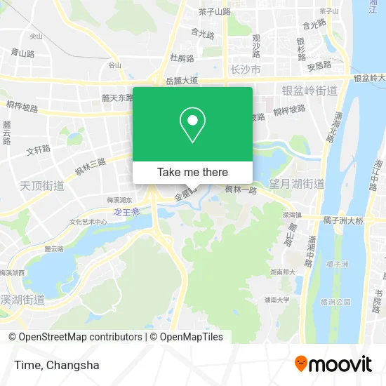
See Time, Yuelu District, on the map
Public Transit to Time in Yuelu District
Wondering how to get to Time in Yuelu District? Moovit helps you find the best way to get to Time with step-by-step directions from the nearest public transit station.
Moovit provides free maps and live directions to help you navigate through your city. View schedules, routes, timetables, and find out how long does it take to get to Time in real time.
Looking for the nearest stop or station to Time? Check out this list of stops closest to your destination: Hunan Finance College South Gate; Lushan Garden; Hunan Finance College; Wangcheng Slope; Liwan Town.
Bus: Route 18, Route 908 Limited, Route W105, Route W109, Route W105, Route W109, Route 908 Limited, Route 312, Route 355, Route W116, Route 303, Route 405, Temporary Route 63, Temporary Route 314, Temporary Route 315, Route 18, 309.Metro: Line 2, Line 2, Line 4.
Want to see if there’s another route that gets you there at an earlier time? Moovit helps you find alternative routes or times. Get directions from and directions to Time easily from the Moovit App or Website.
We make riding to Time easy, which is why over 1.5 million users, including users in Yuelu District, trust Moovit as the best app for public transit. You don’t need to download an individual bus app or train app, Moovit is your all-in-one transit app that helps you find the best bus time or train time available.
For information on prices of bus and metro, costs and ride fares to Time, please check the Moovit app.
Use the app to navigate to popular places including to the airport, hospital, stadium, grocery store, mall, coffee shop, school, college, and university.
Time Address: 湖南省长沙市岳麓区望新路52号附近 street in Yuelu District
- Daki Sushi (Finance Academy Branch),
- COCO,
- K&D,
- MAO MI KTV,
- Miss Cai,
- Feizi Styling (Finance College Branch),
- Changsha Yingju Family Hotel,
- Wangxin Road / Jinxing South Road Auxiliary Road (Intersection),
- Zhongxin New Energy Vehicle Methanol Filling Station,
- Jinxing South Road,
- Yang Guofu Spicy Soup (Cai Yuan Road Branch),
- Route 355 (Hunan Finance Institute South Gate - Gaoxing Logistics Park),
- Good Flavor Specialty Snacks,
- Boiling Flame Music Studio (Caiyuan Road),
- 77 Hotel,
- Lei Lei Noodle Shop,
- Street Electric (Xingao Bridge Jinxing South Road),
- Yuanwei Cake Shop (Wanglu Bridge Branch),
- One Sour Yogurt,
- New Bridge (Jinxing South Road Branch)
Places Near Time (Yuelu District)
- Hunan Province Tumor Hospital, Yuelu District,
- First Affiliated Hospital of Hunan University of Traditional Chinese Medicine - Outpatient Department, Yuhua District,
- Changsha South Station, Yuhua District,
- Changsha Yangming Mountain Funeral Home, Yuhua District,
- Du Fu River Pavilion, Tianxin District,
- Zhongnan University Xiangya Hospital, Kaifu District,
- Changsha Bank (Sifang Branch), Kaifu District,
- Xingsha Police Station Songya Community Police Room, Changsha County,
- Yuelu Mountain Juzizhou Tourist Area, Yuelu District,
- Wanjiali International Mall, Furong District,
- Hunan Provincial Maternal and Child Health Hospital - Outpatient Department, Kaifu District,
- National University of Defense Technology (North Gate), Kaifu District,
- Hunan Provincial Museum - Multipurpose Hall, Kaifu District,
- Central South University Xiangya Second Hospital, Furong District,
- Changsha Bank ATM (Sifang Branch), Kaifu District,
- Changsha South Station Square, Yuelu District,
- Apple Authorized Dealer (Sam Changsha Store), Yuhua District,
- First Club, Kaifu District,
- Hunan University of Traditional Chinese Medicine First Affiliated Hospital, Yuhua District,
- Desiqin City Square, Yuhua District
How to get to popular places in Changsha with public transit
Get around Yuelu District by public transit!
Traveling around Yuelu District has never been so easy. See step by step directions as you travel to any attraction, street or major public transit station. View bus and train schedules, arrival times, service alerts and detailed routes on a map, so you know exactly how to get to anywhere in Yuelu District.
When traveling to any destination around Yuelu District use Moovit's Live Directions with Get Off Notifications to know exactly where and how far to walk, how long to wait for your line, and how many stops are left. Moovit will alert you when it's time to get off — no need to constantly re-check whether yours is the next stop.
Wondering how to use public transit in Yuelu District or how to pay for public transit in Yuelu District? Moovit public transit app can help you navigate your way with public transit easily, and at minimum cost. It includes public transit fees, ticket prices, and costs. Looking for a map of Yuelu District public transit lines? Moovit public transit app shows all public transit maps in Yuelu District with all Bus and Metro routes and stops on an interactive map.
Changsha has 2 transit type(s), including: Bus and Metro, operated by several transit agencies, including Changsha Metro and Changsha Bus Group
Public transit lines with stations closest to Time in Yuelu District
Metro lines with stations closest to Time in Yuelu District
Bus lines with stations closest to Time in Yuelu District
Hunan Finance College South Gate
- Route W105Linke International College - Tulip Boutique Building Materials City
- Route W109Qingshan Road Wangan Intersection - Zhonghua Ridge
- Route 908 LimitedJiangshan Dijing - West Bus Station
- Route 312Gaoyetang - Leigao Road Bus Terminal
- Route 355Hunan Finance College South Gate - Gaoxing Logistics Park