Directions to Time Fittness (Olinda) with public transportation
The following transit lines have routes that pass near Time Fittness
How to get to Time Fittness by bus?
Click on the bus route to see step by step directions with maps, line arrival times and updated time schedules.
From Clínica Nossa Senhora do Carmo, Madalena
54 minFrom Campo do Bueirão, Torre
57 minFrom BR-101, Km 57 s/n, Guabiraba
41 minFrom Estádio do Arruda, Arruda
41 minFrom Hapclinica epaminondas, Paissandu
44 minFrom Apipucos, Apipucos
66 minFrom Rua Manuel Bezerra, Madalena
56 minFrom Bomba Do Hemetério, Bomba Do Hemetério
44 minFrom Rua Dezenove de Novembro 48, Madalena
54 min
Bus stops near Time Fittness in Olinda
Bus lines to Time Fittness in Olinda
- 19001 PONTA DE PEDRAS - RECIFE, P. De Pedras (Não Atende Carne De Vaca),VIEW
- 19002 GOIANA - RECIFE, Goiana,VIEW
- 1907 PAULISTA / RIO DOCE, Via Nobre E Bultrins,VIEW
- 1909 TI PELÓPIDAS / TI JOANA BEZERRA, Ti Pelópidas / Ti Joana Bezerra,VIEW
- 1923 CIDADE TABAJARA / TI PE-15, Via Chã De Mangabeira,VIEW
- 1928 MARANGUAPE II (BACURAU), Maranguape II (Bacurau),VIEW
- 1933 TI PE-15 / TI ABREU E LIMA, Ti Pe-15 / Ti Abreu E Lima,VIEW
- 1936 MIRUEIRA (BACURAU), Mirueira (Bacurau),VIEW
- 1956 IGARASSU (BACURAU), Igarassu (Bacurau),VIEW
- 1957 CAETÉS I (BACURAU), Caetés I (Bacurau),VIEW
- 1963 TI PE-15 / TI IGARASSU (SÍTIO HISTÓRICO), Via Br-101 Sentido Ti Pe-15,VIEW
- 1967 TI IGARASSU (SÍTIO HISTÓRICO) - BRT, Via Sítio Histórico - Inicio na Praça De Cruz De Rebouças,VIEW
- 1977 TI PELÓPIDAS (CONDE DA BOA VISTA), Ti Pelópidas (Conde Da Boa Vista),VIEW
- 1966 TI RIO DOCE/TI PE-15 (FRAGOSO), Ti Rio Doce/Ti Pe-15 (Fragoso),VIEW
- 1062 TI ABREU E LIMA (PCR) (PARADOR) - BRT, TI Abreu e Lima (PCR) (Parador),VIEW
- 1076 TI PELÓPIDAS (PCR) (PARADOR) - BRT, TI Pelópidas (PCR) (Parador),VIEW
- 1946 TI IGARASSU (BR-101), Ti Igarassu (BR-101) ,VIEW
- 1980 IGARASSU / CIDADE TABAJARA, Igarassu / Cidade Tabajara,VIEW
What are the closest stations to Time Fittness?
The closest stations to Time Fittness are:
- Pe-015 | Oficina São Vicente - Pista Central is 128 meters away, 2 min walk.
- Avenida Doutor Joaquim Nabuco 5242 is 153 meters away, 3 min walk.
- Pe-15, 629 | Mercado Público Da Tabajara - Pista Central is 302 meters away, 4 min walk.
Which bus lines stop near Time Fittness?
These bus lines stop near Time Fittness: 1909 TI PELÓPIDAS / TI JOANA BEZERRA, 1923 CIDADE TABAJARA / TI PE-15, 1966 TI RIO DOCE/TI PE-15 (FRAGOSO).
What’s the nearest bus station to Time Fittness in Olinda?
The nearest bus station to Time Fittness in Olinda is Pe-015 | Oficina São Vicente - Pista Central. It’s a 2 min walk away.
What time is the first bus to Time Fittness in Olinda?
The 1963 TI PE-15 / TI IGARASSU (SÍTIO HISTÓRICO) is the first bus that goes to Time Fittness in Olinda. It stops nearby at 3:02 AM.
What time is the last bus to Time Fittness in Olinda?
The 1956 IGARASSU (BACURAU) is the last bus that goes to Time Fittness in Olinda. It stops nearby at 4:01 AM.
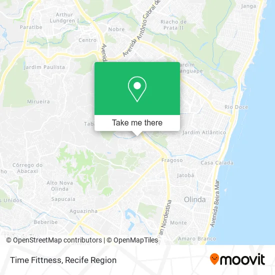
See Time Fittness, Olinda, on the map
Public Transit to Time Fittness in Olinda
Wondering how to get to Time Fittness in Olinda? Moovit helps you find the best way to get to Time Fittness with step-by-step directions from the nearest public transit station.
Moovit provides free maps and live directions to help you navigate through your city. View schedules, routes, timetables, and find out how long does it take to get to Time Fittness in real time.
Looking for the nearest stop or station to Time Fittness? Check out this list of stops closest to your destination: Pe-015 | Oficina São Vicente - Pista Central; Avenida Doutor Joaquim Nabuco 5242; Pe-15.
Bus: 1909 TI PELÓPIDAS / TI JOANA BEZERRA, 1923 CIDADE TABAJARA / TI PE-15, 1966 TI RIO DOCE/TI PE-15 (FRAGOSO), 19001 PONTA DE PEDRAS - RECIFE, 19002 GOIANA - RECIFE, 1907 PAULISTA / RIO DOCE, 1062 TI ABREU E LIMA (PCR) (PARADOR) - BRT, 1076 TI PELÓPIDAS (PCR) (PARADOR) - BRT, 1946 TI IGARASSU (BR-101), 1980 IGARASSU / CIDADE TABAJARA.
Want to see if there’s another route that gets you there at an earlier time? Moovit helps you find alternative routes or times. Get directions from and directions to Time Fittness easily from the Moovit App or Website.
We make riding to Time Fittness easy, which is why over 1.5 million users, including users in Olinda, trust Moovit as the best app for public transit. You don’t need to download an individual bus app or train app, Moovit is your all-in-one transit app that helps you find the best bus time or train time available.
For information on prices of bus, costs and ride fares to Time Fittness, please check the Moovit app.
Use the app to navigate to popular places including to the airport, hospital, stadium, grocery store, mall, coffee shop, school, college, and university.
Time Fittness Address: Rua Grajaú, 32 Tabajara Olinda-PE 53350-340 street in Olinda
- Transportes Menezes,
- Clinica Popular Sao Severino,
- Marinês F de Oliveira,
- Caldinho Do Marcelo,
- Escola municipal 12 de março,
- Recife Calcados,
- Assembleia de Deus Missionária Belém,
- Marielza Lourenço de M,
- Cidade Tabajara,
- Tabajara,
- Agência 81,
- Salão Renovação,
- BR Tecnologias,
- Nogueira Engenharia,
- Jr Lanches,
- Valdomirosilvade,
- Salao el Shaday,
- viciu's pizza,
- Mariel Comercio,
- H2tur Viagens
Places Near Time Fittness (Olinda)
- llll, Fundão,
- Imbiribeira, Imbiribeira,
- Hospital Altino Ventura, Iputinga,
- Hospital Maria Lucinda, Parnamirim,
- hospital otavio de freitas - UTI, Tejipió,
- Shopping Recife, Boa Viagem,
- Shopping RioMar Recife, Pina,
- Arena de Pernambuco, São Lourenço Da Mata,
- SHOPPING TACARUNA, Santo Amaro,
- Shopping Patteo Olinda, Olinda,
- Parque da Jaqueira, Jaqueira,
- Hospital Eduardo Campus Da Pessoa Idosa, Areias,
- Hospital Universitário Oswaldo Cruz, Santo Amaro,
- Hospital Geral De Areias, Areias,
- Imip (Instituto Materno-Infantil De Pernambuco), Coelhos,
- Hospital Agamenon Magalhães, Tamarineira,
- tuuuuu, Olinda,
- Centro de Convenções de Pernambuco, Olinda,
- Marco Zero, Bairro Do Recife,
- SHOPPING GUARARAPES, Jaboatão Dos Guararapes
How to get to popular places in Recife Region with public transit
Get around Olinda by public transit!
Traveling around Olinda has never been so easy. See step by step directions as you travel to any attraction, street or major public transit station. View bus and train schedules, arrival times, service alerts and detailed routes on a map, so you know exactly how to get to anywhere in Olinda.
When traveling to any destination around Olinda use Moovit's Live Directions with Get Off Notifications to know exactly where and how far to walk, how long to wait for your line, and how many stops are left. Moovit will alert you when it's time to get off — no need to constantly re-check whether yours is the next stop.
Wondering how to use public transit in Olinda or how to pay for public transit in Olinda? Moovit public transit app can help you navigate your way with public transit easily, and at minimum cost. It includes public transit fees, ticket prices, and costs. Looking for a map of Olinda public transit lines? Moovit public transit app shows all public transit maps in Olinda with all Bus, Train and Subway routes and stops on an interactive map.
Recife Region has 3 transit type(s), including: Bus, Train and Subway, operated by several transit agencies, including CBTU (Metrorec), BRT (Via Livre), Grande Recife, BORBOREMA IMPERIAL (TIP), BORBOREMA IMPERIAL (B.V), RODOVIÁRIA POTENGY, EMPRESA METROPOLITANA, CONSÓRCIO RECIFE, SÃO JUDAS TADEU, Expresso 1002, Rodotur Turismo, Complementar Recife, Sistema Municipal - Jaboatão, Sistema Municipal - Cabo and Sistema Municipal - Ipojuca