How to get to Time Life by bus?
Click on the bus route to see step by step directions with maps, line arrival times and updated time schedules.
From Century 21 Department Store, Manhattan
52 minFrom Fulton Ave, Bronx
75 minFrom 1231 Lafayette Avenue, Bronx
85 minFrom Metro North - Harlem - 125th Street Station, Manhattan
52 minFrom South Street Seaport, Manhattan
55 minFrom Costco, Manhattan
67 minFrom George Washington Bridge, Manhattan
74 minFrom Fort Lee, NJ, Fort Lee
56 min
How to get to Time Life by train?
Click on the train route to see step by step directions with maps, line arrival times and updated time schedules.
How to get to Time Life by subway?
Click on the subway route to see step by step directions with maps, line arrival times and updated time schedules.
Subway stations near Time Life in Manhattan
Bus stops near Time Life in Manhattan
Bus lines to Time Life in Manhattan
- QM2, Bay Terrace Bell Bl Via Whitestone Exy,VIEW
- QM4, Electchester 164 St Via Jewel Av,VIEW
- QM20, Bay Terrace 211 St Via Willets Pt Bl,VIEW
- W44, Midtown / W 39th Street,VIEW
- QM1, Fresh Meadows 188 St Via Union Tpke,VIEW
- QM5, Glen Oaks 260 St Via H Hrdng Expwy,VIEW
- QM6, Midtown 57 St Via 6 Av,VIEW
- M50, West Side 42 St Pier Crosstown,VIEW
- BXM2, West Midtown Penn Sta-34 St Via Kappock St,VIEW
- SIM1C, Eltingville - Manhattan Express,VIEW
- SIM3, Pt. Richmond - Midtown Manhattan Express,VIEW
- SIM3C, Pt. Richmond - Manhattan Express,VIEW
- SIM10, Eltingville - Midtown Manhattan Express,VIEW
- M5, Limited Washington Heights Gw Bridge,VIEW
- M7, 14 St Via Columbus Via 7 Av,VIEW
- 50TH ST, Midtown / W 39th Street,VIEW
- M20, South Ferry Via 7 Av Via Bat Pk City,VIEW
- M104, 41 St Via Broadway/7 Av,VIEW
- QM10, Lefrak City - Midtown Express,VIEW
- QM12, Forest Hills - Midtown Express,VIEW
What are the closest stations to Time Life?
The closest stations to Time Life are:
- 47-50 Sts-Rockefeller Ctr is 30 yards away, 1 min walk.
- 6 Av/W 48 St is 162 yards away, 2 min walk.
- 6 Av/W 49 St is 180 yards away, 3 min walk.
- W 49 St/Avenue Of the Americas is 257 yards away, 4 min walk.
- 7 Av/W 50 St is 262 yards away, 4 min walk.
- 6 Av/W 50 St is 278 yards away, 4 min walk.
- W 49th St & 6th Ave is 282 yards away, 4 min walk.
- 7 Av/W 49 St is 304 yards away, 4 min walk.
- 6 Av/W 51 St is 305 yards away, 4 min walk.
- 49 St is 334 yards away, 4 min walk.
- 50 St is 541 yards away, 7 min walk.
Which bus lines stop near Time Life?
These bus lines stop near Time Life: BM2, BXM4, BXM8, M1, M104, M5, M50, M7, X37.
Which train lines stop near Time Life?
These train lines stop near Time Life: 2, BABYLON BRANCH, YEL.
Which subway lines stop near Time Life?
These subway lines stop near Time Life: 1, B, D, F, N, R, W.
What’s the nearest subway station to Time Life in Manhattan?
The nearest subway station to Time Life in Manhattan is 47-50 Sts-Rockefeller Ctr. It’s a 1 min walk away.
What’s the nearest bus station to Time Life in Manhattan?
The nearest bus station to Time Life in Manhattan is 6 Av/W 48 St. It’s a 2 min walk away.
What time is the first subway to Time Life in Manhattan?
The 1 is the first subway that goes to Time Life in Manhattan. It stops nearby at 3:01 AM.
What time is the last subway to Time Life in Manhattan?
The A is the last subway that goes to Time Life in Manhattan. It stops nearby at 3:59 AM.
What time is the first bus to Time Life in Manhattan?
The SIM1C is the first bus that goes to Time Life in Manhattan. It stops nearby at 3:02 AM.
What time is the last bus to Time Life in Manhattan?
The M7 is the last bus that goes to Time Life in Manhattan. It stops nearby at 3:10 AM.
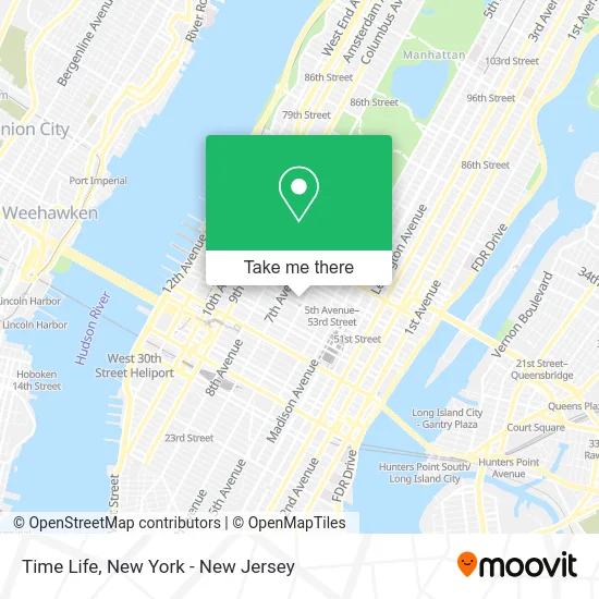
See Time Life, Manhattan, on the map
Public Transit to Time Life in Manhattan
Wondering how to get to Time Life in Manhattan? Moovit helps you find the best way to get to Time Life with step-by-step directions from the nearest public transit station.
Moovit provides free maps and live directions to help you navigate through your city. View schedules, routes, timetables, and find out how long does it take to get to Time Life in real time.
Looking for the nearest stop or station to Time Life? Check out this list of stops closest to your destination: 47-50 Sts-Rockefeller Ctr; 6 Av/W 48 St; 6 Av/W 49 St; W 49 St/Avenue Of the Americas; 7 Av/W 50 St; 6 Av/W 50 St; W 49th St & 6th Ave; 7 Av/W 49 St; 6 Av/W 51 St; 49 St; 50 St.
Bus: BM2, BXM4, BXM8, M1, M104, M5, M50, M7, X37, QM2, QM4, QM20, W44.Train: 2, BABYLON BRANCH, YEL.Subway: 1, B, D, F, N, R, W, FX, M, Q, A, C, E, 2.
Want to see if there’s another route that gets you there at an earlier time? Moovit helps you find alternative routes or times. Get directions from and directions to Time Life easily from the Moovit App or Website.
We make riding to Time Life easy, which is why over 1.5 million users, including users in Manhattan, trust Moovit as the best app for public transit. You don’t need to download an individual bus app or train app, Moovit is your all-in-one transit app that helps you find the best bus time or train time available.
For information on prices of subway, bus and train, costs and ride fares to Time Life, please check the Moovit app.
Use the app to navigate to popular places including to the airport, hospital, stadium, grocery store, mall, coffee shop, school, college, and university.
Time Life Address: 1271 Avenue of the Americas (at W 50th St) street in Manhattan
- Egoavil Law Pc,
- Ddk Consulting Llc,
- Avra,
- MLB Flagship Store,
- Etrade Financial,
- Amni Corporation,
- Elle Magazine,
- E Trade,
- League Baseball,
- UBS,
- H.I.G. Capital Llc,
- Cuerno,
- Davis Wright Tremaine Llp,
- Ted's Montana Grill - New York,
- 1251 Avenue of the Americas,
- Mlb Store,
- Tcw Group,
- New York Real Estate Consultants,
- Capital Grille (Time-Life, NYC),
- Mufg
Places Near Time Life (Manhattan)
- Chinatown, Manhattan,
- 66 John Street, Manhattan,
- San Gennaro Feast, Manhattan,
- Wall Street, Manhattan,
- 911 Memorial, Manhattan,
- Mountainside Hospital, Glen Ridge,
- Times Square, Manhattan,
- 376 Hudson Street, Manhattan,
- qqqq, Manhattan,
- 1 Police Plaza, Manhattan,
- 111 Centre New York City Supreme Court, Manhattan,
- Katz's Deli, Manhattan,
- Rockefeller Center, Manhattan,
- Hudson Yards, Manhattan,
- Bellevue Hospital, Manhattan,
- 3 Stone St, Manhattan,
- SoHo, Manhattan,
- Pier 83, Manhattan,
- 26 Federal Plaza, Manhattan,
- Queens Center Mall, Queens
How to get to popular places in New York - New Jersey with public transit
Get around Manhattan by public transit!
Traveling around Manhattan has never been so easy. See step by step directions as you travel to any attraction, street or major public transit station. View bus and train schedules, arrival times, service alerts and detailed routes on a map, so you know exactly how to get to anywhere in Manhattan.
When traveling to any destination around Manhattan use Moovit's Live Directions with Get Off Notifications to know exactly where and how far to walk, how long to wait for your line, and how many stops are left. Moovit will alert you when it's time to get off — no need to constantly re-check whether yours is the next stop.
Wondering how to use public transit in Manhattan or how to pay for public transit in Manhattan? Moovit public transit app can help you navigate your way with public transit easily, and at minimum cost. It includes public transit fees, ticket prices, and costs. Looking for a map of Manhattan public transit lines? Moovit public transit app shows all public transit maps in Manhattan with all Bus, Train, Subway, Light Rail, Ferry and Cable Car routes and stops on an interactive map.
New York - New Jersey has 6 transit type(s), including: Bus, Train, Subway, Light Rail, Ferry and Cable Car, operated by several transit agencies, including MTA Subway, Metro-North Railroad, LIRR, PATH, MTA New York City Transit - Express routes, MTA Bus, NJ Transit, NYC Ferry, NICE bus, Bee-Line Bus, NJ Transit Rail, Norwalk Transit District, Hartford Line, River Valley Transit and HART