Directions to Times Square (Richmond) with public transportation
The following transit lines have routes that pass near Times Square
 Bus: 14, 3B, FLIXBUS N2601, 29, 95.
- Train: NORTHEAST REGIONAL.
How to get to Times Square by bus?
Click on the bus route to see step by step directions with maps, line arrival times and updated time schedules.
From Rose Gaming Resort, Prince William County
220 minFrom Busch Gardens Williamsburg (Employee Parking Lot), James City County
136 minFrom Hampton University, Hampton
296 minFrom Lorton, VA - Amtrak Auto Train Station (LOR), Fairfax County
210 minFrom Lorton, VA, Fairfax County
205 minFrom Potomac Mills Mall, Prince William County
195 minFrom Woodbridge, VA, Prince William County
140 minFrom UVA Hospital Medical Center, Charlottesville
284 minFrom Amazon Fulfillment Center-Ric3, Richmond
57 min
How to get to Times Square by train?
Click on the train route to see step by step directions with maps, line arrival times and updated time schedules.
Bus stops near Times Square in Richmond
Train station near Times Square in Richmond
- Pathrichmond Main Street Amtrak Station, 60 min walk,VIEW
Bus lines to Times Square in Richmond
- 14, Hermitage/Azalea,VIEW
- 29, 29x Gaskins Express(Hrc),VIEW
- 95, 95x Richmond-Petersburg Express (Pbg),VIEW
- BRT, Broad/Main/Rocketts,VIEW
- 5, Cary/Main/Whitcomb,VIEW
- 87, Bellemeade/Hopkins/Ss Plaza,VIEW
- 1, Chamberlayne/Azalea,VIEW
- 2A, Forest Hill/North Ave,VIEW
- 2B, Jahnke/Forest Hill/North Ave,VIEW
- 2C, Semmes/Midlothian/Belt Blvd,VIEW
- 3C, U.S. 1/Highland Park,VIEW
- 78, Cary/Colorado/Downtown,VIEW
What are the closest stations to Times Square?
The closest stations to Times Square are:
- 5th + Grace is 167 yards away, 3 min walk.
- 7th Street And Franklin Street is 244 yards away, 4 min walk.
- Convention Center Eastbound Station is 255 yards away, 4 min walk.
- Cary + 3rd is 288 yards away, 4 min walk.
- 2nd & Franklin is 294 yards away, 4 min walk.
- Broad & 4th is 297 yards away, 4 min walk.
- Pathrichmond Main Street Amtrak Station is 5079 yards away, 60 min walk.
Which bus lines stop near Times Square?
These bus lines stop near Times Square: 14, 3B, FLIXBUS N2601.
Which train line stops near Times Square?
NORTHEAST REGIONAL (Newport News)
What’s the nearest bus station to Times Square in Richmond?
The nearest bus station to Times Square in Richmond is 5th + Grace. It’s a 3 min walk away.
What time is the first train to Times Square in Richmond?
The NORTHEAST REGIONAL is the first train that goes to Times Square in Richmond. It stops nearby at 5:19 AM.
What time is the last train to Times Square in Richmond?
The NORTHEAST REGIONAL is the last train that goes to Times Square in Richmond. It stops nearby at 6:52 PM.
What time is the first bus to Times Square in Richmond?
The 1 is the first bus that goes to Times Square in Richmond. It stops nearby at 5:05 AM.
What time is the last bus to Times Square in Richmond?
The BRT is the last bus that goes to Times Square in Richmond. It stops nearby at 1:21 AM.
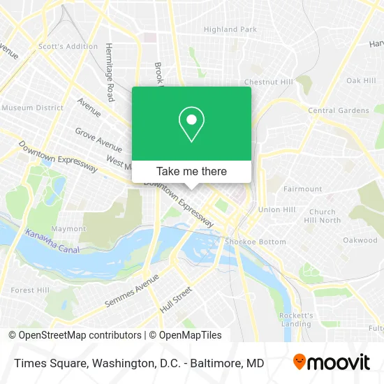
See Times Square, Richmond, on the map
Public Transit to Times Square in Richmond
Wondering how to get to Times Square in Richmond? Moovit helps you find the best way to get to Times Square with step-by-step directions from the nearest public transit station.
Moovit provides free maps and live directions to help you navigate through your city. View schedules, routes, timetables, and find out how long does it take to get to Times Square in real time.
Looking for the nearest stop or station to Times Square? Check out this list of stops closest to your destination: 5th + Grace; 7th Street And Franklin Street; Convention Center Eastbound Station; Cary + 3rd; 2nd & Franklin; Broad & 4th; Pathrichmond Main Street Amtrak Station.
Bus: 14, 3B, FLIXBUS N2601, 29, 95, BRT, 5, 87.Train: NORTHEAST REGIONAL.
Want to see if there’s another route that gets you there at an earlier time? Moovit helps you find alternative routes or times. Get directions from and directions to Times Square easily from the Moovit App or Website.
We make riding to Times Square easy, which is why over 1.5 million users, including users in Richmond, trust Moovit as the best app for public transit. You don’t need to download an individual bus app or train app, Moovit is your all-in-one transit app that helps you find the best bus time or train time available.
For information on prices of bus and train, costs and ride fares to Times Square, please check the Moovit app.
Use the app to navigate to popular places including to the airport, hospital, stadium, grocery store, mall, coffee shop, school, college, and university.
Times Square Address: 4 N 4th St Richmond, VA 23219 street in Richmond
- 4n4 Midtown Apartment,
- Calm K9 Training,
- Asian American Coal,
- Legend Property Group,
- 4n4 Midtown,
- Parkway 3rd & Cary Lot,
- Massad Building,
- Boomtown Richmond,
- Smok'n Mirrors Beauty Bar,
- K-Town Kitchen & Bar,
- Shepherds Way Relief Center,
- Wise Benefits,
- Dominion Payroll Services,
- Brisk Auto Glass,
- Real Life,
- Richmond Moy Yat Kung Fu Academy,
- Moy Tung Athletic Association,
- The Massad House Hotel,
- USPS Collection Box - Blue Box,
- Wells Linwood T
Places Near Times Square (Richmond)
- Marriott Marquis Washington, DC, Washington,
- National Museum of African American History and Culture, Washington,
- Westfield Montgomery Mall, Montgomery County,
- M&T Bank Stadium, Baltimore,
- National Zoo, Washington,
- Basilica of the National Shrine, Washington,
- The Anthem, Washington,
- Washington DC VA Medical Center, Washington,
- National Mall, Washington,
- PG Mall, Prince George's County,
- Pennsylvania Ave NW (3rd st and pennsylvania), Washington,
- Rock Creek Tennis Center, Washington,
- Sibley Memorial Hospital, Washington,
- Georgetown, Washington,
- Washington National Cathedral, Washington,
- Museum Of The Bible, Washington,
- Amazon Hq2, Arlington County,
- Warner Theatre, Washington,
- Camden Yards, Baltimore,
- Capital One Arena, Washington
How to get to popular places in Washington, D.C. - Baltimore, MD with public transit
Get around Richmond by public transit!
Traveling around Richmond has never been so easy. See step by step directions as you travel to any attraction, street or major public transit station. View bus and train schedules, arrival times, service alerts and detailed routes on a map, so you know exactly how to get to anywhere in Richmond.
When traveling to any destination around Richmond use Moovit's Live Directions with Get Off Notifications to know exactly where and how far to walk, how long to wait for your line, and how many stops are left. Moovit will alert you when it's time to get off — no need to constantly re-check whether yours is the next stop.
Wondering how to use public transit in Richmond or how to pay for public transit in Richmond? Moovit public transit app can help you navigate your way with public transit easily, and at minimum cost. It includes public transit fees, ticket prices, and costs. Looking for a map of Richmond public transit lines? Moovit public transit app shows all public transit maps in Richmond with all Bus, Train, Metro, Light Rail and Ferry routes and stops on an interactive map.
Washington, D.C. - Baltimore, MD has 5 transit type(s), including: Bus, Train, Metro, Light Rail and Ferry, operated by several transit agencies, including WMATA, Montgomery County Ride On, Fairfax Connector, TheBus, PRTC, DASH - Alexandria, Arlington Transit (ART), RTA of Central Maryland, MDOT MTA, MDOT MTA Light RailLink, MDOT MTA Commuter Bus, MDOT MTA Local Bus, FXBGO!, Virginia Railway Express (VRE) and MARC