Directions to Dmitrovskoye Highway, 11 (Timiryazevsky) with public transportation
The following transit lines have routes that pass near Dmitrovskoye Highway, 11
 Bus: 311, M40, T56, T78, 87.
- Train: D1, D2, Leningradskoe Direction, SAVYOLOVO DIRECTION, Belorussky Direction.
- Metro: 9, 13.
How to get to Dmitrovskoye Highway, 11 by bus?
Click on the bus route to see step by step directions with maps, line arrival times and updated time schedules.
How to get to Dmitrovskoye Highway, 11 by train?
Click on the train route to see step by step directions with maps, line arrival times and updated time schedules.
How to get to Dmitrovskoye Highway, 11 by metro?
Click on the metro route to see step by step directions with maps, line arrival times and updated time schedules.
From Shelepikhinskaya Embankment, Presnensky
38 minFrom Petrovsky National Research Center. Scientific Advisory Department (Polyclinic), Khamovniki
41 minFrom Moscow City International Business Center, Presnensky
45 minFrom Infectious Clinical Hospital 1, Pokrovskoe-Streshnevo
64 minFrom Gannushkin Psychiatric Hospital No. 4, Preobrazhensky
54 minFrom Malyi Theater. Stage on Ordynka, Zamoskvorechye
27 minFrom MDM Theater, Khamovniki
34 min
Bus stops near Dmitrovskoye Highway, 11 in Timiryazevsky
Metro station near Dmitrovskoye Highway, 11 in Timiryazevsky
- Timiryazevskaya, 4 min walk,VIEW
Light Rail stations near Dmitrovskoye Highway, 11 in Timiryazevsky
- Kostyakova Street, 6 min walk,VIEW
Train station near Dmitrovskoye Highway, 11 in Timiryazevsky
- Timiryazevskaya, 6 min walk,VIEW
Bus lines to Dmitrovskoye Highway, 11 in Timiryazevsky
- M40, Hospital,VIEW
- T56, Angarsk Street,VIEW
- T78, Severny 4th District,VIEW
- 87, Pedagogical College,VIEW
- 447, Svyatoslav Fedorov Park,VIEW
- 72, Kronshtadtsky Blvd.,VIEW
- 82, 3rd Yamskogo Polya St,VIEW
- 801, Solomennaya Storozhka Drive,VIEW
- S585, Banny Lane,VIEW
- 126, Timiryazevskaya Metro - Marina Roshcha Metro,VIEW
- S532, Metro Timiryazevskaya - Belorussky Railway Station,VIEW
- 539, Rizhsky Railway Station - Metro Timiryazevskaya,VIEW
- 23, 6 Yablochkova St.,VIEW
What are the closest stations to Dmitrovskoye Highway, 11?
The closest stations to Dmitrovskoye Highway, 11 are:
- Timiryazevskaya Metro is 192 meters away, 4 min walk.
- Timiryazevskaya is 224 meters away, 4 min walk.
- Kostyakova Street is 348 meters away, 6 min walk.
- Timiryazevskaya is 369 meters away, 6 min walk.
- Northern Administrative District Prefecture is 655 meters away, 9 min walk.
Which bus line stops near Dmitrovskoye Highway, 11?
311 (Metro Partizanskaya→Ostankino Platform)
Which train lines stop near Dmitrovskoye Highway, 11?
These train lines stop near Dmitrovskoye Highway, 11: D1, D2, Leningradskoe Direction, SAVYOLOVO DIRECTION.
Which metro line stops near Dmitrovskoye Highway, 11?
9 (Bulvar Dmitriya Donskogo→Altufyevo)
What’s the nearest light rail station to Dmitrovskoye Highway, 11 in Timiryazevsky?
The nearest light rail station to Dmitrovskoye Highway, 11 in Timiryazevsky is Kostyakova Street. It’s a 6 min walk away.
What’s the nearest metro station to Dmitrovskoye Highway, 11 in Timiryazevsky?
The nearest metro station to Dmitrovskoye Highway, 11 in Timiryazevsky is Timiryazevskaya. It’s a 4 min walk away.
What’s the nearest train station to Dmitrovskoye Highway, 11 in Timiryazevsky?
The nearest train station to Dmitrovskoye Highway, 11 in Timiryazevsky is Timiryazevskaya. It’s a 6 min walk away.
What’s the nearest bus station to Dmitrovskoye Highway, 11 in Timiryazevsky?
The nearest bus station to Dmitrovskoye Highway, 11 in Timiryazevsky is Timiryazevskaya Metro. It’s a 4 min walk away.
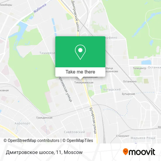
See Dmitrovskoye Highway, 11, Timiryazevsky, on the map
Public Transit to Dmitrovskoye Highway, 11 in Timiryazevsky
Wondering how to get to Dmitrovskoye Highway, 11 in Timiryazevsky? Moovit helps you find the best way to get to Dmitrovskoye Highway, 11 with step-by-step directions from the nearest public transit station.
Moovit provides free maps and live directions to help you navigate through your city. View schedules, routes, timetables, and find out how long does it take to get to Dmitrovskoye Highway, 11 in real time.
Looking for the nearest stop or station to Dmitrovskoye Highway, 11? Check out this list of stops closest to your destination: Timiryazevskaya Metro; Timiryazevskaya; Kostyakova Street; Timiryazevskaya; Northern Administrative District Prefecture.
Bus: 311, M40, T56, T78, 87, 447, 72, 82, 801, S585, 126, S532, 539.Train: D1, D2, Leningradskoe Direction, SAVYOLOVO DIRECTION, Belorussky Direction, SAVYOLOVO DIRECTION.Metro: 9, 13.
Want to see if there’s another route that gets you there at an earlier time? Moovit helps you find alternative routes or times. Get directions from and directions to Dmitrovskoye Highway, 11 easily from the Moovit App or Website.
We make riding to Dmitrovskoye Highway, 11 easy, which is why over 1.5 million users, including users in Timiryazevsky, trust Moovit as the best app for public transit. You don’t need to download an individual bus app or train app, Moovit is your all-in-one transit app that helps you find the best bus time or train time available.
For information on prices of metro, train, light rail, shuttle and bus, costs and ride fares to Dmitrovskoye Highway, 11, please check the Moovit app.
Use the app to navigate to popular places including to the airport, hospital, stadium, grocery store, mall, coffee shop, school, college, and university.
Dmitrovskoye Highway, 11 Address: Moscow street in Timiryazevsky
- Phoenix Dance Studio,
- Souvenir Vending Machine, Moscow Metro,
- Glass24,
- Lampoved,
- All-Russian Research Institute of Grain and Its Processing Products,
- Breathing Residential Complex,
- School 152,
- Dmitrovskoye Highway 9B Building 2,
- Altufyevo,
- MIPT,
- 1C Training Center #1,
- College of Service Sphere 10 on Dmitrovskoe Highway 11,
- Metrograd Shopping Center Parking,
- Timiryazevskaya Station,
- Women's Consultation, City Clinical Hospital 24,
- Metro Timiryazevskaya Stop,
- Dmitrovskoye Highway 13A,
- Tinkoff,
- MTS,
- Prana
Places Near Dmitrovskoye Highway, 11 (Timiryazevsky)
- Leroy Merlin,
- Military Unit 61899, Mosrentgen,
- M.F. Vladimirsky Moscow Regional Research Clinical Institute, Meshchansky,
- October 50th Anniversary Park, Vernadsky Prospect,
- Mira Prospect 53, Reutov,
- City Clinical Hospital No. 36 named after F.I. Inozemtsev, Falcon Mountain,
- Shchelkovo Bus Station, Moscow, Golyanovo,
- Gymnasium named after E. M. Primakov,
- Gorbunov Cultural Center, Filyovsky Park,
- Tchaikovsky Concert Hall, Tverskoy,
- City Clinical Hospital No. 24, Savelovskiy,
- MTS Live Arena,
- 22 Building of City Clinical Hospital named after S.P. Botkin, Begovoy,
- V. A. Nassonova Research Institute of Rheumatology, Moskvorechye-Saburovo,
- Riga-Mall Shopping Center, Krasnogorsk,
- N.N. Blokhin Oncology Center, Nagatino-Sadovniki,
- City Shopping Center, Lefortovo,
- State Scientific Center of Coloproctology named after A. N. Rykhikh, Khoroshyovo-Mnyovniki,
- Globus, Kosino-Ukhtonsky,
- Food City, Teply Stan
How to get to popular places in Moscow with public transit
Get around Timiryazevsky by public transit!
Traveling around Timiryazevsky has never been so easy. See step by step directions as you travel to any attraction, street or major public transit station. View bus and train schedules, arrival times, service alerts and detailed routes on a map, so you know exactly how to get to anywhere in Timiryazevsky.
When traveling to any destination around Timiryazevsky use Moovit's Live Directions with Get Off Notifications to know exactly where and how far to walk, how long to wait for your line, and how many stops are left. Moovit will alert you when it's time to get off — no need to constantly re-check whether yours is the next stop.
Wondering how to use public transit in Timiryazevsky or how to pay for public transit in Timiryazevsky? Moovit public transit app can help you navigate your way with public transit easily, and at minimum cost. It includes public transit fees, ticket prices, and costs. Looking for a map of Timiryazevsky public transit lines? Moovit public transit app shows all public transit maps in Timiryazevsky with all Bus, Train, Metro, Light Rail, Trolleybus, Shuttle and Gondola routes and stops on an interactive map.
Moscow has 7 transit type(s), including: Bus, Train, Metro, Light Rail, Trolleybus, Shuttle and Gondola, operated by several transit agencies, including Moscow Metro SUE, Mosgortrans SUE, Magistral Routes, Mosgortrans, Gepart LLC, Aeroexpress, Minibus, Central PPK JSC, Khimkielektrotrans ME, Podolsk Trolleybus MUE, Vidnoe Trolleybus Park MUE, TC Veles LLC, Startrans LLC, Mostransavto SUE and Autoline Group OJSC