How to get to Tink Tank Spaces by bus?
Click on the bus route to see step by step directions with maps, line arrival times and updated time schedules.
From SAP Headquarters, Walldorf
54 minFrom Hauptfeuerwache, Berufsfeuerwehr Mannheim, Neckarau
94 minFrom MVV Energie Ladestation, Käfertal
127 minFrom Friedhof Käfertal, Käfertal
130 minFrom Möbel Höffner, Schwetzingen
71 minFrom GRN-Klinik Schwetzingen, Schwetzingen
48 minFrom SAP Walldorf P18, Walldorf
56 minFrom SAP Campus, Walldorf
52 minFrom FH 1863, Neckarstadt-Ost/Wohlgelegen
122 min
How to get to Tink Tank Spaces by train?
Click on the train route to see step by step directions with maps, line arrival times and updated time schedules.
Light Rail stations near Tink Tank Spaces in Bergheim
Bus stops near Tink Tank Spaces in Bergheim
Bus lines to Tink Tank Spaces in Bergheim
- 33, Emmertsgrund,VIEW
- 34, Hd Hauptbahnhof,VIEW
- M3, Bismarckplatz,VIEW
- 22, Eppelheim,VIEW
- 35, Betriebshof,VIEW
- 35E, Waldorfschule Hd,VIEW
- 36, Pfaffengrund,VIEW
- 20, S-Bahnhof Altstadt,VIEW
- 28, Mombertplatz,VIEW
- 31, Technologiepark,VIEW
- 31E, Jugendherberge,VIEW
- 5, Heidelberg-Mannheim,VIEW
- E, Hd Hauptbahnhof,VIEW
- M3, Kolbenzeil,VIEW
- M5, Neuenheimer Feld,VIEW
- 26, Bismarckplatz – Campus Bergheim – Betriebshof - HD Hauptbahnhof Süd – Messplatz – Kirchheim Rathaus – Kirchheim Friedhof,VIEW
- E, Bismarckplatz – Montpellierbrücke – HD Hauptbahnhof Süd – Gadamerplatz – Kranichweg/Stotz – Eppelheim Kirchheimer Straße,VIEW
- E, S-Bf Orthopädie - S-Bf Schlierbach/Ziegelhausen - Ziegelhausen Kirche - Hirtenaue - Neckarschule - Bärenbach Süd,VIEW
- M2, Wieblingen Mitte - Betriebshof,VIEW
- M5, S-Bahnhof Altstadt,VIEW
What are the closest stations to Tink Tank Spaces?
The closest stations to Tink Tank Spaces are:
- Heidelberg, Hbf (West) is 108 meters away, 2 min walk.
- Czernybrücke is 204 meters away, 3 min walk.
- Betriebshof is 209 meters away, 3 min walk.
- Hd Hauptbahnhof is 210 meters away, 3 min walk.
- Heidelberg, Czernybrücke is 282 meters away, 4 min walk.
- Heidelberg, Betriebshof is 286 meters away, 4 min walk.
- Heidelberg, Hauptbahnhof is 292 meters away, 5 min walk.
- Heidelberg, Marriott is 502 meters away, 7 min walk.
Which bus lines stop near Tink Tank Spaces?
These bus lines stop near Tink Tank Spaces: 713, 717, 721.
Which train lines stop near Tink Tank Spaces?
These train lines stop near Tink Tank Spaces: RB68, S3.
Which light rail lines stop near Tink Tank Spaces?
These light rail lines stop near Tink Tank Spaces: 21, S1, S4.
What’s the nearest light rail station to Tink Tank Spaces in Bergheim?
The nearest light rail station to Tink Tank Spaces in Bergheim is Heidelberg, Hbf (West). It’s a 2 min walk away.
What’s the nearest bus station to Tink Tank Spaces in Bergheim?
The nearest bus stations to Tink Tank Spaces in Bergheim are Czernybrücke, Betriebshof and Hd Hauptbahnhof. The closest one is a 3 min walk away.
What time is the first light rail to Tink Tank Spaces in Bergheim?
The S3 is the first light rail that goes to Tink Tank Spaces in Bergheim. It stops nearby at 4:03 AM.
What time is the last light rail to Tink Tank Spaces in Bergheim?
The S3 is the last light rail that goes to Tink Tank Spaces in Bergheim. It stops nearby at 1:41 AM.
What time is the first train to Tink Tank Spaces in Bergheim?
The RE 73 is the first train that goes to Tink Tank Spaces in Bergheim. It stops nearby at 4:20 AM.
What time is the last train to Tink Tank Spaces in Bergheim?
The RB68 is the last train that goes to Tink Tank Spaces in Bergheim. It stops nearby at 1:34 AM.
What time is the first bus to Tink Tank Spaces in Bergheim?
The RNV 1011 is the first bus that goes to Tink Tank Spaces in Bergheim. It stops nearby at 3:05 AM.
What time is the last bus to Tink Tank Spaces in Bergheim?
The RNV 1011 is the last bus that goes to Tink Tank Spaces in Bergheim. It stops nearby at 3:05 AM.
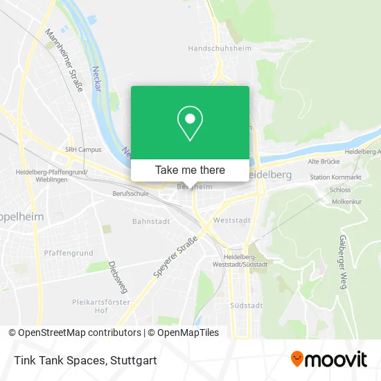
See Tink Tank Spaces, Bergheim, on the map
Public Transit to Tink Tank Spaces in Bergheim
Wondering how to get to Tink Tank Spaces in Bergheim? Moovit helps you find the best way to get to Tink Tank Spaces with step-by-step directions from the nearest public transit station.
Moovit provides free maps and live directions to help you navigate through your city. View schedules, routes, timetables, and find out how long does it take to get to Tink Tank Spaces in real time.
Looking for the nearest stop or station to Tink Tank Spaces? Check out this list of stops closest to your destination: Heidelberg; Czernybrücke; Betriebshof; Hd Hauptbahnhof; Heidelberg; Heidelberg; Heidelberg; Heidelberg.
Bus: 713, 717, 721, 33, 34, M3, 22, 35, 35E, 36, 20, 28, 31, 31E, 5, 26, E, E, M2, M5, M5, M5, E, M2, M2, M2.Train: RB68, S3.Light Rail: 21, S1, S4.
Want to see if there’s another route that gets you there at an earlier time? Moovit helps you find alternative routes or times. Get directions from and directions to Tink Tank Spaces easily from the Moovit App or Website.
We make riding to Tink Tank Spaces easy, which is why over 1.5 million users, including users in Bergheim, trust Moovit as the best app for public transit. You don’t need to download an individual bus app or train app, Moovit is your all-in-one transit app that helps you find the best bus time or train time available.
For information on prices of bus, train and light rail, costs and ride fares to Tink Tank Spaces, please check the Moovit app.
Use the app to navigate to popular places including to the airport, hospital, stadium, grocery store, mall, coffee shop, school, college, and university.
Tink Tank Spaces Address: Bergheimer Straße 147 Bergheim, 69115 Heidelberg street in Bergheim
- Phellow Seven,
- Acht Grad,
- Theresia Bauer,
- Ausländerbehörde Heidelberg,
- Alpha Taxigesellschaft,
- Stefan Frank Vermögensverwaltungs,
- Seehr Lecker Uwe Vontaschitzki,
- Kicollege - Shiatsu und Seiki,
- Thalpia,
- Taeter Theater,
- Aikido-Schule Ralph Byrszel,
- Was-Schulung,
- Atemtherapie Peter Schaub,
- Interkulturelles Zentrum Heidelberg,
- Restaurant Cottage,
- Mariam Kemptner,
- Alexander Bold,
- Glückskinder Betreuungsservice,
- Esprint Druckerei & Verlags,
- Weinbar Chez Robert
Places Near Tink Tank Spaces (Bergheim)
- Porsche-Arena, Bad Cannstatt,
- Porsche Museum, Zuffenhausen,
- Pariser Platz Stuttgart, Stuttgart-Mitte,
- Hanns-Martin-Schleyer-Halle, Bad Cannstatt,
- Mercedes-Benz Museum, Bad Cannstatt,
- Gleis 101/102 (tief), Stuttgart-Mitte,
- Gasometer Pforzheim, Pforzheim,
- Mettingen Eros-Center Puff Laufhaus, Esslingen Am Neckar,
- Geilhaus Haus 33a, Reutlingen-Betzingen,
- FlixBus Haltestelle, Stuttgart,
- Waldfriedhof, Degerloch,
- Hauptbahnhof Stuttgart, Stuttgart-Mitte,
- SI-Centrum, Möhringen,
- Im Wizemann (Halle), Bad Cannstatt,
- Klinikum Stuttgart - Katharinenhospital, Stuttgart-Mitte,
- Schleyerhalle, Bad Cannstatt,
- Marmorsaal Im Weissenburgpark, Stuttgart-Süd,
- Mercedes-Benz Museum (Mercedes Museum Stuttgart), Bad Cannstatt,
- Wilhelma (U-Bahn Wilhelma), Bad Cannstatt,
- Hanns-Martin-Schleyer-Halle (Stuttgart Hans-Martin-Schleyerhalle), Bad Cannstatt
How to get to popular places in Stuttgart with public transit
Get around Bergheim by public transit!
Traveling around Bergheim has never been so easy. See step by step directions as you travel to any attraction, street or major public transit station. View bus and train schedules, arrival times, service alerts and detailed routes on a map, so you know exactly how to get to anywhere in Bergheim.
When traveling to any destination around Bergheim use Moovit's Live Directions with Get Off Notifications to know exactly where and how far to walk, how long to wait for your line, and how many stops are left. Moovit will alert you when it's time to get off — no need to constantly re-check whether yours is the next stop.
Wondering how to use public transit in Bergheim or how to pay for public transit in Bergheim? Moovit public transit app can help you navigate your way with public transit easily, and at minimum cost. It includes public transit fees, ticket prices, and costs. Looking for a map of Bergheim public transit lines? Moovit public transit app shows all public transit maps in Bergheim with all Bus, Train, Subway, Light Rail, Ferry, S-Bahn and Funicular routes and stops on an interactive map.
Stuttgart has 7 transit type(s), including: Bus, Train, Subway, Light Rail, Ferry, S-Bahn and Funicular, operated by several transit agencies, including SSB - Stadtbahn, SSB, SSB - Seilbahn / Zacke, S-Bahn Stuttgart, Rhein-Neckar-Verkehr GmbH (rnv), Karlsruher Verkehrsverbund, DB AG, DB Regiobus BW, Arverio Baden-Württemberg GmbH, DB RegioNetz Verkehrs GmbH Westfrankenbahn, DB Regio AG Baden-Württemberg, Südwestdeutsche Verkehrs-AG, DB Regio AG Mitte Region Hessen, DB and Bodensee-Oberschwaben-Bahn
Public transit lines with stations closest to Tink Tank Spaces in Bergheim
Bus lines with stations closest to Tink Tank Spaces in Bergheim
Czernybrücke
 33Emmertsgrund - Mombertplatz - Rohrbach Süd - Kirchheim Rathaus - HD Hauptbahnhof - Bismarckplatz - S-Bf Altstadt - S-Bf Schlierbach/Ziegelhausen - Ziegelhausen Köpfel
- 34Kranichweg/Stotz - S-Bf Pfaffengrund/Wieblingen - Wieblingen Mitte - Betriebshof - HD Hauptbahnhof - Bismarckplatz - Alte Brücke Nord - Kreuzgrundweg - Heidebuckelweg - Heiligkreuzsteinach Schule
- M3Kolbenzeil - Bismarckplatz
Betriebshof
- 22Bismarckplatz – Montpellierbrücke – HD Hauptbahnhof Süd – Gadamerplatz – Kranichweg/Stotz – Eppelheim Kirchheimer Straße
- 35(HD Waldorfschule -) Wieblingen Nord - Betriebshof - Bismarckplatz - S-Bf Altstadt - S-Bf Schlierbach/Ziegelhausen - Neckargemünd Bf - Neckargemünd Bildungszentrum
- 35E(HD Waldorfschule -) Wieblingen Nord - Betriebshof - Bismarckplatz - S-Bf Altstadt - S-Bf Schlierbach/Ziegelhausen - Neckargemünd Bf - Neckargemünd Bildungszentrum
- 36S-Bf Orthopädie - S-Bf Schlierbach/Ziegelhausen - Ziegelhausen Kirche - Hirtenaue - Neckarschule - Bärenbach Süd
Hd Hauptbahnhof
- 20(Sportzentrum Nord –) Schwimmbad – Medizinische Klinik/Chirurgie/Zoo – HD Hauptbahnhof – Seegarten – Friedrich-Ebert-Platz – Rathaus/Bergbahn – S-Bf Altstadt
- 28(Sportzentrum Nord –) Schwimmbad – Campus Im Neuenheimer Feld – Betriebshof – HD Hauptbahnhof – S-Bf Weststadt/Südstadt – EMBL – Mombertplatz
- 31Universitätsklinikum - Neuenheim - Technologiepark - Bismarckplatz - Universitätsplatz
- 31EUniversitätsklinikum - Neuenheim - Technologiepark - Bismarckplatz - Universitätsplatz
- 5Weinheim - Viernheim - Mannheim - Heidelberg - Weinheim
Betriebshof
- 26Bismarckplatz – Campus Bergheim – Betriebshof - HD Hauptbahnhof Süd – Messplatz – Kirchheim Rathaus – Kirchheim Friedhof
- EBismarckplatz – Montpellierbrücke – HD Hauptbahnhof Süd – Gadamerplatz – Kranichweg/Stotz – Eppelheim Kirchheimer Straße
- ES-Bf Orthopädie - S-Bf Schlierbach/Ziegelhausen - Ziegelhausen Kirche - Hirtenaue - Neckarschule - Bärenbach Süd
- M2Wieblingen Mitte - Betriebshof