How to get to Tintoreria Rodriguez by bus?
Click on the bus route to see step by step directions with maps, line arrival times and updated time schedules.
From Estación de Servicio Cruz de Mayo, Ciudad Real
20 minFrom Bar Los Gemelos, Ciudad Real
20 minFrom Calle Camino del Vicario, Ciudad Real
28 minFrom Únicaja, Ciudad Real
20 minFrom Pago del Vicario, Ciudad Real
19 minFrom Calle San Antón, Ciudad Real
35 minFrom Carretera de Porzuna, Ciudad Real
22 minFrom Depaso, Miguelturra
29 min
Bus stops near Tintoreria Rodriguez in La Morería
Bus lines to Tintoreria Rodriguez in La Morería
What are the closest stations to Tintoreria Rodriguez?
The closest stations to Tintoreria Rodriguez are:
- Calle Alarcos Hotel Nh is 56 meters away, 2 min walk.
- Calle Obispo Estenaga Frente Numero 1 is 81 meters away, 2 min walk.
- Paseo Del Prado is 85 meters away, 2 min walk.
- Plaza De La Provincia is 194 meters away, 3 min walk.
- Ronda Alarcos 22 is 324 meters away, 5 min walk.
Which bus lines stop near Tintoreria Rodriguez?
These bus lines stop near Tintoreria Rodriguez: 6, L1.
What’s the nearest bus station to Tintoreria Rodriguez in La Morería?
The nearest bus stations to Tintoreria Rodriguez in La Morería are Calle Alarcos Hotel Nh, Calle Obispo Estenaga Frente Numero 1 and Paseo Del Prado. The closest one is a 2 min walk away.
What time is the first bus to Tintoreria Rodriguez in La Morería?
The 2 is the first bus that goes to Tintoreria Rodriguez in La Morería. It stops nearby at 6:10 AM.
What time is the last bus to Tintoreria Rodriguez in La Morería?
The 2 is the last bus that goes to Tintoreria Rodriguez in La Morería. It stops nearby at 11:03 PM.
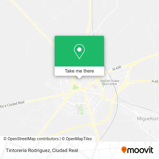
See Tintoreria Rodriguez, La Morería, on the map
Public Transit to Tintoreria Rodriguez in La Morería
Wondering how to get to Tintoreria Rodriguez in La Morería? Moovit helps you find the best way to get to Tintoreria Rodriguez with step-by-step directions from the nearest public transit station.
Moovit provides free maps and live directions to help you navigate through your city. View schedules, routes, timetables, and find out how long does it take to get to Tintoreria Rodriguez in real time.
Looking for the nearest stop or station to Tintoreria Rodriguez? Check out this list of stops closest to your destination: Calle Alarcos Hotel Nh; Calle Obispo Estenaga Frente Numero 1; Paseo Del Prado; Plaza De La Provincia; Ronda Alarcos 22.
Bus: 6, L1, 3, 1B, 4, 1A, 5, 2.
Want to see if there’s another route that gets you there at an earlier time? Moovit helps you find alternative routes or times. Get directions from and directions to Tintoreria Rodriguez easily from the Moovit App or Website.
We make riding to Tintoreria Rodriguez easy, which is why over 1.5 million users, including users in La Morería, trust Moovit as the best app for public transit. You don’t need to download an individual bus app or train app, Moovit is your all-in-one transit app that helps you find the best bus time or train time available.
For information on prices of bus, costs and ride fares to Tintoreria Rodriguez, please check the Moovit app.
Use the app to navigate to popular places including to the airport, hospital, stadium, grocery store, mall, coffee shop, school, college, and university.
Tintoreria Rodriguez Address: Calle Alamillo Bajo, 2 13001 Ciudad Real street in La Morería
- Cervecería Alhambra,
- Aszen Peluquería,
- Ekanashop,
- Viajes Dulcinea,
- Naranjo Beteta, m,
- La Unión,
- Gloria Bendita,
- Clínica Dental Adeslas Dental,
- Centro de Salud Puerta de Toledo,
- Crêperie le Breizh,
- José Miguel Gruz Gallego,
- Pastelería Cruz Cafe,
- Zumo Ostada Café,
- Moma,
- Lome Peluqueros,
- El Mundo Positivo de Nita,
- La Alianza Española,
- Pub La Ostra Azul,
- Detalles & Caprichitos Manualidades y Complementos,
- Centro de Mediacion e Intervención Familiar de Castilla La m
Places Near Tintoreria Rodriguez (La Morería)
- Decathlon Ciudad Real, Nuevo Parque,
- Playapark Parque Acuático Ciudad Real, Pta. Toledo-Atalaya,
- Aulario Polivalente (Ed. Juan de Mariana), Ciudad Real,
- Leroy Merlín Compact, Larache,
- Calle Parque de Gasset 4, Ciudad Real,
- Decathlon, Nuevo Parque,
- Polideportivo Juan Carlos I, Ciudad Real,
- Polígono Industrial Avanzado, Ciudad Real,
- Feria de Ciudad Real, Ciudad Real,
- Calle Severo Ochoa 13, Ciudad Real,
- Avda. de las Ciencias s/n, Ciudad Real,
- Hospital Quirónsalud Ciudad Real, Ciudad Jardín,
- Carrefour, Nuevo Parque,
- UCLM Campus Ciudad Real, Ciudad Real,
- Hospital General De Ciudad Real, Nuevo Hospital,
- Centro Comercial Puerta del Ave, Nuevo Parque,
- E.Leclerc Ciudad Real, Ciudad Real,
- Plaza Escultor Joaquín García Donaire, El Pilar,
- Hospital General, Ciudad Real,
- Recinto Ferial, La Granja
How to get to popular places in Ciudad Real with public transit
Get around La Morería by public transit!
Traveling around La Morería has never been so easy. See step by step directions as you travel to any attraction, street or major public transit station. View bus and train schedules, arrival times, service alerts and detailed routes on a map, so you know exactly how to get to anywhere in La Morería.
When traveling to any destination around La Morería use Moovit's Live Directions with Get Off Notifications to know exactly where and how far to walk, how long to wait for your line, and how many stops are left. Moovit will alert you when it's time to get off — no need to constantly re-check whether yours is the next stop.
Wondering how to use public transit in La Morería or how to pay for public transit in La Morería? Moovit public transit app can help you navigate your way with public transit easily, and at minimum cost. It includes public transit fees, ticket prices, and costs. Looking for a map of La Morería public transit lines? Moovit public transit app shows all public transit maps in La Morería with all bus routes and stops on an interactive map.
Ciudad Real has 1 transit type(s), including: bus, operated by several transit agencies, including Aisa, Interbus, Aibus, Autobuses Arteaga, Transporte urbano de Valdepeñas, Samar, Rubiocar and Bogasbus