Directions to Tiny Bone Tattoo (Windham) with public transportation
The following transit lines have routes that pass near Tiny Bone Tattoo
 Bus: 53.
How to get to Tiny Bone Tattoo by bus?
Click on the bus route to see step by step directions with maps, line arrival times and updated time schedules.
From Middleton Curtis T, Windham
23 minFrom US Department of Justice, Windham
31 minFrom Shear Designs Hair Studio & Tanning, Windham
28 minFrom Social Security Numbers Credit, Windham
27 minFrom Color and You, Cheshire
142 minFrom Brattleboro Planning & Zoning, Windham
33 minFrom Holiday Inn Express & Suites-Holiday Inn Express & Brattleboro, Windham
27 minFrom Necca-New England Center for Circus Arts, Windham
31 minFrom TACO BELL, Windham
26 minFrom L.A. Burdick Chocolate, Cheshire
140 min
Bus stop near Tiny Bone Tattoo in Windham
- Putney Meadows, 1 min walk,VIEW
Bus lines to Tiny Bone Tattoo in Windham
- 53, Brattleboro Transportation Center,VIEW
What are the closest stations to Tiny Bone Tattoo?
The closest stations to Tiny Bone Tattoo are:
- Putney Meadows is 50 yards away, 1 min walk.
Which bus line stops near Tiny Bone Tattoo?
53 (Brattleboro Transportation Center→Penguin Mart)
What’s the nearest bus station to Tiny Bone Tattoo in Windham?
The nearest bus station to Tiny Bone Tattoo in Windham is Putney Meadows. It’s a 1 min walk away.
What time is the first bus to Tiny Bone Tattoo in Windham?
The 53 is the first bus that goes to Tiny Bone Tattoo in Windham. It stops nearby at 6:12 AM.
What time is the last bus to Tiny Bone Tattoo in Windham?
The 53 is the last bus that goes to Tiny Bone Tattoo in Windham. It stops nearby at 5:45 PM.
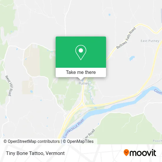
See Tiny Bone Tattoo, Windham, on the map
Public Transit to Tiny Bone Tattoo in Windham
Wondering how to get to Tiny Bone Tattoo in Windham? Moovit helps you find the best way to get to Tiny Bone Tattoo with step-by-step directions from the nearest public transit station.
Moovit provides free maps and live directions to help you navigate through your city. View schedules, routes, timetables, and find out how long does it take to get to Tiny Bone Tattoo in real time.
Looking for the nearest stop or station to Tiny Bone Tattoo? Check out this list of stops closest to your destination: Putney Meadows.
Bus: 53.
Want to see if there’s another route that gets you there at an earlier time? Moovit helps you find alternative routes or times. Get directions from and directions to Tiny Bone Tattoo easily from the Moovit App or Website.
We make riding to Tiny Bone Tattoo easy, which is why over 1.5 million users, including users in Windham, trust Moovit as the best app for public transit. You don’t need to download an individual bus app or train app, Moovit is your all-in-one transit app that helps you find the best bus time or train time available.
For information on prices of bus, costs and ride fares to Tiny Bone Tattoo, please check the Moovit app.
Use the app to navigate to popular places including to the airport, hospital, stadium, grocery store, mall, coffee shop, school, college, and university.
Tiny Bone Tattoo Address: 26 Kimball Hl street in Windham
- United Church of Putney,
- Miriam Wolf Dr,
- Darrow Lara - Lara Darrow Yoga Therapy,
- Putney Books,
- Padma Healing Arts,
- Ohlson Mareka,
- Putney Family Services,
- Moose on Main,
- Green Mountain Well,
- Fletcher D Proctor Attorney,
- 802 Credit Union,
- Get Out,
- Sewflakes of Vermont,
- Mobil,
- Putney Volunteer Fire Department,
- King Boat Works,
- 79 Pratt Rd,
- Cass Hill,
- Santa's Airport,
- Santa's Land Usa
Places Near Tiny Bone Tattoo (Windham)
- Sugarbush Resort,
- Waterbury, VT,
- Ecco,
- MVU,
- WXXX, Chittenden,
- Richford Auto,
- GLOBALFOUNDRIES, Chittenden,
- Champlain Valley Exposition, Chittenden,
- Missisquoi River Basin Association,
- University of Vermont Medical Center - Fanny Allen Campus, Chittenden,
- Castleton University, Rutland,
- Springfield, VT, Windsor,
- Xxxxxxxxxxxxx, Chittenden,
- Barre, VT,
- Spring Step,
- Dartmouth-Hitchcock Medical Center, Clinical Systems, Grafton,
- Hannaford, Rutland,
- Castleton, VT, Rutland,
- Rutland, VT, Rutland,
- Derby Line Stanstead Border Crossing
How to get to popular places in Vermont with public transit
Get around Windham by public transit!
Traveling around Windham has never been so easy. See step by step directions as you travel to any attraction, street or major public transit station. View bus and train schedules, arrival times, service alerts and detailed routes on a map, so you know exactly how to get to anywhere in Windham.
When traveling to any destination around Windham use Moovit's Live Directions with Get Off Notifications to know exactly where and how far to walk, how long to wait for your line, and how many stops are left. Moovit will alert you when it's time to get off — no need to constantly re-check whether yours is the next stop.
Wondering how to use public transit in Windham or how to pay for public transit in Windham? Moovit public transit app can help you navigate your way with public transit easily, and at minimum cost. It includes public transit fees, ticket prices, and costs. Looking for a map of Windham public transit lines? Moovit public transit app shows all public transit maps in Windham with all Bus, Train and Ferry routes and stops on an interactive map.
Vermont has 3 transit type(s), including: Bus, Train and Ferry, operated by several transit agencies, including Green Mountain Transit, Wilmington MOOver, Advance Transit, Vermont Translines, Rockingham MOOver, The Bus (Marble Valley Regional Transit District), Green Mountain Express, Rural Community Transportation, Addison County Transit Resources, Stagecoach Transportation Services, Amtrak, Greyhound-us, Dartmouth Campus Connector and Lake Champlain Ferries