How to get to To Boca by bus?
Click on the bus route to see step by step directions with maps, line arrival times and updated time schedules.
From Military Trail & Yamato Rd., Boca Raton
57 minFrom Brazzers, Boca Raton
28 minFrom Blanche Ely High School, Pompano Beach
75 minFrom Don Estridge High Tech Middle Sch, Boca Raton
57 minFrom Butterfly World, Pompano Beach
87 minFrom Pretty in Palm Beach, Boynton Beach-Delray Beach
76 minFrom Amazon Fulfillment Center-DMF3, Pompano Beach
74 minFrom Intersection : N Andrews Ave & Sample Rd., Pompano Beach
69 minFrom North Area Transportation Terminal, Pompano Beach
99 min
How to get to To Boca by train?
Click on the train route to see step by step directions with maps, line arrival times and updated time schedules.
Bus stops near To Boca in Boca Raton
Train station near To Boca in Boca Raton
- Boca Raton, 14 min walk,VIEW
Bus lines to To Boca in Boca Raton
What are the closest stations to To Boca?
The closest stations to To Boca are:
- Federal Hwy @ SE 5th St is 83 yards away, 2 min walk.
- FEDERAL HWY at SE 7TH ST is 304 yards away, 4 min walk.
- Boca Raton is 1143 yards away, 14 min walk.
Which bus lines stop near To Boca?
These bus lines stop near To Boca: 1, 10, 94.
Which train line stops near To Boca?
BLFM (Mco)
What’s the nearest train station to To Boca in Boca Raton?
The nearest train station to To Boca in Boca Raton is Boca Raton. It’s a 14 min walk away.
What’s the nearest bus station to To Boca in Boca Raton?
The nearest bus station to To Boca in Boca Raton is Federal Hwy @ SE 5th St. It’s a 2 min walk away.
What time is the first train to To Boca in Boca Raton?
The BLFM is the first train that goes to To Boca in Boca Raton. It stops nearby at 6:14 AM.
What time is the last train to To Boca in Boca Raton?
The BLFM is the last train that goes to To Boca in Boca Raton. It stops nearby at 11:53 PM.
What time is the first bus to To Boca in Boca Raton?
The 10 is the first bus that goes to To Boca in Boca Raton. It stops nearby at 5:25 AM.
What time is the last bus to To Boca in Boca Raton?
The 10 is the last bus that goes to To Boca in Boca Raton. It stops nearby at 12:18 AM.
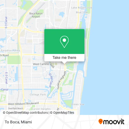
See To Boca, Boca Raton, on the map
Public Transit to To Boca in Boca Raton
Wondering how to get to To Boca in Boca Raton? Moovit helps you find the best way to get to To Boca with step-by-step directions from the nearest public transit station.
Moovit provides free maps and live directions to help you navigate through your city. View schedules, routes, timetables, and find out how long does it take to get to To Boca in real time.
Looking for the nearest stop or station to To Boca? Check out this list of stops closest to your destination: Federal Hwy @ SE 5th St; FEDERAL HWY at SE 7TH ST; Boca Raton.
Bus: 1, 10, 94, 92.Train: BLFM.
Want to see if there’s another route that gets you there at an earlier time? Moovit helps you find alternative routes or times. Get directions from and directions to To Boca easily from the Moovit App or Website.
We make riding to To Boca easy, which is why over 1.5 million users, including users in Boca Raton, trust Moovit as the best app for public transit. You don’t need to download an individual bus app or train app, Moovit is your all-in-one transit app that helps you find the best bus time or train time available.
For information on prices of bus and train, costs and ride fares to To Boca, please check the Moovit app.
Use the app to navigate to popular places including to the airport, hospital, stadium, grocery store, mall, coffee shop, school, college, and university.
To Boca Address: 601 S Federal Hwy Boca Raton, FL 33432 street in Boca Raton
- United Community,
- Creative Planning,
- Renee & Michael Luzzi Real Estate,
- RE/MAX,
- Yan Binder - Morgan Stanley,
- Eliot Popper - Morgan Stanley,
- Marc Strasser & Jared Strasser - Morgan Stanley,
- Realty Standard Inc.,
- Co &,
- Fuze Vitality,
- Somera & Silva, LLP,
- Iglam Studio by Lorena,
- Alina Gobbi,
- Piercing Doctor,
- Unified Home Management,
- Infinity Creations,
- Denise Andrade Hair at,
- Skin by Dylan,
- Beauty in Ink,
- Enhanced Lookz
Places Near To Boca (Boca Raton)
- Dolphin Mall, Miami,
- Sawgrass mall ( FL ), Miami Beach,
- Little Havana, Miami,
- Dolphin Mall Bus, Miami,
- Marlins Park, Miami,
- Port of Miami Cruise Terminal, Miami,
- Aventura Mall, Miami Beach,
- Miami VA Hospital, Miami,
- Miami Design District, Miami,
- Bayside Marketplace, Miami,
- Zoo Miami, Miami,
- Hard Rock Stadium, Miami Gardens,
- Keiser University Flagship Campus, West Palm Beach,
- Miami Freedom Park, Miami,
- Richard E. Gerstein Justice Building, Miami,
- Miami-Dade County Courthouse, Miami,
- Brickell City Centre, Miami,
- Wynwood, Miami,
- Sawgrass Mall, Miami,
- Aventura Mall, Miami
How to get to popular places in Miami with public transit
Get around Boca Raton by public transit!
Traveling around Boca Raton has never been so easy. See step by step directions as you travel to any attraction, street or major public transit station. View bus and train schedules, arrival times, service alerts and detailed routes on a map, so you know exactly how to get to anywhere in Boca Raton.
When traveling to any destination around Boca Raton use Moovit's Live Directions with Get Off Notifications to know exactly where and how far to walk, how long to wait for your line, and how many stops are left. Moovit will alert you when it's time to get off — no need to constantly re-check whether yours is the next stop.
Wondering how to use public transit in Boca Raton or how to pay for public transit in Boca Raton? Moovit public transit app can help you navigate your way with public transit easily, and at minimum cost. It includes public transit fees, ticket prices, and costs. Looking for a map of Boca Raton public transit lines? Moovit public transit app shows all public transit maps in Boca Raton with all Bus, Train, Light Rail and Ferry routes and stops on an interactive map.
Miami has 4 transit type(s), including: Bus, Train, Light Rail and Ferry, operated by several transit agencies, including Broward County Transit, Miami-Dade Transit, Metrorail, Palm Tran, Tri-Rail, Brightline, MARTY, City of Homestead Trolley, Key West Transit, Treasure Coast Connector, GoLine IRT, Amtrak, Greyhound-us, FlixBus-us and Aventura Express Shuttle Bus