How to get to Tobacco Processors by bus?
Click on the bus route to see step by step directions with maps, line arrival times and updated time schedules.
From Busch Gardens Williamsburg (Employee Parking Lot), James City County
161 minFrom Lorton, VA - Amtrak Auto Train Station (LOR), Fairfax County
235 minFrom Potomac Mills Mall, Prince William County
220 minFrom Rose Gaming Resort, Prince William County
245 minFrom Lorton, VA, Fairfax County
230 minFrom Woodbridge, VA, Prince William County
164 minFrom Amazon Fulfillment Center-Ric3, Richmond
84 minFrom UVA Hospital Medical Center, Charlottesville
309 min
Bus stops near Tobacco Processors in Richmond
Bus lines to Tobacco Processors in Richmond
What are the closest stations to Tobacco Processors?
The closest stations to Tobacco Processors are:
- Broad + Hamilton is 200 yards away, 3 min walk.
- Scotts Addition Eastbound Station is 535 yards away, 7 min walk.
- Westwood Ave + Broad St is 734 yards away, 9 min walk.
Which bus lines stop near Tobacco Processors?
These bus lines stop near Tobacco Processors: 18, 50, BRT.
What’s the nearest bus station to Tobacco Processors in Richmond?
The nearest bus station to Tobacco Processors in Richmond is Broad + Hamilton. It’s a 3 min walk away.
What time is the first bus to Tobacco Processors in Richmond?
The BRT is the first bus that goes to Tobacco Processors in Richmond. It stops nearby at 5:08 AM.
What time is the last bus to Tobacco Processors in Richmond?
The BRT is the last bus that goes to Tobacco Processors in Richmond. It stops nearby at 1:08 AM.
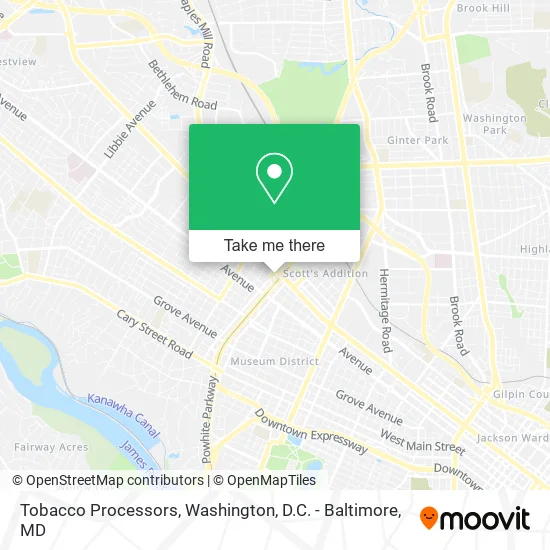
See Tobacco Processors, Richmond, on the map
Public Transit to Tobacco Processors in Richmond
Wondering how to get to Tobacco Processors in Richmond? Moovit helps you find the best way to get to Tobacco Processors with step-by-step directions from the nearest public transit station.
Moovit provides free maps and live directions to help you navigate through your city. View schedules, routes, timetables, and find out how long does it take to get to Tobacco Processors in real time.
Looking for the nearest stop or station to Tobacco Processors? Check out this list of stops closest to your destination: Broad + Hamilton; Scotts Addition Eastbound Station; Westwood Ave + Broad St.
Bus: 18, 50, BRT, 91.
Want to see if there’s another route that gets you there at an earlier time? Moovit helps you find alternative routes or times. Get directions from and directions to Tobacco Processors easily from the Moovit App or Website.
We make riding to Tobacco Processors easy, which is why over 1.5 million users, including users in Richmond, trust Moovit as the best app for public transit. You don’t need to download an individual bus app or train app, Moovit is your all-in-one transit app that helps you find the best bus time or train time available.
For information on prices of bus and train, costs and ride fares to Tobacco Processors, please check the Moovit app.
Use the app to navigate to popular places including to the airport, hospital, stadium, grocery store, mall, coffee shop, school, college, and university.
Tobacco Processors Address: 1501 N Hamilton St Richmond, VA 23230 street in Richmond
- Estes Express,
- Garrett's Auto Station,
- Virginia Forestry Association,
- US-33/N,
- Donohue John Barry Jr Attorney,
- Steelhead Management,
- Sanko Auto Repair,
- Beck's Auto,
- Express Cafe,
- The 3600 Centre Gym,
- Ren Jones,
- Bookkeeping Department,
- Maxim Healthcare Services,
- Paytime,
- Arthritis Foundation-VA Chapter,
- Net Metering,
- Juvenile Diabetes Research Foundation,
- The Jasper the Veil Brewing Co,
- First Home Care Richmond Resource,
- Argon
Places Near Tobacco Processors (Richmond)
- The Anthem, Washington,
- Capital One Arena, Washington,
- Westfield Montgomery Mall, Montgomery County,
- Marriott Marquis Washington, DC, Washington,
- Pennsylvania Ave NW (3rd st and pennsylvania), Washington,
- Camden Yards, Baltimore,
- National Zoo, Washington,
- Georgetown, Washington,
- Sibley Memorial Hospital, Washington,
- National Theatre, Washington,
- Washington National Cathedral, Washington,
- Rock Creek Tennis Center, Washington,
- Warner Theatre, Washington,
- Museum Of The Bible, Washington,
- Amazon Hq2, Arlington County,
- M&T Bank Stadium, Baltimore,
- Washington DC VA Medical Center, Washington,
- National Museum of African American History and Culture, Washington,
- PG Mall, Prince George's County,
- Basilica of the National Shrine, Washington
How to get to popular places in Washington, D.C. - Baltimore, MD with public transit
Get around Richmond by public transit!
Traveling around Richmond has never been so easy. See step by step directions as you travel to any attraction, street or major public transit station. View bus and train schedules, arrival times, service alerts and detailed routes on a map, so you know exactly how to get to anywhere in Richmond.
When traveling to any destination around Richmond use Moovit's Live Directions with Get Off Notifications to know exactly where and how far to walk, how long to wait for your line, and how many stops are left. Moovit will alert you when it's time to get off — no need to constantly re-check whether yours is the next stop.
Wondering how to use public transit in Richmond or how to pay for public transit in Richmond? Moovit public transit app can help you navigate your way with public transit easily, and at minimum cost. It includes public transit fees, ticket prices, and costs. Looking for a map of Richmond public transit lines? Moovit public transit app shows all public transit maps in Richmond with all Bus, Train, Metro, Light Rail and Ferry routes and stops on an interactive map.
Washington, D.C. - Baltimore, MD has 5 transit type(s), including: Bus, Train, Metro, Light Rail and Ferry, operated by several transit agencies, including WMATA, Montgomery County Ride On, Fairfax Connector, TheBus, PRTC, DASH - Alexandria, Arlington Transit (ART), RTA of Central Maryland, MDOT MTA, MDOT MTA Light RailLink, MDOT MTA Commuter Bus, MDOT MTA Local Bus, FXBGO!, Virginia Railway Express (VRE) and MARC