Directions to Todeschini (Angra Dos Reis) with public transportation
The following transit lines have routes that pass near Todeschini
 Bus: 106, 306, T10, T11, T21.
- Ferry: ANGRA DOS REIS - ILHA GRANDE, ANGRA DOS REIS - ILHA GRANDE.
How to get to Todeschini by bus?
Click on the bus route to see step by step directions with maps, line arrival times and updated time schedules.
From Rua da Paz 42, Jacuecanga
34 minFrom Ponta Leste, Jacuecanga
82 minFrom Condominio Portogalo, Jacuecanga
64 minFrom Climarine, Jacuecanga
30 minFrom Rodovia Governador Mário Covas, BR 101, km 457, Jacuecanga
52 minFrom Sindicato dos Metalúrgicos de Angra dos Reis, Jacuecanga
43 minFrom Condominio Praia do Engenho, Cunhambebe
58 minFrom Praia Portogalo, Jacuecanga
72 minFrom Atelier Mariacereja, Jacuecanga
31 min
Bus stops near Todeschini in Angra Dos Reis
Ferry station near Todeschini in Angra Dos Reis
- Estação Santa Luzia (Angra Dos Reis) ⛴, 6 min walk,VIEW
Bus lines to Todeschini in Angra Dos Reis
- UFF, Rota 1,VIEW
- 105, Morro do Moreno,VIEW
- T10, Centro (Direto),VIEW
- T11, Garagem → Ponta Leste,VIEW
- 102, Caputera,VIEW
- 103, Camorim,VIEW
- 104, Monsuaba,VIEW
- 106, Jacuecanga (Via Balneário),VIEW
- B106, Jacuecanga (via Morro da Cruz),VIEW
- 300, Ponta Leste,VIEW
- 306, Belém,VIEW
- C03, Marinas,VIEW
- C03B, Marinas (via Balneário),VIEW
- C01, Centro (Circular),VIEW
- C01B, Circular (via Pestalozzi),VIEW
- C05B, Retiro (via Balneário),VIEW
- T20, Parque Mambucaba (via Praia Brava / Vila Histórica),VIEW
- T21, Frade,VIEW
- T21B, Praia Brava,VIEW
- T21C, Frade (via Itinga),VIEW
What are the closest stations to Todeschini?
The closest stations to Todeschini are:
- 12 - Trevo is 41 meters away, 1 min walk.
- Rodovia Governador Mário Covas is 49 meters away, 1 min walk.
- Estrada Das Marinas, 1700 is 65 meters away, 2 min walk.
- Estação Santa Luzia (Angra Dos Reis) ⛴ is 391 meters away, 6 min walk.
- Trevo / Sentido Centro is 482 meters away, 7 min walk.
- 10 - Trevo Centro is 482 meters away, 7 min walk.
- Trevo / Sentido Japuíba is 482 meters away, 7 min walk.
Which bus lines stop near Todeschini?
These bus lines stop near Todeschini: 106, 306, T10, T11, T21.
What’s the nearest bus station to Todeschini in Angra Dos Reis?
The nearest bus stations to Todeschini in Angra Dos Reis are 12 - Trevo and Rodovia Governador Mário Covas. The closest one is a 1 min walk away.
What’s the nearest ferry station to Todeschini in Angra Dos Reis?
The nearest ferry station to Todeschini in Angra Dos Reis is Estação Santa Luzia (Angra Dos Reis) ⛴. It’s a 6 min walk away.
What time is the first bus to Todeschini in Angra Dos Reis?
The T20 is the first bus that goes to Todeschini in Angra Dos Reis. It stops nearby at 4:54 AM.
What time is the last bus to Todeschini in Angra Dos Reis?
The T11 is the last bus that goes to Todeschini in Angra Dos Reis. It stops nearby at 1:54 AM.
What time is the first ferry to Todeschini in Angra Dos Reis?
The ANGRA DOS REIS - ILHA GRANDE is the first ferry that goes to Todeschini in Angra Dos Reis. It stops nearby at 8:35 AM.
What time is the last ferry to Todeschini in Angra Dos Reis?
The ANGRA DOS REIS - ILHA GRANDE is the last ferry that goes to Todeschini in Angra Dos Reis. It stops nearby at 6:30 PM.
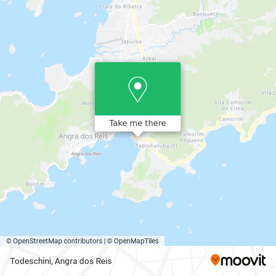
See Todeschini, Angra Dos Reis, on the map
Public Transit to Todeschini in Angra Dos Reis
Wondering how to get to Todeschini in Angra Dos Reis? Moovit helps you find the best way to get to Todeschini with step-by-step directions from the nearest public transit station.
Moovit provides free maps and live directions to help you navigate through your city. View schedules, routes, timetables, and find out how long does it take to get to Todeschini in real time.
Looking for the nearest stop or station to Todeschini? Check out this list of stops closest to your destination: 12 - Trevo; Rodovia Governador Mário Covas; Estrada Das Marinas; Estação Santa Luzia (Angra Dos Reis) ⛴; Trevo / Sentido Centro; 10 - Trevo Centro; Trevo / Sentido Japuíba.
Bus: 106, 306, T10, T11, T21, UFF, 105, 102, 103, 104, C03, C03B, C01, C01B, C05B, T20, 221.Ferry: ANGRA DOS REIS - ILHA GRANDE, ANGRA DOS REIS - ILHA GRANDE.
Want to see if there’s another route that gets you there at an earlier time? Moovit helps you find alternative routes or times. Get directions from and directions to Todeschini easily from the Moovit App or Website.
We make riding to Todeschini easy, which is why over 1.5 million users, including users in Angra Dos Reis, trust Moovit as the best app for public transit. You don’t need to download an individual bus app or train app, Moovit is your all-in-one transit app that helps you find the best bus time or train time available.
For information on prices of bus, costs and ride fares to Todeschini, please check the Moovit app.
Use the app to navigate to popular places including to the airport, hospital, stadium, grocery store, mall, coffee shop, school, college, and university.
Todeschini Address: Estrada das Marinas, Praia da Chácara Angra dos Reis-RJ street in Angra Dos Reis
- Amor Perfeito,
- Underground - Shopping Piratas Mall,
- Drica Arantes Bijuterias,
- Carijo & Prazeres,
- Localiza Rent a Car - Angra dos Reis,
- O TIMONEIRO BOUTIQUE,
- Ótica Souza Lima Ltda,
- Sonho dos Juniors F e Presentes Ltda Me,
- Alex Zenatti Despachante Marítimo,
- MONTALEAO & BOUZON ARTIGOS DE VESTUARIO E ESPORTIVO,
- RELOJOARIA FARIA,
- Banco 24 Horas,
- Casa & Vídeo,
- Mercure Rio de Janeiro Angra,
- Hotel Mercure Apt Angra Porto Bali Angra dos Reis,
- Portogalo Suíte Hotel,
- Hotel do Bosque,
- Casa Angra Imóveis,
- Lions Clube Caraguatatuba Mar,
- Porto Bali
Places Near Todeschini (Angra Dos Reis)
- Avenida Almirante Jair Carneiro Toscano de Brito 110, Angra Dos Reis,
- Praia de Paraty Mirim, Parati,
- Alambique Engenho D'Ouro, Parati,
- Verolme, Jacuecanga,
- Praia do Laboratório, Angra Dos Reis,
- Rua Cônegos Bittencourt, Angra Dos Reis,
- Avenida Antônio Bertholdo da Silva Jordão 7346, Jacuecanga,
- Garatucaia, Angra Dos Reis,
- Vila Galé Eco Resort De Angra, Angra Dos Reis,
- Centro Histórico de Paraty, Parati,
- Rua Prefeito João Gregório Galindo, Cunhambebe,
- Rodovia Procurador Haroldo Fernandes Duarte, Km 513,5 s / n, Cunhambebe,
- Mambucaba, Mambucaba,
- Vila Residencial De Mambucaba, Mambucaba,
- BR 101, Km 508 s/n, Cunhambebe,
- Cachoeira do Tobogã, Parati,
- Rua Prefeito João Gregório Galindo 2487, Angra Dos Reis,
- Condominio Laranjeiras, Parati Mirim,
- praia jabaquara - parati, Parati,
- Rodovia BR 101, Km 533 s/n, Mambucaba
How to get to popular places in Angra dos Reis with public transit
Get around Angra Dos Reis by public transit!
Traveling around Angra Dos Reis has never been so easy. See step by step directions as you travel to any attraction, street or major public transit station. View bus and train schedules, arrival times, service alerts and detailed routes on a map, so you know exactly how to get to anywhere in Angra Dos Reis.
When traveling to any destination around Angra Dos Reis use Moovit's Live Directions with Get Off Notifications to know exactly where and how far to walk, how long to wait for your line, and how many stops are left. Moovit will alert you when it's time to get off — no need to constantly re-check whether yours is the next stop.
Wondering how to use public transit in Angra Dos Reis or how to pay for public transit in Angra Dos Reis? Moovit public transit app can help you navigate your way with public transit easily, and at minimum cost. It includes public transit fees, ticket prices, and costs. Looking for a map of Angra Dos Reis public transit lines? Moovit public transit app shows all public transit maps in Angra Dos Reis with all Bus and Ferry routes and stops on an interactive map.
Angra dos Reis has 2 transit type(s), including: Bus and Ferry, operated by several transit agencies, including Viação Senhor do Bonfim, Colitur Transportes Rodoviários, Cooparatyense (Vans), Costa Verde Transportes, Barcas Rio, Objetiva Tour, Vilanova Tour, Rodoviário Oceano, BusUFF and Colitur (Tarifa Zero - Paraty)