How to get to Todo Modo by bus?
Click on the bus route to see step by step directions with maps, line arrival times and updated time schedules.
From San Mauro a Signa, Signa
71 minFrom Trespiano Cemetery, Florence
38 minFrom Osteria Street 8, Florence
40 minFrom Scientific Pole, Sesto Fiorentino
59 minFrom Florence Osmannoro, Sesto Fiorentino
46 minFrom Trespiano, Florence
42 minFrom Bruno Buozzi Street, Campi Bisenzio
46 minFrom Campi Bisenzio, Campi Bisenzio
49 minFrom Asmana Wellness World Florence, Campi Bisenzio
59 min
How to get to Todo Modo by train?
Click on the train route to see step by step directions with maps, line arrival times and updated time schedules.
Bus stops near Todo Modo in Florence
Light Rail stations near Todo Modo in Florence
- Valfonda - Santa Maria Novella Station, 9 min walk,VIEW
Train station near Todo Modo in Florence
- Florence Santa Maria Novella, 10 min walk,VIEW
Bus lines to Todo Modo in Florence
What are the closest stations to Todo Modo?
The closest stations to Todo Modo are:
- New Vineyard is 145 meters away, 2 min walk.
- Guicciardini Carraia is 272 meters away, 4 min walk.
- Sauro Square is 272 meters away, 4 min walk.
- Borgo Ognissanti is 423 meters away, 6 min walk.
- Valfonda - Santa Maria Novella Station is 659 meters away, 9 min walk.
- Florence Santa Maria Novella is 724 meters away, 10 min walk.
Which bus lines stop near Todo Modo?
These bus lines stop near Todo Modo: 20, C1, C3.
Which train line stops near Todo Modo?
R (Prato/Firenze)
What’s the nearest light rail station to Todo Modo in Florence?
The nearest light rail station to Todo Modo in Florence is Valfonda - Santa Maria Novella Station. It’s a 9 min walk away.
What’s the nearest train station to Todo Modo in Florence?
The nearest train station to Todo Modo in Florence is Florence Santa Maria Novella. It’s a 10 min walk away.
What’s the nearest bus station to Todo Modo in Florence?
The nearest bus station to Todo Modo in Florence is New Vineyard. It’s a 2 min walk away.
What time is the first light rail to Todo Modo in Florence?
The T2 is the first light rail that goes to Todo Modo in Florence. It stops nearby at 12:16 AM.
What time is the last light rail to Todo Modo in Florence?
The T2 is the last light rail that goes to Todo Modo in Florence. It stops nearby at 12:45 AM.
What time is the first train to Todo Modo in Florence?
The R is the first train that goes to Todo Modo in Florence. It stops nearby at 4:32 AM.
What time is the last train to Todo Modo in Florence?
The R is the last train that goes to Todo Modo in Florence. It stops nearby at 12:40 AM.
What time is the first bus to Todo Modo in Florence?
The 11 is the first bus that goes to Todo Modo in Florence. It stops nearby at 6:14 AM.
What time is the last bus to Todo Modo in Florence?
The 11 is the last bus that goes to Todo Modo in Florence. It stops nearby at 12:29 AM.
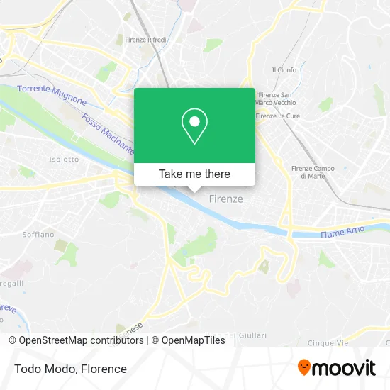
See Todo Modo, Florence, on the map
Public Transit to Todo Modo in Florence
Wondering how to get to Todo Modo in Florence? Moovit helps you find the best way to get to Todo Modo with step-by-step directions from the nearest public transit station.
Moovit provides free maps and live directions to help you navigate through your city. View schedules, routes, timetables, and find out how long does it take to get to Todo Modo in real time.
Looking for the nearest stop or station to Todo Modo? Check out this list of stops closest to your destination: New Vineyard; Guicciardini Carraia; Sauro Square; Borgo Ognissanti; Valfonda - Santa Maria Novella Station; Florence Santa Maria Novella.
Bus: 20, C1, C3, 6, 11, 18, C4, C2.Train: R.
Want to see if there’s another route that gets you there at an earlier time? Moovit helps you find alternative routes or times. Get directions from and directions to Todo Modo easily from the Moovit App or Website.
We make riding to Todo Modo easy, which is why over 1.5 million users, including users in Florence, trust Moovit as the best app for public transit. You don’t need to download an individual bus app or train app, Moovit is your all-in-one transit app that helps you find the best bus time or train time available.
For information on prices of bus and train, costs and ride fares to Todo Modo, please check the Moovit app.
Use the app to navigate to popular places including to the airport, hospital, stadium, grocery store, mall, coffee shop, school, college, and university.
Todo Modo Address: Fossi Street street in Florence
- Luca Patrussi Antiques,
- Frilli Gallery,
- Via dei Fossi 31,
- RR Representations by Rossi Riccardo,
- Bernabei Restoration Studio by Fabio Bernabei,
- Barone Ricasoli,
- Piero Boni,
- Benheart,
- ZV Italia,
- Carlo Goldoni,
- Curio - Auction House in Florence,
- Il Latini,
- Via dei Palchetti 6r,
- Hospital Church of Saint John of God,
- Unicorno Hotel,
- Bazzanti,
- Church of San Paolino,
- Rucellai Palace,
- The Mall Outlet - Florence,
- Borgo Ognissanti 20
Places Near Todo Modo (Florence)
- Mandela Forum (Nelson Mandela Forum), Florence,
- Torregalli Hospital Scandicci *, Scandicci,
- Nelson Mandela Forum, Florence,
- Santa Maria Nuova Hospital, Florence,
- Campi Bisenzio, Campi Bisenzio,
- I Gigli, Campi Bisenzio,
- Asmana, Campi Bisenzio,
- Verdi Theater, Florence,
- Visarno Arena, Florence,
- Michelangelo Square, Florence,
- Cascine Park, Florence,
- Piero Palagi Hospital Facility-Florence, Florence,
- Artemio Franchi Municipal Stadium, Florence,
- OOO, Florence,
- Visarno Hippodrome, Florence,
- IKEA Florence, Sesto Fiorentino,
- Michelangelo Square, Florence,
- Tobacco Manufacture, Florence,
- Field of Mars, Florence,
- Santa Maria Novella Station, Florence
How to get to popular places in Florence with public transit
Get around Florence by public transit!
Traveling around Florence has never been so easy. See step by step directions as you travel to any attraction, street or major public transit station. View bus and train schedules, arrival times, service alerts and detailed routes on a map, so you know exactly how to get to anywhere in Florence.
When traveling to any destination around Florence use Moovit's Live Directions with Get Off Notifications to know exactly where and how far to walk, how long to wait for your line, and how many stops are left. Moovit will alert you when it's time to get off — no need to constantly re-check whether yours is the next stop.
Wondering how to use public transit in Florence or how to pay for public transit in Florence? Moovit public transit app can help you navigate your way with public transit easily, and at minimum cost. It includes public transit fees, ticket prices, and costs. Looking for a map of Florence public transit lines? Moovit public transit app shows all public transit maps in Florence with all Bus, Train, Light Rail, Ferry and Funicular routes and stops on an interactive map.
Florence has 5 transit type(s), including: Bus, Train, Light Rail, Ferry and Funicular, operated by several transit agencies, including Florence Urban - Tuscan Bus Lines, GEST, Livorno and Province - Tuscan Bus Lines, Arezzo, Florence and Provinces - Tuscan Bus Lines, Prato and Province - Tuscan Bus Lines, Lucca and Province - Tuscan Bus Lines, Massa, Carrara and Province - Tuscan Bus Lines, Pisa and Province - Tuscan Bus Lines, Grosseto, Siena and Provinces - Tuscan Bus Lines, Arezzo, Siena and Provinces - Tuscan Bus Lines, Florence and Province - Tuscan Bus Lines, Pistoia and Province - Tuscan Bus Lines, Siena and Province - Tuscan Bus Lines, Arezzo and Province - Tuscan Bus Lines and Trenitalia