How to get to Tools More For Less by bus?
Click on the bus route to see step by step directions with maps, line arrival times and updated time schedules.
From Circa Resort & Casino, Las Vegas
61 minFrom Las Vegas Hair Clinic, Las Vegas
62 minFrom Alura Jenson, Paradise
42 minFrom Nelson's Landing Cliff Jump, Las Vegas
73 minFrom Coinstar, Las Vegas
59 minFrom Tufesa Bus Station, Las Vegas
73 minFrom I-15 (Las Vegas Freeway), Paradise
45 minFrom Kenny C Guinn Middle School, Spring Valley
66 minFrom Sunset Station Hotel & Casino, Henderson
47 min
Bus stops near Tools More For Less in Paradise
Monorail station near Tools More For Less in Paradise
- Mgm Station, 55 min walk,VIEW
Bus lines to Tools More For Less in Paradise
What are the closest stations to Tools More For Less?
The closest stations to Tools More For Less are:
- Wb Tropicana After Topaz is 420 yards away, 6 min walk.
- Sb Eastern After Reno is 735 yards away, 9 min walk.
- Mgm Station is 4718 yards away, 55 min walk.
Which bus lines stop near Tools More For Less?
These bus lines stop near Tools More For Less: 110, 201.
What’s the nearest bus station to Tools More For Less in Paradise?
The nearest bus station to Tools More For Less in Paradise is Wb Tropicana After Topaz. It’s a 6 min walk away.
What time is the first bus to Tools More For Less in Paradise?
The 110 is the first bus that goes to Tools More For Less in Paradise. It stops nearby at 3:00 AM.
What time is the last bus to Tools More For Less in Paradise?
The 201 is the last bus that goes to Tools More For Less in Paradise. It stops nearby at 3:38 AM.
What time is the first Monorail to Tools More For Less in Paradise?
The LVM is the first Monorail that goes to Tools More For Less in Paradise. It stops nearby at 7:00 AM.
What time is the last Monorail to Tools More For Less in Paradise?
The LVM is the last Monorail that goes to Tools More For Less in Paradise. It stops nearby at 12:02 AM.
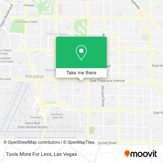
See Tools More For Less, Paradise, on the map
Public Transit to Tools More For Less in Paradise
Wondering how to get to Tools More For Less in Paradise? Moovit helps you find the best way to get to Tools More For Less with step-by-step directions from the nearest public transit station.
Moovit provides free maps and live directions to help you navigate through your city. View schedules, routes, timetables, and find out how long does it take to get to Tools More For Less in real time.
Looking for the nearest stop or station to Tools More For Less? Check out this list of stops closest to your destination: Wb Tropicana After Topaz; Sb Eastern After Reno; Mgm Station.
Bus: 110, 201.Monorail: LVM.
Want to see if there’s another route that gets you there at an earlier time? Moovit helps you find alternative routes or times. Get directions from and directions to Tools More For Less easily from the Moovit App or Website.
We make riding to Tools More For Less easy, which is why over 1.7 million users, including users in Paradise, trust Moovit as the best app for public transit. You don’t need to download an individual bus app or train app, Moovit is your all-in-one transit app that helps you find the best bus time or train time available.
For information on prices of bus, costs and ride fares to Tools More For Less, please check the Moovit app.
Use the app to navigate to popular places including to the airport, hospital, stadium, grocery store, mall, coffee shop, school, college, and university.
Tools More For Less Address: 2169 E Tropicana Ave street in Paradise
- PBR Professional Bull Riders World Finals,
- Tropicana East Shopping Center,
- Topaz St / E Tropicana Ave,
- Pinball Hall of Fame,
- E Harmon Ave / S Eastern Ave,
- Sea Mountain Spa (Swinger Party One Love Temple Nude Resort and Swingers Retreat),
- Tropicana @ McLeod (E),
- Amazon Locker-Paleo,
- Walmart,
- Back To the 80's Cafe (Back To the 80s Cafe & More),
- Walmart Supercenter,
- Unlv TRANSIT Center (W),
- E Russell Rd / S Eastern Ave,
- Bulldog Liquidators,
- UNLV Student Union Philip J. Cohen Theatre,
- Desert Springs Hospital Medical Center,
- T-Mobile,
- Ham Hall Fine Arts Building (HFA) room 283,
- Goodwill Retail Store and Donation Center,
- Meadows mall
Places Near Tools More For Less (Paradise)
- Omega Mart, Las Vegas,
- Allegiant Stadium, Paradise,
- Koolsville Tattoos, Las Vegas,
- Walmart, Las Vegas,
- Area15, Las Vegas,
- The Neon Museum, Las Vegas,
- Welcome To Fabulous Las Vegas Sign, Paradise,
- Town Square, Enterprise,
- Las Vegas Premium Outlets-North, Enterprise,
- Las Vegas South Premium Outlets, Enterprise,
- Gold & Silver Pawn Shop, Las Vegas,
- Meow Wolf - Las Vegas (Meow Wolf's Omega Mart), Las Vegas,
- Trump International Hotel Las Vegas, Paradise,
- The Palms Casino Resort, Paradise,
- Lee Canyon, Las Vegas,
- The Deuce Bus Stop at Fremont St, Las Vegas,
- Las Vegas North Premium Outlets, Las Vegas,
- Zak Bagans Haunted Museum, Las Vegas,
- Walmart Supercenter, Las Vegas,
- Arte Museum Las Vegas, Paradise
How to get to popular places in Las Vegas with public transit
Get around Paradise by public transit!
Traveling around Paradise has never been so easy. See step by step directions as you travel to any attraction, street or major public transit station. View bus and train schedules, arrival times, service alerts and detailed routes on a map, so you know exactly how to get to anywhere in Paradise.
When traveling to any destination around Paradise use Moovit's Live Directions with Get Off Notifications to know exactly where and how far to walk, how long to wait for your line, and how many stops are left. Moovit will alert you when it's time to get off — no need to constantly re-check whether yours is the next stop.
Wondering how to use public transit in Paradise or how to pay for public transit in Paradise? Moovit public transit app can help you navigate your way with public transit easily, and at minimum cost. It includes public transit fees, ticket prices, and costs. Looking for a map of Paradise public transit lines? Moovit public transit app shows all public transit maps in Paradise with all Bus and Monorail routes and stops on an interactive map.
Las Vegas has 2 transit type(s), including: Bus and Monorail, operated by several transit agencies, including RTCSNV, City of Las Vegas, Alvand Transportation, Vegas Airporter, Las Vegas Monorail, FlixBus-us and Greyhound-us