Directions to Toothworx (Baltimore County) with public transportation
The following transit lines have routes that pass near Toothworx
 Bus: 81, CITYLINK LIME.
- Metro: METRO.
How to get to Toothworx by bus?
Click on the bus route to see step by step directions with maps, line arrival times and updated time schedules.
From Pimlico Race Course, Baltimore
59 minFrom I-695 @ Exit 17 (Security Blvd/MD 122), Baltimore County
42 minFrom Walmart, Baltimore County
42 minFrom Baltimore Polytechnic Institute, Baltimore
75 minFrom I-70 at Security Blvd Baltimore City Lot Park & Ride, Baltimore
80 minFrom Reisterstown Road Plaza, Baltimore
45 minFrom Owings Mills, Maryland, Baltimore County
79 minFrom Mva, Baltimore
50 minFrom Sinai Hospital, Baltimore
59 minFrom Johns Hopkins Medicine at Green Spring Station, Baltimore County
78 min
Bus stops near Toothworx in Baltimore County
Metro station near Toothworx in Baltimore County
- Old Court Metro, 63 min walk,VIEW
What are the closest stations to Toothworx?
The closest stations to Toothworx are:
- Liberty Rd & Fieldstone Rd Nb is 17 yards away, 1 min walk.
- Brenbrook Dr & Cinnamon Cir Sb is 1264 yards away, 16 min walk.
- Old Court Metro is 5423 yards away, 63 min walk.
Which bus line stops near Toothworx?
81 (Deer Park)
What’s the nearest bus station to Toothworx in Baltimore County?
The nearest bus station to Toothworx in Baltimore County is Liberty Rd & Fieldstone Rd Nb. It’s a 1 min walk away.
What time is the first metro to Toothworx in Baltimore County?
The METRO is the first metro that goes to Toothworx in Baltimore County. It stops nearby at 4:59 AM.
What time is the last metro to Toothworx in Baltimore County?
The METRO is the last metro that goes to Toothworx in Baltimore County. It stops nearby at 12:26 AM.
What time is the first bus to Toothworx in Baltimore County?
The CITYLINK LIME is the first bus that goes to Toothworx in Baltimore County. It stops nearby at 3:57 AM.
What time is the last bus to Toothworx in Baltimore County?
The CITYLINK LIME is the last bus that goes to Toothworx in Baltimore County. It stops nearby at 3:11 AM.
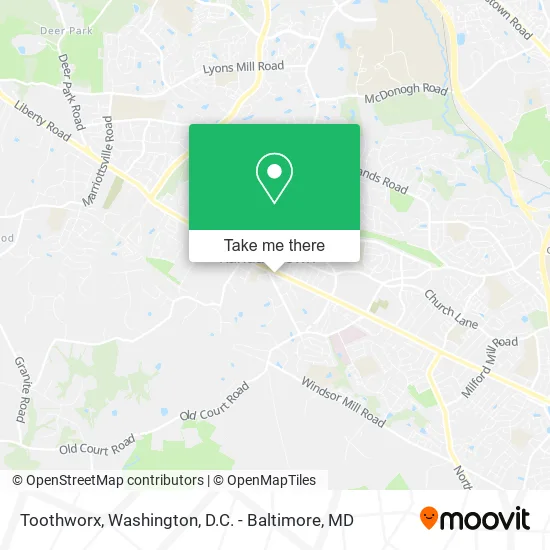
See Toothworx, Baltimore County, on the map
Public Transit to Toothworx in Baltimore County
Wondering how to get to Toothworx in Baltimore County? Moovit helps you find the best way to get to Toothworx with step-by-step directions from the nearest public transit station.
Moovit provides free maps and live directions to help you navigate through your city. View schedules, routes, timetables, and find out how long does it take to get to Toothworx in real time.
Looking for the nearest stop or station to Toothworx? Check out this list of stops closest to your destination: Liberty Rd & Fieldstone Rd Nb; Brenbrook Dr & Cinnamon Cir Sb; Old Court Metro.
Bus: 81, CITYLINK LIME.Metro: METRO.
Want to see if there’s another route that gets you there at an earlier time? Moovit helps you find alternative routes or times. Get directions from and directions to Toothworx easily from the Moovit App or Website.
We make riding to Toothworx easy, which is why over 1.5 million users, including users in Baltimore County, trust Moovit as the best app for public transit. You don’t need to download an individual bus app or train app, Moovit is your all-in-one transit app that helps you find the best bus time or train time available.
For information on prices of bus and metro, costs and ride fares to Toothworx, please check the Moovit app.
Use the app to navigate to popular places including to the airport, hospital, stadium, grocery store, mall, coffee shop, school, college, and university.
Toothworx Address: 8919 Liberty Rd Randallstown, MD 21133 street in Baltimore County
- Association of Bridal Consultants Baltimore Networking Group,
- National Life Insurance,
- Dr. Joseph Nkwanyuo,
- Medicare Insurance Advisors Randallstown,
- Tahna Purnell, LCPC,
- Baltimore County Public Schools,
- Lesgo Kustomz Transpor,
- Greater Baltimore Bailbond & Insurance,
- Chizel It Transformation Center,
- Breakthrough Outreach Misionary Ministry,
- MR. Lee Tint & Welding,
- Danby Appliance Repair,
- Dimple's,
- T&T Auto Detailing LLC.,
- Women Out Networking,
- Lendmark Financial,
- Jeanine Wood-Harri,
- ATM,
- Shepherd Locksmith,
- Speechless Global Music
Places Near Toothworx (Baltimore County)
- Washington National Cathedral, Washington,
- National Theatre, Washington,
- Westfield Montgomery Mall, Montgomery County,
- Amazon Hq2, Arlington County,
- M&T Bank Stadium, Baltimore,
- Capital One Arena, Washington,
- Marriott Marquis Washington, DC, Washington,
- Washington DC VA Medical Center, Washington,
- Georgetown, Washington,
- The Anthem, Washington,
- National Zoo, Washington,
- Warner Theatre, Washington,
- National Museum of African American History and Culture, Washington,
- Rock Creek Tennis Center, Washington,
- PG Mall, Prince George's County,
- Museum Of The Bible, Washington,
- Camden Yards, Baltimore,
- Basilica of the National Shrine, Washington,
- Pennsylvania Ave NW (3rd st and pennsylvania), Washington,
- Sibley Memorial Hospital, Washington
How to get to popular places in Washington, D.C. - Baltimore, MD with public transit
Get around Baltimore County by public transit!
Traveling around Baltimore County has never been so easy. See step by step directions as you travel to any attraction, street or major public transit station. View bus and train schedules, arrival times, service alerts and detailed routes on a map, so you know exactly how to get to anywhere in Baltimore County.
When traveling to any destination around Baltimore County use Moovit's Live Directions with Get Off Notifications to know exactly where and how far to walk, how long to wait for your line, and how many stops are left. Moovit will alert you when it's time to get off — no need to constantly re-check whether yours is the next stop.
Wondering how to use public transit in Baltimore County or how to pay for public transit in Baltimore County? Moovit public transit app can help you navigate your way with public transit easily, and at minimum cost. It includes public transit fees, ticket prices, and costs. Looking for a map of Baltimore County public transit lines? Moovit public transit app shows all public transit maps in Baltimore County with all Bus, Train, Metro, Light Rail and Ferry routes and stops on an interactive map.
Washington, D.C. - Baltimore, MD has 5 transit type(s), including: Bus, Train, Metro, Light Rail and Ferry, operated by several transit agencies, including WMATA, Montgomery County Ride On, Fairfax Connector, TheBus, PRTC, DASH - Alexandria, Arlington Transit (ART), RTA of Central Maryland, MDOT MTA, MDOT MTA Light RailLink, MDOT MTA Commuter Bus, MDOT MTA Local Bus, FXBGO!, Virginia Railway Express (VRE) and MARC