How to get to Top Line Auto Services by bus?
Click on the bus route to see step by step directions with maps, line arrival times and updated time schedules.
From Walmart Supercenter, Fort Lauderdale
62 minFrom Cam Transfer, Coral Springs-Margate
55 minFrom Hotel Soap, Fort Lauderdale
29 minFrom I-95, Fort Lauderdale
66 minFrom Wilton Manors, Fort Lauderdale
41 minFrom Walmart, Fort Lauderdale
61 minFrom Sample Rd, Deerfield Beach
59 minFrom Oakland Park Boulevard & State Road 7, Fort Lauderdale
59 minFrom CCA Calvary Christian Academy, Fort Lauderdale
48 minFrom Tri-Rail-Deerfield Beach Station, Deerfield Beach
69 min
Bus stops near Top Line Auto Services in Pompano Beach
Train station near Top Line Auto Services in Pompano Beach
- Cypress Creek Station, 21 min walk,VIEW
Bus lines to Top Line Auto Services in Pompano Beach
What are the closest stations to Top Line Auto Services?
The closest stations to Top Line Auto Services are:
- Dixie Highway/Southwest 3rd Street is 60 yards away, 2 min walk.
- Cypress Road/Southeast 5th Court is 150 yards away, 3 min walk.
- Cypress Creek Station is 1717 yards away, 21 min walk.
Which bus lines stop near Top Line Auto Services?
These bus lines stop near Top Line Auto Services: 20, 42, 50.
What’s the nearest train station to Top Line Auto Services in Pompano Beach?
The nearest train station to Top Line Auto Services in Pompano Beach is Cypress Creek Station. It’s a 21 min walk away.
What’s the nearest bus station to Top Line Auto Services in Pompano Beach?
The nearest bus station to Top Line Auto Services in Pompano Beach is Dixie Highway/Southwest 3rd Street. It’s a 2 min walk away.
What time is the first train to Top Line Auto Services in Pompano Beach?
The TRIRAIL is the first train that goes to Top Line Auto Services in Pompano Beach. It stops nearby at 4:38 AM.
What time is the last train to Top Line Auto Services in Pompano Beach?
The TRIRAIL is the last train that goes to Top Line Auto Services in Pompano Beach. It stops nearby at 10:43 PM.
What time is the first bus to Top Line Auto Services in Pompano Beach?
The 20 is the first bus that goes to Top Line Auto Services in Pompano Beach. It stops nearby at 5:01 AM.
What time is the last bus to Top Line Auto Services in Pompano Beach?
The 50 is the last bus that goes to Top Line Auto Services in Pompano Beach. It stops nearby at 11:42 PM.
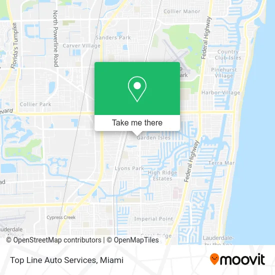
See Top Line Auto Services, Pompano Beach, on the map
Public Transit to Top Line Auto Services in Pompano Beach
Wondering how to get to Top Line Auto Services in Pompano Beach? Moovit helps you find the best way to get to Top Line Auto Services with step-by-step directions from the nearest public transit station.
Moovit provides free maps and live directions to help you navigate through your city. View schedules, routes, timetables, and find out how long does it take to get to Top Line Auto Services in real time.
Looking for the nearest stop or station to Top Line Auto Services? Check out this list of stops closest to your destination: Dixie Highway/Southwest 3rd Street; Cypress Road/Southeast 5th Court; Cypress Creek Station.
Bus: 20, 42, 50, 60.Train: TRIRAIL.
Want to see if there’s another route that gets you there at an earlier time? Moovit helps you find alternative routes or times. Get directions from and directions to Top Line Auto Services easily from the Moovit App or Website.
We make riding to Top Line Auto Services easy, which is why over 1.5 million users, including users in Pompano Beach, trust Moovit as the best app for public transit. You don’t need to download an individual bus app or train app, Moovit is your all-in-one transit app that helps you find the best bus time or train time available.
For information on prices of bus and train, costs and ride fares to Top Line Auto Services, please check the Moovit app.
Use the app to navigate to popular places including to the airport, hospital, stadium, grocery store, mall, coffee shop, school, college, and university.
Top Line Auto Services Address: 50 SW 5th St Pompano Beach, FL 33060 street in Pompano Beach
- Moto Marine,
- Henry Garages,
- Pompano Beach Fire Rescue Station 63,
- Pompano Beach Padlock Locksmith Service,
- Sea Mario Restaurant,
- More Than Oneway Hotdogs,
- Girlys Kitchen Cuisine,
- NZ Salon,
- Three Princes Air Duct Cleaning Service,
- Cure & More,
- Taqueira Mexicana Quic,
- La Bodega Latin Store,
- Edward Jones Investments,
- Stevies Quick Air Conditioning Repair,
- License To Chill,
- JLK's Beauty Salon,
- Exxon,
- Presto! ATM,
- Quick Serve Food Mart,
- El Jalapeno Feliz
Places Near Top Line Auto Services (Pompano Beach)
- Richard E. Gerstein Justice Building, Miami,
- Aventura Mall, Miami,
- Miami VA Hospital, Miami,
- Miami Design District, Miami,
- Marlins Park, Miami,
- Miami Freedom Park, Miami,
- Sawgrass mall ( FL ), Miami Beach,
- Wynwood, Miami,
- Port of Miami Cruise Terminal, Miami,
- Brickell City Centre, Miami,
- Little Havana, Miami,
- Miami-Dade County Courthouse, Miami,
- Dolphin Mall Bus, Miami,
- Sawgrass Mall, Miami,
- Keiser University Flagship Campus, West Palm Beach,
- Hard Rock Stadium, Miami Gardens,
- Dolphin Mall, Miami,
- Bayside Marketplace, Miami,
- Zoo Miami, Miami,
- Aventura Mall, Miami Beach
How to get to popular places in Miami with public transit
Get around Pompano Beach by public transit!
Traveling around Pompano Beach has never been so easy. See step by step directions as you travel to any attraction, street or major public transit station. View bus and train schedules, arrival times, service alerts and detailed routes on a map, so you know exactly how to get to anywhere in Pompano Beach.
When traveling to any destination around Pompano Beach use Moovit's Live Directions with Get Off Notifications to know exactly where and how far to walk, how long to wait for your line, and how many stops are left. Moovit will alert you when it's time to get off — no need to constantly re-check whether yours is the next stop.
Wondering how to use public transit in Pompano Beach or how to pay for public transit in Pompano Beach? Moovit public transit app can help you navigate your way with public transit easily, and at minimum cost. It includes public transit fees, ticket prices, and costs. Looking for a map of Pompano Beach public transit lines? Moovit public transit app shows all public transit maps in Pompano Beach with all Bus, Train, Light Rail and Ferry routes and stops on an interactive map.
Miami has 4 transit type(s), including: Bus, Train, Light Rail and Ferry, operated by several transit agencies, including Broward County Transit, Miami-Dade Transit, Metrorail, Palm Tran, Tri-Rail, Brightline, MARTY, City of Homestead Trolley, Key West Transit, Treasure Coast Connector, GoLine IRT, Amtrak, Greyhound-us, FlixBus-us and Aventura Express Shuttle Bus