How to get to Top Notch Transportation by bus?
Click on the bus route to see step by step directions with maps, line arrival times and updated time schedules.
From Miami Springs Senior High School, Miami
81 minFrom Lincoln Road Mall & Lincoln Road, Miami Beach
34 minFrom Kimpton Angler's Hotel, Miami Beach
43 minFrom DoubleTree by Hilton Hotel Miami Airport & Convention Center, North Westside
48 minFrom W 72 Ave & Flagler St, Miami
51 minFrom Joe's Stone Crab, Miami Beach
46 minFrom Amtrak, Miami
80 minFrom Tri Rail Metrorail Transfer Station, Miami
75 minFrom Explorer 96 Mav, North Westside
62 minFrom Best Western Plus Atlantic Beach Resort Miami Beach, Miami Beach
60 min
How to get to Top Notch Transportation by train?
Click on the train route to see step by step directions with maps, line arrival times and updated time schedules.
Bus stops near Top Notch Transportation in Miami
Train stations near Top Notch Transportation in Miami
Bus lines to Top Notch Transportation in Miami
What are the closest stations to Top Notch Transportation?
The closest stations to Top Notch Transportation are:
- Nw 4 St & Nw 9 Av is 102 yards away, 2 min walk.
- W Flagler St & Nw 9 Av is 407 yards away, 6 min walk.
- W Flagler St @ Nw 8 Av is 484 yards away, 6 min walk.
- Sw 1 St @ Sw 9 Av is 547 yards away, 7 min walk.
- Nw 6 St & Nw 7 Av is 626 yards away, 8 min walk.
- Nw 7 Av & Nw 7 St is 668 yards away, 9 min walk.
- Government Center is 1697 yards away, 21 min walk.
- MiamiCentral Station is 1708 yards away, 21 min walk.
- Miami is 1708 yards away, 21 min walk.
Which bus lines stop near Top Notch Transportation?
These bus lines stop near Top Notch Transportation: 11, 7, 77.
Which train line stops near Top Notch Transportation?
GREEN (Palmetto Station Rail Southbound→Dadeland South Stat.rail Southbound)
What’s the nearest train station to Top Notch Transportation in Miami?
The nearest train stations to Top Notch Transportation in Miami are Government Center, MiamiCentral Station and Miami. The closest one is a 21 min walk away.
What’s the nearest bus station to Top Notch Transportation in Miami?
The nearest bus station to Top Notch Transportation in Miami is Nw 4 St & Nw 9 Av. It’s a 2 min walk away.
What time is the first train to Top Notch Transportation in Miami?
The ORANGE is the first train that goes to Top Notch Transportation in Miami. It stops nearby at 5:17 AM.
What time is the last train to Top Notch Transportation in Miami?
The GREEN is the last train that goes to Top Notch Transportation in Miami. It stops nearby at 12:44 AM.
What time is the first bus to Top Notch Transportation in Miami?
The 11 is the first bus that goes to Top Notch Transportation in Miami. It stops nearby at 3:02 AM.
What time is the last bus to Top Notch Transportation in Miami?
The 11 is the last bus that goes to Top Notch Transportation in Miami. It stops nearby at 2:42 AM.
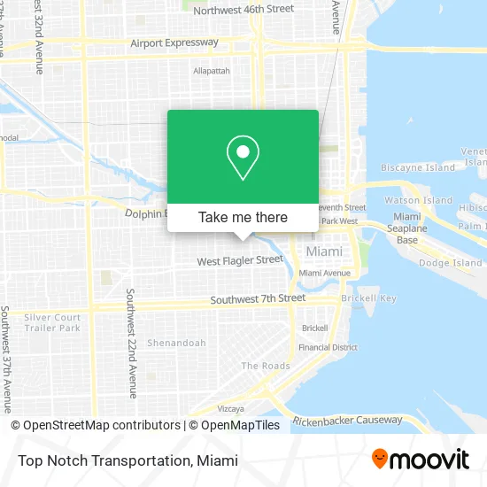
See Top Notch Transportation, Miami, on the map
Public Transit to Top Notch Transportation in Miami
Wondering how to get to Top Notch Transportation in Miami? Moovit helps you find the best way to get to Top Notch Transportation with step-by-step directions from the nearest public transit station.
Moovit provides free maps and live directions to help you navigate through your city. View schedules, routes, timetables, and find out how long does it take to get to Top Notch Transportation in real time.
Looking for the nearest stop or station to Top Notch Transportation? Check out this list of stops closest to your destination: Nw 4 St & Nw 9 Av; W Flagler St & Nw 9 Av; W Flagler St @ Nw 8 Av; Sw 1 St @ Sw 9 Av; Nw 6 St & Nw 7 Av; Nw 7 Av & Nw 7 St; Government Center; MiamiCentral Station; Miami.
Bus: 11, 7, 77, MIAHAVA, 208.Train: GREEN, ORANGE, TRIRAIL, TRIRAIL, BLFM.
Want to see if there’s another route that gets you there at an earlier time? Moovit helps you find alternative routes or times. Get directions from and directions to Top Notch Transportation easily from the Moovit App or Website.
We make riding to Top Notch Transportation easy, which is why over 1.5 million users, including users in Miami, trust Moovit as the best app for public transit. You don’t need to download an individual bus app or train app, Moovit is your all-in-one transit app that helps you find the best bus time or train time available.
For information on prices of bus, train and light rail, costs and ride fares to Top Notch Transportation, please check the Moovit app.
Use the app to navigate to popular places including to the airport, hospital, stadium, grocery store, mall, coffee shop, school, college, and university.
Top Notch Transportation Address: 301 NW 9th Ave Miami, FL 33128 street in Miami
- Miami Black Car Service,
- NW 4th St / NW 9th Ave,
- Best Chiropractic Adjustment,
- Palma,
- Coinsource,
- Max Autoservice,
- College Hunks Hauling Junk & Moving - Miami,
- Peñalver Clinic,
- Old School International Seafood Cuisine,
- Vara,
- La Portena Cafeteria,
- Miami Times,
- Blink Charging,
- Plumbing Services,
- Mercy Family Child Care Inc,
- Eagle Construction & Investments,
- SBN Restoration,
- Easton Lockout & Change Locks,
- Hope for Miami,
- Northwest 10th Avenue & Northwest 5th Street
Places Near Top Notch Transportation (Miami)
- Dolphin Mall, Miami,
- Marlins Park, Miami,
- Little Havana, Miami,
- 1351 NW 12th St, Miami,
- Miami-Dade County Courthouse, Miami,
- Zoo Miami, Miami,
- Sawgrass Mall, Miami,
- Keiser University Flagship Campus, West Palm Beach,
- Miami Freedom Park, Miami,
- Dolphin Mall Bus, Miami,
- Hard Rock Stadium, Miami Gardens,
- Miami Design District, Miami,
- Port of Miami Cruise Terminal, Miami,
- Aventura Mall, Miami Beach,
- Sawgrass mall ( FL ), Miami Beach,
- Aventura Mall, Miami,
- Wynwood, Miami,
- Bayside Marketplace, Miami,
- Richard E. Gerstein Justice Building, Miami,
- Brickell City Centre, Miami
How to get to popular places in Miami with public transit
Get around Miami by public transit!
Traveling around Miami has never been so easy. See step by step directions as you travel to any attraction, street or major public transit station. View bus and train schedules, arrival times, service alerts and detailed routes on a map, so you know exactly how to get to anywhere in Miami.
When traveling to any destination around Miami use Moovit's Live Directions with Get Off Notifications to know exactly where and how far to walk, how long to wait for your line, and how many stops are left. Moovit will alert you when it's time to get off — no need to constantly re-check whether yours is the next stop.
Wondering how to use public transit in Miami or how to pay for public transit in Miami? Moovit public transit app can help you navigate your way with public transit easily, and at minimum cost. It includes public transit fees, ticket prices, and costs. Looking for a map of Miami public transit lines? Moovit public transit app shows all public transit maps in Miami with all Bus, Train, Light Rail and Ferry routes and stops on an interactive map.
Miami has 4 transit type(s), including: Bus, Train, Light Rail and Ferry, operated by several transit agencies, including Broward County Transit, Miami-Dade Transit, Metrorail, Palm Tran, Tri-Rail, Brightline, MARTY, City of Homestead Trolley, Key West Transit, Treasure Coast Connector, GoLine IRT, Amtrak, Greyhound-us, FlixBus-us and Aventura Express Shuttle Bus