How to get to Topitop by bus?
Click on the bus route to see step by step directions with maps, line arrival times and updated time schedules.
From POR WONG DE 2 DE MAYO EN SAN ISIDRO, San Isidro
34 minFrom Parque de la Amistad - Surco, Lima
42 minFrom Avenida Universitaria Cdra 40 Mz A lote 3 (A dos cuadras de Av Los Alisos cruce de av unive, Los Olivos
46 minFrom MZ O LT COOPERATIVA VIRGEN DE FATIMA SMP, San Martin
44 minFrom JR COTABAMBAS CERCADO DE LIMA, Lima
40 minFrom Gamarra Plaza Norte, Independen
41 minFrom Chongo de Huayta, Los Olivos
40 minFrom Terminal Terrestre Yerbateros, San Luis
44 minFrom puente de los suspiros barranco, Barranco
51 minFrom Ovalo Balta, Barranco
51 min
Bus stops near Topitop in San Miguel
Bus lines to Topitop in San Miguel
- 206, Alameda Del Corregidor (La Molina) - San Marcos (San Miguel),VIEW
- 1008, Sucre (Magdalena Del Mar) - Villa Club (Carabayllo),VIEW
- 1011, Carabayllo - Pueblo Libre,VIEW
- 1021, Mercado (Magdalena Del Mar) - Torre Blanca (Carabayllo),VIEW
- 1182, San Juan de Miraflores - Carabayllo,VIEW
- 1326, Av. San Juan (Puente Piedra) - Plaza San Miguel (San Miguel),VIEW
- 1336, Torreblanca (Carabayllo) - Universitaria (San Miguel),VIEW
- 1338, La Playa (Ventanilla) - La Paz (La Perla),VIEW
- 1462, Carabayllo - Universitaria - Brasil - Carabayllo,VIEW
- 1337, Villa Club (Carabayllo) - La Marina (San Miguel),VIEW
- IO40, Los Olivos - San Miguel,VIEW
- 201, Ovalo La Perla (Callao) - Ceres (Ate),VIEW
- 204, Manchay (Pachacamac) - Faucett (San Miguel),VIEW
- 1315, Jose Galvez (Pachacamac) - Óvalo Centenario (Callao),VIEW
- IM47, Km. 22 - Faucett - La Marina - Brasil - Caquetá - Km. 22,VIEW
- OM19, Chepen (Villa El Salvador),VIEW
- 209, San Marcos (San Miguel) - Tagore (Ate),VIEW
- 1173, Pacasmayo (San Martin de Porres) - La Marina (San Miguel),VIEW
- 1203, Portón (San Juan De Lurigancho) - Plaza Norte (San Martin De Porres) - Portón (San Juan De Lurigancho),VIEW
- 1228, Ovalo La Perla (Callao) - Huaycán (Ate),VIEW
What are the closest stations to Topitop?
The closest stations to Topitop are:
- La Marina is 146 meters away, 3 min walk.
- La Marina/Univ. is 160 meters away, 3 min walk.
- Plaza San Miguel is 204 meters away, 3 min walk.
- Universitaria is 223 meters away, 4 min walk.
- Cc. Plaza San Miguel is 349 meters away, 5 min walk.
Which bus lines stop near Topitop?
These bus lines stop near Topitop: 1182, 1326, 1337, 1338, 1462, 201.
What’s the nearest bus station to Topitop in San Miguel?
The nearest bus stations to Topitop in San Miguel are La Marina, La Marina/Univ. and Plaza San Miguel. The closest one is a 3 min walk away.
What time is the first bus to Topitop in San Miguel?
The 1254 is the first bus that goes to Topitop in San Miguel. It stops nearby at 3:35 AM.
What time is the last bus to Topitop in San Miguel?
The 1315 is the last bus that goes to Topitop in San Miguel. It stops nearby at 1:07 AM.
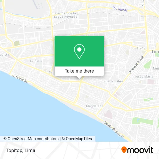
See Topitop, San Miguel, on the map
Public Transit to Topitop in San Miguel
Wondering how to get to Topitop in San Miguel? Moovit helps you find the best way to get to Topitop with step-by-step directions from the nearest public transit station.
Moovit provides free maps and live directions to help you navigate through your city. View schedules, routes, timetables, and find out how long does it take to get to Topitop in real time.
Looking for the nearest stop or station to Topitop? Check out this list of stops closest to your destination: La Marina; La Marina/Univ.; Plaza San Miguel; Universitaria; Cc. Plaza San Miguel.
Bus: 1182, 1326, 1337, 1338, 1462, 201, 206, 1008, 1011, 1021, IO40, 204, 1315, IM47, OM19, 209, 1173, 1203, 1228, 1253, 1254.
Want to see if there’s another route that gets you there at an earlier time? Moovit helps you find alternative routes or times. Get directions from and directions to Topitop easily from the Moovit App or Website.
We make riding to Topitop easy, which is why over 1.5 million users, including users in San Miguel, trust Moovit as the best app for public transit. You don’t need to download an individual bus app or train app, Moovit is your all-in-one transit app that helps you find the best bus time or train time available.
For information on prices of bus, costs and ride fares to Topitop, please check the Moovit app.
Use the app to navigate to popular places including to the airport, hospital, stadium, grocery store, mall, coffee shop, school, college, and university.
Topitop Address: Av. La Marina 2100 tda. 244 street in San Miguel
- Essentiel Pour Michelle Belau,
- Tda 76,
- Reebok San Miguel,
- Western Union - Plaza San Miguel,
- Victoria's Secret,
- Ritzy Of Italy,
- Toku Sushi,
- Leonisa Plaza San Miguel,
- Avenida La Marina 2000,
- SAN MIGUEL CON LA MARINA,
- iShop Plaza San Miguel,
- Crepes & Waffles,
- Grill Longhorn San Miguel,
- Av. Pacifico cruce Av. Haya de la Torre,
- Tommy Hilfiger,
- Bath & Body Works,
- Marathon Sports,
- calle san isidro san miguel,
- A 3 CUADRAS DE LA PLAZA SAN MIGUEL,
- Coney Park Conexxion
Places Near Topitop (San Miguel)
- Barranco, Barranco,
- Parque de las Leyendas, San Miguel,
- av arequipa, Lima,
- Real Plaza Puruchuco, Ate,
- Mall Del Sur,
- Jockey Plaza, Santiago D,
- Aeropuerto Internacional Jorge Chávez, Ventanilla,
- Miraflores, Miraflores,
- Av. La Marina, San Miguel,
- Gamarra,
- Circuito Mágico Del Agua, Lima,
- Av. Abancay, Lima,
- Paradero Av.Brasil,
- Centro Comercial Plaza Norte, Independen,
- Plaza San Miguel, San Miguel,
- Av. Salaverry, Jesus Mari,
- Pontificia Universidad Católica del Perú - PUCP, San Miguel,
- Parque Kennedy, Miraflores,
- Hospital Edgardo Rebagliati Martins, Jesus Mari,
- Larcomar, Miraflores
How to get to popular places in Lima with public transit
Get around San Miguel by public transit!
Traveling around San Miguel has never been so easy. See step by step directions as you travel to any attraction, street or major public transit station. View bus and train schedules, arrival times, service alerts and detailed routes on a map, so you know exactly how to get to anywhere in San Miguel.
When traveling to any destination around San Miguel use Moovit's Live Directions with Get Off Notifications to know exactly where and how far to walk, how long to wait for your line, and how many stops are left. Moovit will alert you when it's time to get off — no need to constantly re-check whether yours is the next stop.
Wondering how to use public transit in San Miguel or how to pay for public transit in San Miguel? Moovit public transit app can help you navigate your way with public transit easily, and at minimum cost. It includes public transit fees, ticket prices, and costs. Looking for a map of San Miguel public transit lines? Moovit public transit app shows all public transit maps in San Miguel with all Bus, Metro and Ferry routes and stops on an interactive map.
Lima has 3 transit type(s), including: Bus, Metro and Ferry, operated by several transit agencies, including Metro de Lima Línea 2 , Metro de Lima, Corredor Rojo, Metropolitano, Metropolitano - Alimentadores, Corredor Morado, Corredor Azul, Rutas Tradicionales, Transportes y Servicios La Esperanza S.A., Las Flores S.A., Virgen de la Asunción S.A., Consorcio HAM, Transportes y Service Canadá S.A., ETUL4SA and ETUCHISA