How to get to Torburn Partners by bus?
Click on the bus route to see step by step directions with maps, line arrival times and updated time schedules.
From Brandsmart USA - Clearance Center, Fl, Davie
67 minFrom Tamarac, Coral Springs-Margate
31 minFrom Coral Square Mall Shopping Center, Coral Springs-Margate
45 minFrom South Plantation High School, Plantation
40 minFrom Griffin Road And 441, Hollywood
64 minFrom State Road 7 & West Sunrise Boulevard, Plantation
42 minFrom Griffin Road & Davie Road, Davie
47 minFrom Cam Transfer, Coral Springs-Margate
69 minFrom 595 Express, Davie
50 minFrom CCA Calvary Christian Academy, Fort Lauderdale
71 min
Bus stops near Torburn Partners in Plantation
Bus lines to Torburn Partners in Plantation
What are the closest stations to Torburn Partners?
The closest stations to Torburn Partners are:
- Sunrise Boulevard/University Drive is 203 yards away, 3 min walk.
- University Drive/Northwest 17th Court - (Motorola) is 317 yards away, 5 min walk.
Which bus lines stop near Torburn Partners?
These bus lines stop near Torburn Partners: 02, 36, 81.
What’s the nearest bus station to Torburn Partners in Plantation?
The nearest bus station to Torburn Partners in Plantation is Sunrise Boulevard/University Drive. It’s a 3 min walk away.
What time is the first bus to Torburn Partners in Plantation?
The 81 is the first bus that goes to Torburn Partners in Plantation. It stops nearby at 4:36 AM.
What time is the last bus to Torburn Partners in Plantation?
The 02 is the last bus that goes to Torburn Partners in Plantation. It stops nearby at 1:11 AM.
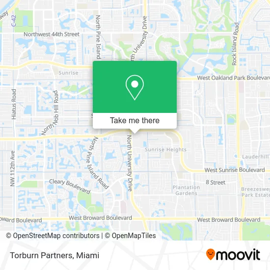
See Torburn Partners, Plantation, on the map
Public Transit to Torburn Partners in Plantation
Wondering how to get to Torburn Partners in Plantation? Moovit helps you find the best way to get to Torburn Partners with step-by-step directions from the nearest public transit station.
Moovit provides free maps and live directions to help you navigate through your city. View schedules, routes, timetables, and find out how long does it take to get to Torburn Partners in real time.
Looking for the nearest stop or station to Torburn Partners? Check out this list of stops closest to your destination: Sunrise Boulevard/University Drive; University Drive/Northwest 17th Court - (Motorola).
Bus: 02, 36, 81, 56.
Want to see if there’s another route that gets you there at an earlier time? Moovit helps you find alternative routes or times. Get directions from and directions to Torburn Partners easily from the Moovit App or Website.
We make riding to Torburn Partners easy, which is why over 1.5 million users, including users in Plantation, trust Moovit as the best app for public transit. You don’t need to download an individual bus app or train app, Moovit is your all-in-one transit app that helps you find the best bus time or train time available.
For information on prices of bus, costs and ride fares to Torburn Partners, please check the Moovit app.
Use the app to navigate to popular places including to the airport, hospital, stadium, grocery store, mall, coffee shop, school, college, and university.
Torburn Partners Address: West Sunrise Boulevard street in Plantation
- Adore Plastic Surgery,
- Femme Fatale Salon,
- Al Salam Restaurant and Market,
- Al Salam Mediterranean,
- Natural Healers,
- Hijabs Queen,
- Jacaranda Travel,
- Alarm Association of Florida,
- Lawlor White & Murphey,
- Tropical Cleaning Services,
- Geico Insurance Agent,
- DUNKIN',
- Olivo Mediterranean Cuisine,
- University D/N Marcano B ,
- From the Inside-Out School of Etiquette,
- Sunrise B/Motorola Ent,
- US Il Holdings,
- Xfinity Store by Comcast,
- American Tire and Auto Center,
- Nationsbenefits
Places Near Torburn Partners (Plantation)
- Miami Design District, Miami,
- Richard E. Gerstein Justice Building, Miami,
- Miami Freedom Park, Miami,
- Miami-Dade County Courthouse, Miami,
- Wynwood, Miami,
- Aventura Mall, Miami Beach,
- Sawgrass mall ( FL ), Miami Beach,
- Brickell City Centre, Miami,
- Sawgrass Mall, Miami,
- Hard Rock Stadium, Miami Gardens,
- Bayside Marketplace, Miami,
- Dolphin Mall, Miami,
- Miami VA Hospital, Miami,
- Dolphin Mall Bus, Miami,
- Keiser University Flagship Campus, West Palm Beach,
- Zoo Miami, Miami,
- Marlins Park, Miami,
- Port of Miami Cruise Terminal, Miami,
- Aventura Mall, Miami,
- Little Havana, Miami
How to get to popular places in Miami with public transit
Get around Plantation by public transit!
Traveling around Plantation has never been so easy. See step by step directions as you travel to any attraction, street or major public transit station. View bus and train schedules, arrival times, service alerts and detailed routes on a map, so you know exactly how to get to anywhere in Plantation.
When traveling to any destination around Plantation use Moovit's Live Directions with Get Off Notifications to know exactly where and how far to walk, how long to wait for your line, and how many stops are left. Moovit will alert you when it's time to get off — no need to constantly re-check whether yours is the next stop.
Wondering how to use public transit in Plantation or how to pay for public transit in Plantation? Moovit public transit app can help you navigate your way with public transit easily, and at minimum cost. It includes public transit fees, ticket prices, and costs. Looking for a map of Plantation public transit lines? Moovit public transit app shows all public transit maps in Plantation with all Bus, Train, Light Rail and Ferry routes and stops on an interactive map.
Miami has 4 transit type(s), including: Bus, Train, Light Rail and Ferry, operated by several transit agencies, including Broward County Transit, Miami-Dade Transit, Metrorail, Palm Tran, Tri-Rail, Brightline, MARTY, City of Homestead Trolley, Key West Transit, Treasure Coast Connector, GoLine IRT, Amtrak, Greyhound-us, FlixBus-us and Aventura Express Shuttle Bus