How to get to Total Computing by bus?
Click on the bus route to see step by step directions with maps, line arrival times and updated time schedules.
From Farmer's Fridge, Indianapolis City (Balance)
45 minFrom Sidney & Lois Eskenazi Hospital, Indianapolis City (Balance)
45 minFrom Pffui News, Indianapolis City (Balance)
49 minFrom Tough Guys, Indianapolis City (Balance)
53 minFrom 46th Street & Emerson Avenue, Indianapolis City (Balance)
52 minFrom Indygo Bus Route 39A, Indianapolis City (Balance)
34 minFrom IUPUI University Tower Ballroom, Indianapolis City (Balance)
42 minFrom IU Health Indiana University Hospital (IU Hospital) Parking Garage, Indianapolis City (Balance)
42 minFrom Dr Andrea Cmejla, Od, Indianapolis City (Balance)
33 minFrom Small Business Adm, Indianapolis City (Balance)
39 min
Bus stops near Total Computing in Indianapolis City (Balance)
Bus lines to Total Computing in Indianapolis City (Balance)
What are the closest stations to Total Computing?
The closest stations to Total Computing are:
- Broad Ripple Ave & Guilford Ave is 202 yards away, 3 min walk.
- College Ave & Kessler Station Nb is 289 yards away, 4 min walk.
Which bus lines stop near Total Computing?
These bus lines stop near Total Computing: 82, 90.
What’s the nearest bus station to Total Computing in Indianapolis City (Balance)?
The nearest bus station to Total Computing in Indianapolis City (Balance) is Broad Ripple Ave & Guilford Ave. It’s a 3 min walk away.
What time is the first bus to Total Computing in Indianapolis City (Balance)?
The 90 is the first bus that goes to Total Computing in Indianapolis City (Balance). It stops nearby at 4:53 AM.
What time is the last bus to Total Computing in Indianapolis City (Balance)?
The 90 is the last bus that goes to Total Computing in Indianapolis City (Balance). It stops nearby at 1:09 AM.
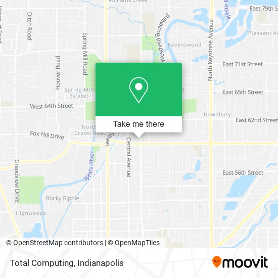
See Total Computing, Indianapolis City (Balance), on the map
Public Transit to Total Computing in Indianapolis City (Balance)
Wondering how to get to Total Computing in Indianapolis City (Balance)? Moovit helps you find the best way to get to Total Computing with step-by-step directions from the nearest public transit station.
Moovit provides free maps and live directions to help you navigate through your city. View schedules, routes, timetables, and find out how long does it take to get to Total Computing in real time.
Looking for the nearest stop or station to Total Computing? Check out this list of stops closest to your destination: Broad Ripple Ave & Guilford Ave; College Ave & Kessler Station Nb.
Bus: 82, 90, 19.
Want to see if there’s another route that gets you there at an earlier time? Moovit helps you find alternative routes or times. Get directions from and directions to Total Computing easily from the Moovit App or Website.
We make riding to Total Computing easy, which is why over 1.5 million users, including users in Indianapolis City (Balance), trust Moovit as the best app for public transit. You don’t need to download an individual bus app or train app, Moovit is your all-in-one transit app that helps you find the best bus time or train time available.
For information on prices of bus, costs and ride fares to Total Computing, please check the Moovit app.
Use the app to navigate to popular places including to the airport, hospital, stadium, grocery store, mall, coffee shop, school, college, and university.
Total Computing Address: 5948 N College Ave Indianapolis, IN 46220 street in Indianapolis City (Balance)
- Ability Allies,
- Jason Glenn Reyome Attorney,
- Cotter's Massage Parlor With Happy Endings,
- Indianapolis Air Conditioning Contractors,
- Canchola Key Locksmith,
- Northside Paws Veterinary Care,
- Worthington Design & Remodeling - Meridian Kessler Design Studio,
- BMV License Agency,
- Hudgins E Ronald,
- Down South Beverage Company, Inc.,
- Ivy Tech CC Anderson Bookstore,
- Big Red Liquors,
- Bierman Autism Centers - Broad Ripple, In,
- Local Blitz,
- Riley Center,
- A&G Marketing,
- Tanner Consulting,
- Mark Jamerson,
- Glenn Lewzader-Carpenter Realtors,
- Greg Hillman, Realtor, Carpenter Realtors
Places Near Total Computing (Indianapolis City (Balance))
- THE BALT, Indianapolis City (Balance),
- Cotter's Massage Parlor With Happy Endings, Indianapolis City (Balance),
- Indiana, Indianapolis City (Balance),
- Castleton Square Mall, Indianapolis,
- Plainfield, IN, Plainfield,
- Indiana Convention Center, Indianapolis City (Balance),
- Indianapolis Airport Zone 2, Indianapolis City (Balance),
- Lucas Oil Stadium, Indianapolis City (Balance),
- I-465 / I-65 Interchange, Indianapolis City (Balance),
- Eskenazi Hospital, Indianapolis City (Balance),
- 119 W 19th St Parking, Indianapolis City (Balance),
- Lilly Corporate Center (Eli Lilly & Co), Indianapolis City (Balance),
- Jersey Barn, Indianapolis City (Balance),
- Train Ride At Castleton Mall, Indianapolis City (Balance),
- I U Health Methodist Hospital, Indianapolis City (Balance),
- Gainbridge Fieldhouse, Indianapolis City (Balance),
- Indianapolis Motor Speedway, Speedway,
- Methodist Hospital of Indianapolis, Indianapolis City (Balance),
- St. Vincent Hospital - Indianapolis, Indianapolis City (Balance),
- St. Vincent entrance #1, Indianapolis City (Balance)
How to get to popular places in Indianapolis with public transit
Get around Indianapolis City (Balance) by public transit!
Traveling around Indianapolis City (Balance) has never been so easy. See step by step directions as you travel to any attraction, street or major public transit station. View bus and train schedules, arrival times, service alerts and detailed routes on a map, so you know exactly how to get to anywhere in Indianapolis City (Balance).
When traveling to any destination around Indianapolis City (Balance) use Moovit's Live Directions with Get Off Notifications to know exactly where and how far to walk, how long to wait for your line, and how many stops are left. Moovit will alert you when it's time to get off — no need to constantly re-check whether yours is the next stop.
Wondering how to use public transit in Indianapolis City (Balance) or how to pay for public transit in Indianapolis City (Balance)? Moovit public transit app can help you navigate your way with public transit easily, and at minimum cost. It includes public transit fees, ticket prices, and costs. Looking for a map of Indianapolis City (Balance) public transit lines? Moovit public transit app shows all public transit maps in Indianapolis City (Balance) with all bus routes and stops on an interactive map.
Indianapolis has 1 transit type(s), including: bus, operated by several transit agencies, including IndyGo, FlixBus-us and Greyhound-us