How to get to Total Insurance by bus?
Click on the bus route to see step by step directions with maps, line arrival times and updated time schedules.
From Doral Voice, North Westside
129 minFrom IKEA Miami, North Westside
91 minFrom NW 183rd St / NW 47th Ave, Miami Gardens
114 minFrom Miami Dade College West Campus, North Westside
74 minFrom Spin Group, North Westside
99 minFrom Barbara Goleman Senior High School's, Hialeah
81 minFrom Dolphin Mall, Miami, North Westside
95 minFrom 72nd Ave. & 25th St. @ Miami, North Westside
86 minFrom Amelia Earhart Park, Miami
115 minFrom Amtrak, Miami
113 min
Bus stop near Total Insurance in Kendale Lakes-Tamiami
- Nw 122 St@frontage Rd (Okech), 13 min walk,VIEW
Bus lines to Total Insurance in Kendale Lakes-Tamiami
- HIAMAR, City Of Hialeah Transit (Marlin),VIEW
What are the closest stations to Total Insurance?
The closest stations to Total Insurance are:
- Nw 122 St@frontage Rd (Okech) is 1049 yards away, 13 min walk.
Which bus lines stop near Total Insurance?
These bus lines stop near Total Insurance: 54, DLOOP3, DLOOP4, HIAMAR.
What’s the nearest bus station to Total Insurance in Kendale Lakes-Tamiami?
The nearest bus station to Total Insurance in Kendale Lakes-Tamiami is Nw 122 St@frontage Rd (Okech). It’s a 13 min walk away.
What time is the first bus to Total Insurance in Kendale Lakes-Tamiami?
The HIAMAR is the first bus that goes to Total Insurance in Kendale Lakes-Tamiami. It stops nearby at 6:16 AM.
What time is the last bus to Total Insurance in Kendale Lakes-Tamiami?
The HIAMAR is the last bus that goes to Total Insurance in Kendale Lakes-Tamiami. It stops nearby at 8:38 PM.
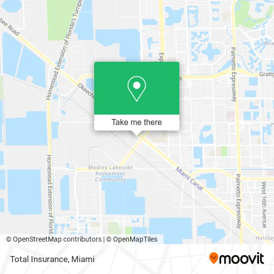
See Total Insurance, Kendale Lakes-Tamiami, on the map
Public Transit to Total Insurance in Kendale Lakes-Tamiami
Wondering how to get to Total Insurance in Kendale Lakes-Tamiami? Moovit helps you find the best way to get to Total Insurance with step-by-step directions from the nearest public transit station.
Moovit provides free maps and live directions to help you navigate through your city. View schedules, routes, timetables, and find out how long does it take to get to Total Insurance in real time.
Looking for the nearest stop or station to Total Insurance? Check out this list of stops closest to your destination: Nw 122 St@frontage Rd (Okech).
Bus: 54, DLOOP3, DLOOP4, HIAMAR.
Want to see if there’s another route that gets you there at an earlier time? Moovit helps you find alternative routes or times. Get directions from and directions to Total Insurance easily from the Moovit App or Website.
We make riding to Total Insurance easy, which is why over 1.5 million users, including users in Kendale Lakes-Tamiami, trust Moovit as the best app for public transit. You don’t need to download an individual bus app or train app, Moovit is your all-in-one transit app that helps you find the best bus time or train time available.
For information on prices of bus and train, costs and ride fares to Total Insurance, please check the Moovit app.
Use the app to navigate to popular places including to the airport, hospital, stadium, grocery store, mall, coffee shop, school, college, and university.
Total Insurance Address: 11710 NW South River Dr Miami, FL 33178 street in Kendale Lakes-Tamiami
- Top Trucking,
- Ajm Trucking,
- CITGO,
- 10-4 Truck Parts,
- Road Star Carrier,
- Central Concrete Supermix,
- Miller Heavy Equipment,
- Machinery Intertrade,
- Oso Ddy Transport,
- Polimix,
- US National Freight,
- Gem Paver Systems (Gem Pavers Systems),
- PNC Bank,
- U Gas,
- Navy Federal Credit Union,
- Statewide Carrier,
- South Shore United Carriers,
- Truck Brokerage by National Group Inc.,
- Insurance & Beyond,
- Elite Carrier Services of Miami
Places Near Total Insurance (Kendale Lakes-Tamiami)
- Wynwood, Miami,
- Zoo Miami, Miami,
- Aventura Mall, Miami,
- Sawgrass mall ( FL ), Miami Beach,
- Port of Miami Cruise Terminal, Miami,
- Keiser University Flagship Campus, West Palm Beach,
- Bayside Marketplace, Miami,
- Miami Freedom Park, Miami,
- Miami-Dade County Courthouse, Miami,
- Miami VA Hospital, Miami,
- Little Havana, Miami,
- Aventura Mall, Miami Beach,
- Sawgrass Mall, Miami,
- Marlins Park, Miami,
- Hard Rock Stadium, Miami Gardens,
- Dolphin Mall Bus, Miami,
- Richard E. Gerstein Justice Building, Miami,
- Dolphin Mall, Miami,
- Brickell City Centre, Miami,
- Miami Design District, Miami
How to get to popular places in Miami with public transit
Get around Kendale Lakes-Tamiami by public transit!
Traveling around Kendale Lakes-Tamiami has never been so easy. See step by step directions as you travel to any attraction, street or major public transit station. View bus and train schedules, arrival times, service alerts and detailed routes on a map, so you know exactly how to get to anywhere in Kendale Lakes-Tamiami.
When traveling to any destination around Kendale Lakes-Tamiami use Moovit's Live Directions with Get Off Notifications to know exactly where and how far to walk, how long to wait for your line, and how many stops are left. Moovit will alert you when it's time to get off — no need to constantly re-check whether yours is the next stop.
Wondering how to use public transit in Kendale Lakes-Tamiami or how to pay for public transit in Kendale Lakes-Tamiami? Moovit public transit app can help you navigate your way with public transit easily, and at minimum cost. It includes public transit fees, ticket prices, and costs. Looking for a map of Kendale Lakes-Tamiami public transit lines? Moovit public transit app shows all public transit maps in Kendale Lakes-Tamiami with all Bus, Train, Light Rail and Ferry routes and stops on an interactive map.
Miami has 4 transit type(s), including: Bus, Train, Light Rail and Ferry, operated by several transit agencies, including Broward County Transit, Miami-Dade Transit, Metrorail, Palm Tran, Tri-Rail, Brightline, MARTY, City of Homestead Trolley, Key West Transit, Treasure Coast Connector, GoLine IRT, Amtrak, Greyhound-us, FlixBus-us and Aventura Express Shuttle Bus