Directions to Total Wireless (Deerfield Beach) with public transportation
The following transit lines have routes that pass near Total Wireless
 Bus: 48, 92.
- Train: TRIRAIL, FLORIDIAN, SILVER METEOR.
How to get to Total Wireless by bus?
Click on the bus route to see step by step directions with maps, line arrival times and updated time schedules.
From Blanche Ely High School, Pompano Beach
75 minFrom Class Room GN 101 Florida Atlantic University, Boca Raton
79 minFrom Lynn University, Boca Raton
84 minFrom Walmart Supercenter, Pompano Beach
74 minFrom John Knox Village Health Center, Pompano Beach
75 minFrom Margate, FL, Coral Springs-Margate
92 minFrom Brazzers, Boca Raton
92 minFrom Amazon Fulfillment Center-DMF3, Pompano Beach
79 minFrom Harrah's Pompano Beach, Pompano Beach
78 minFrom Mizner Park, Boca Raton
71 min
How to get to Total Wireless by train?
Click on the train route to see step by step directions with maps, line arrival times and updated time schedules.
Bus stop near Total Wireless in Deerfield Beach
- Hillsboro Boulevard/Lock Road, 4 min walk,VIEW
Train station near Total Wireless in Deerfield Beach
- Deerfield Beach Station, 62 min walk,VIEW
Bus lines to Total Wireless in Deerfield Beach
- 48, Hillsboro - 441,VIEW
What are the closest stations to Total Wireless?
The closest stations to Total Wireless are:
- Hillsboro Boulevard/Lock Road is 242 yards away, 4 min walk.
- Deerfield Beach Station is 5277 yards away, 62 min walk.
Which bus lines stop near Total Wireless?
These bus lines stop near Total Wireless: 48, 92.
Which train line stops near Total Wireless?
TRIRAIL (Southbound To Miami Airport)
What’s the nearest bus station to Total Wireless in Deerfield Beach?
The nearest bus station to Total Wireless in Deerfield Beach is Hillsboro Boulevard/Lock Road. It’s a 4 min walk away.
What time is the first train to Total Wireless in Deerfield Beach?
The TRIRAIL is the first train that goes to Total Wireless in Deerfield Beach. It stops nearby at 4:35 AM.
What time is the last train to Total Wireless in Deerfield Beach?
The FLORIDIAN is the last train that goes to Total Wireless in Deerfield Beach. It stops nearby at 4:57 PM.
What time is the first bus to Total Wireless in Deerfield Beach?
The 48 is the first bus that goes to Total Wireless in Deerfield Beach. It stops nearby at 5:45 AM.
What time is the last bus to Total Wireless in Deerfield Beach?
The 48 is the last bus that goes to Total Wireless in Deerfield Beach. It stops nearby at 10:44 PM.
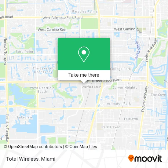
See Total Wireless, Deerfield Beach, on the map
Public Transit to Total Wireless in Deerfield Beach
Wondering how to get to Total Wireless in Deerfield Beach? Moovit helps you find the best way to get to Total Wireless with step-by-step directions from the nearest public transit station.
Moovit provides free maps and live directions to help you navigate through your city. View schedules, routes, timetables, and find out how long does it take to get to Total Wireless in real time.
Looking for the nearest stop or station to Total Wireless? Check out this list of stops closest to your destination: Hillsboro Boulevard/Lock Road; Deerfield Beach Station.
Bus: 48, 92.Train: TRIRAIL, FLORIDIAN, SILVER METEOR.
Want to see if there’s another route that gets you there at an earlier time? Moovit helps you find alternative routes or times. Get directions from and directions to Total Wireless easily from the Moovit App or Website.
We make riding to Total Wireless easy, which is why over 1.5 million users, including users in Deerfield Beach, trust Moovit as the best app for public transit. You don’t need to download an individual bus app or train app, Moovit is your all-in-one transit app that helps you find the best bus time or train time available.
For information on prices of bus and train, costs and ride fares to Total Wireless, please check the Moovit app.
Use the app to navigate to popular places including to the airport, hospital, stadium, grocery store, mall, coffee shop, school, college, and university.
Total Wireless Address: 1668 W Hillsboro Blvd Deerfield Beach, FL 33442 street in Deerfield Beach
- Fleur de Lis Jewelry & Access,
- Tma Envios,
- CL Wizard - Concrete Leak Specialist,
- Lucky Massage Spa,
- New Oriental Massage and Spa,
- Tedescos Bakery,
- Post Office,
- Robert Demick DDS,
- Dr Festa,
- Teich Carla Paris Od Pl,
- Mable Ventures,
- MRS. Daniele Trevathan, LMHC, QS, McAp, Sap,
- Koh Church,
- Kidz on the Rise LLC,
- Katherine Llopiz,
- 100 South Military Trail,
- Broward North Regional Courthouse,
- Global Safe,
- Watson Caring Science Institute (Wcsi),
- Actax Financial
Places Near Total Wireless (Deerfield Beach)
- Dolphin Mall, Miami,
- Keiser University Flagship Campus, West Palm Beach,
- Miami VA Hospital, Miami,
- Sawgrass mall ( FL ), Miami Beach,
- Dolphin Mall Bus, Miami,
- Aventura Mall, Miami Beach,
- Miami Design District, Miami,
- Wynwood, Miami,
- Marlins Park, Miami,
- Richard E. Gerstein Justice Building, Miami,
- Bayside Marketplace, Miami,
- Aventura Mall, Miami,
- Sawgrass Mall, Miami,
- Miami-Dade County Courthouse, Miami,
- Little Havana, Miami,
- Port of Miami Cruise Terminal, Miami,
- Hard Rock Stadium, Miami Gardens,
- Brickell City Centre, Miami,
- Miami Freedom Park, Miami,
- Zoo Miami, Miami
How to get to popular places in Miami with public transit
Get around Deerfield Beach by public transit!
Traveling around Deerfield Beach has never been so easy. See step by step directions as you travel to any attraction, street or major public transit station. View bus and train schedules, arrival times, service alerts and detailed routes on a map, so you know exactly how to get to anywhere in Deerfield Beach.
When traveling to any destination around Deerfield Beach use Moovit's Live Directions with Get Off Notifications to know exactly where and how far to walk, how long to wait for your line, and how many stops are left. Moovit will alert you when it's time to get off — no need to constantly re-check whether yours is the next stop.
Wondering how to use public transit in Deerfield Beach or how to pay for public transit in Deerfield Beach? Moovit public transit app can help you navigate your way with public transit easily, and at minimum cost. It includes public transit fees, ticket prices, and costs. Looking for a map of Deerfield Beach public transit lines? Moovit public transit app shows all public transit maps in Deerfield Beach with all Bus, Train, Light Rail and Ferry routes and stops on an interactive map.
Miami has 4 transit type(s), including: Bus, Train, Light Rail and Ferry, operated by several transit agencies, including Broward County Transit, Miami-Dade Transit, Metrorail, Palm Tran, Tri-Rail, Brightline, MARTY, City of Homestead Trolley, Key West Transit, Treasure Coast Connector, GoLine IRT, Amtrak, Greyhound-us, FlixBus-us and Aventura Express Shuttle Bus