How to get to Total Wireless by bus?
Click on the bus route to see step by step directions with maps, line arrival times and updated time schedules.
From Pier 17, Manhattan
60 minFrom Ellis Island, Manhattan
47 minFrom Statue of Liberty, Manhattan
43 minFrom 22 Cortlandt St, Manhattan
47 minFrom Ground Zero / Zona Cero. New York, Manhattan
49 minFrom NY Lottery Center, Manhattan
45 minFrom Stone St, Manhattan
49 minFrom 4 World Trade Center, Manhattan
48 minFrom 22 Cortlandt Street, Manhattan
47 min
How to get to Total Wireless by subway?
Click on the subway route to see step by step directions with maps, line arrival times and updated time schedules.
From Pier 17, Manhattan
58 minFrom Ellis Island, Manhattan
42 minFrom Statue of Liberty, Manhattan
42 minFrom 22 Cortlandt St, Manhattan
44 minFrom Ground Zero / Zona Cero. New York, Manhattan
46 minFrom NY Lottery Center, Manhattan
43 minFrom Stone St, Manhattan
44 minFrom 4 World Trade Center, Manhattan
45 minFrom 22 Cortlandt Street, Manhattan
44 min
Bus stops near Total Wireless in New York - New Jersey
Subway stations near Total Wireless in New York - New Jersey
Bus lines to Total Wireless in New York - New Jersey
What are the closest stations to Total Wireless?
The closest stations to Total Wireless are:
- 86 St/Fort Hamilton Pkwy is 12 yards away, 1 min walk.
- Fort Hamilton Pkwy/86 St is 40 yards away, 1 min walk.
- Gowanus Ep En Rp/86 St is 130 yards away, 2 min walk.
- 5 Av/86 St is 206 yards away, 3 min walk.
- 86 St is 434 yards away, 6 min walk.
- 8 Av is 2227 yards away, 27 min walk.
Which bus lines stop near Total Wireless?
These bus lines stop near Total Wireless: B63, S93.
Which subway line stops near Total Wireless?
R (Downtown & Brooklyn)
What’s the nearest subway station to Total Wireless in New York - New Jersey?
The nearest subway station to Total Wireless in New York - New Jersey is 86 St. It’s a 6 min walk away.
What’s the nearest bus station to Total Wireless in New York - New Jersey?
The nearest bus stations to Total Wireless in New York - New Jersey are 86 St/Fort Hamilton Pkwy and Fort Hamilton Pkwy/86 St. The closest one is a 1 min walk away.
What time is the first subway to Total Wireless in New York - New Jersey?
The R is the first subway that goes to Total Wireless in New York - New Jersey. It stops nearby at 3:03 AM.
What time is the last subway to Total Wireless in New York - New Jersey?
The N is the last subway that goes to Total Wireless in New York - New Jersey. It stops nearby at 3:38 AM.
What time is the first bus to Total Wireless in New York - New Jersey?
The B63 is the first bus that goes to Total Wireless in New York - New Jersey. It stops nearby at 3:15 AM.
What time is the last bus to Total Wireless in New York - New Jersey?
The S53 is the last bus that goes to Total Wireless in New York - New Jersey. It stops nearby at 3:22 AM.
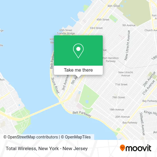
See Total Wireless, New York - New Jersey, on the map
Public Transit to Total Wireless in New York - New Jersey
Wondering how to get to Total Wireless in New York - New Jersey? Moovit helps you find the best way to get to Total Wireless with step-by-step directions from the nearest public transit station.
Moovit provides free maps and live directions to help you navigate through your city. View schedules, routes, timetables, and find out how long does it take to get to Total Wireless in real time.
Looking for the nearest stop or station to Total Wireless? Check out this list of stops closest to your destination: 86 St/Fort Hamilton Pkwy; Fort Hamilton Pkwy/86 St; Gowanus Ep En Rp/86 St; 5 Av/86 St; 86 St; 8 Av.
Bus: B63, S93, B1, B16, S53, B70, X28, X38.Subway: R, N, W.
Want to see if there’s another route that gets you there at an earlier time? Moovit helps you find alternative routes or times. Get directions from and directions to Total Wireless easily from the Moovit App or Website.
We make riding to Total Wireless easy, which is why over 1.5 million users, including users in New York - New Jersey, trust Moovit as the best app for public transit. You don’t need to download an individual bus app or train app, Moovit is your all-in-one transit app that helps you find the best bus time or train time available.
For information on prices of subway and bus, costs and ride fares to Total Wireless, please check the Moovit app.
Use the app to navigate to popular places including to the airport, hospital, stadium, grocery store, mall, coffee shop, school, college, and university.
Total Wireless Address: 563 86th St street in New York - New Jersey
- Dreamy Lash | Eyelash Extension | Eyelash Lift,
- New Dna 1 Unisex,
- Njn Beauty,
- Dreamylash,
- Cricket Wireless Authorized Retailer,
- Pawn Shop Sell Gold Sell Coins Sell Cards,
- Ocean Lash,
- Hawaii Poke One,
- 86th St Fort Hamilton,
- Fort Hamilton Pkwy and 86th St,
- Luxhairnyc,
- Laundry on 86,
- Cell Tell,
- Bay Ridge Flower Shop,
- Menatique,
- Gk Furniture,
- Wowbeaute,
- Family Daycare (Rebeca),
- Spectrum Store,
- Fedex Staffed
Places Near Total Wireless (New York - New Jersey)
- 111 Centre New York City Supreme Court, Manhattan,
- Katz's Deli, Manhattan,
- SoHo, Manhattan,
- Bellevue Hospital, Manhattan,
- Chinatown, Manhattan,
- Queens Center Mall, Queens,
- Mountainside Hospital, Glen Ridge,
- Wall Street, Manhattan,
- 911 Memorial, Manhattan,
- Hudson Yards, Manhattan,
- Rockefeller Center, Manhattan,
- 376 Hudson Street, Manhattan,
- 3 Stone St, Manhattan,
- 66 John Street, Manhattan,
- Times Square, Manhattan,
- Pier 83, Manhattan,
- San Gennaro Feast, Manhattan,
- qqqq, Manhattan,
- 26 Federal Plaza, Manhattan,
- 1 Police Plaza, Manhattan
How to get to popular places in New York - New Jersey with public transit
Get around New York - New Jersey by public transit!
Traveling around New York - New Jersey has never been so easy. See step by step directions as you travel to any attraction, street or major public transit station. View bus and train schedules, arrival times, service alerts and detailed routes on a map, so you know exactly how to get to anywhere in New York - New Jersey.
When traveling to any destination around New York - New Jersey use Moovit's Live Directions with Get Off Notifications to know exactly where and how far to walk, how long to wait for your line, and how many stops are left. Moovit will alert you when it's time to get off — no need to constantly re-check whether yours is the next stop.
Wondering how to use public transit in New York - New Jersey or how to pay for public transit in New York - New Jersey? Moovit public transit app can help you navigate your way with public transit easily, and at minimum cost. It includes public transit fees, ticket prices, and costs. Looking for a map of New York - New Jersey public transit lines? Moovit public transit app shows all public transit maps in New York - New Jersey with all Bus, Train, Subway, Light Rail, Ferry and Cable Car routes and stops on an interactive map.
New York - New Jersey has 6 transit type(s), including: Bus, Train, Subway, Light Rail, Ferry and Cable Car, operated by several transit agencies, including MTA Subway, Metro-North Railroad, LIRR, PATH, MTA New York City Transit - Express routes, MTA Bus, NJ Transit, NYC Ferry, NICE bus, Bee-Line Bus, NJ Transit Rail, Norwalk Transit District, Hartford Line, River Valley Transit and HART