How to get to Total Wireless by bus?
Click on the bus route to see step by step directions with maps, line arrival times and updated time schedules.
From Franklin Ave, Bronx
56 minFrom Whitestone, NY, Queens
68 minFrom Rider Avenue, Bronx
55 minFrom Rucker Park, Manhattan
83 minFrom George Washington Bridge, Manhattan
80 minFrom 1910 monterey avenue, Bronx
55 minFrom The Bronx Zoo, Bronx
59 minFrom 300 Canal Place, Bronx
56 minFrom Cross County Shopping Center, Yonkers
55 minFrom East Tremont Ave, Bronx
45 min
How to get to Total Wireless by train?
Click on the train route to see step by step directions with maps, line arrival times and updated time schedules.
How to get to Total Wireless by subway?
Click on the subway route to see step by step directions with maps, line arrival times and updated time schedules.
Bus stops near Total Wireless in Bronx
Subway stations near Total Wireless in Bronx
Bus lines to Total Wireless in Bronx
- BX12, Inwood Bway-207 St Via Pelham Via Fordhm,VIEW
- BX12-SBS, Select Bus Broadway Inwood,VIEW
- BX23, Co-Op City Loop Via Sections 5-4-3-2-1,VIEW
- BX26, Co-Op City Earhart Lane Via Allerton Av,VIEW
- BX28, Norwood 205 St Station Via Gunhill,VIEW
- BX30, Co-Op City Earhart La Via Boston Rd,VIEW
- BXM7, Co-Op City Dreiser Loop Via Bruckner Exy,VIEW
- BX25, Bedford Park Lehman College Via Allerton,VIEW
- BX38, Fordham Center 192 St Via Gunhill,VIEW
- Q50, Limited Flushing,VIEW
What are the closest stations to Total Wireless?
The closest stations to Total Wireless are:
- Bartow Av/Co-Op City Blvd is 75 yards away, 2 min walk.
- Asch Loop/Bartow Av is 147 yards away, 3 min walk.
- Asch Loop/Alcott Pl is 242 yards away, 4 min walk.
- Baychester Av/Aldrich St is 459 yards away, 6 min walk.
- Pelham Pkwy is 1189 yards away, 14 min walk.
- Pelham Bay Park is 2255 yards away, 27 min walk.
Which bus lines stop near Total Wireless?
These bus lines stop near Total Wireless: BX12-SBS, BX23, BX26, BX28, BX30, BXM7.
Which train line stops near Total Wireless?
2 (513#| North White Plains)
Which subway line stops near Total Wireless?
5 (Uptown & The Bronx)
What’s the nearest subway station to Total Wireless in Bronx?
The nearest subway station to Total Wireless in Bronx is Pelham Pkwy. It’s a 14 min walk away.
What’s the nearest bus station to Total Wireless in Bronx?
The nearest bus station to Total Wireless in Bronx is Bartow Av/Co-Op City Blvd. It’s a 2 min walk away.
What time is the first subway to Total Wireless in Bronx?
The 5 is the first subway that goes to Total Wireless in Bronx. It stops nearby at 3:02 AM.
What time is the last subway to Total Wireless in Bronx?
The 6 is the last subway that goes to Total Wireless in Bronx. It stops nearby at 3:58 AM.
What time is the first bus to Total Wireless in Bronx?
The BX28 is the first bus that goes to Total Wireless in Bronx. It stops nearby at 3:32 AM.
What time is the last bus to Total Wireless in Bronx?
The BX28 is the last bus that goes to Total Wireless in Bronx. It stops nearby at 2:52 AM.
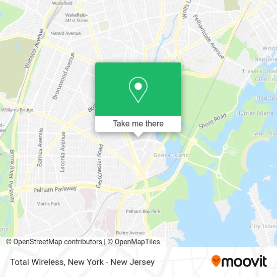
See Total Wireless, Bronx, on the map
Public Transit to Total Wireless in Bronx
Wondering how to get to Total Wireless in Bronx? Moovit helps you find the best way to get to Total Wireless with step-by-step directions from the nearest public transit station.
Moovit provides free maps and live directions to help you navigate through your city. View schedules, routes, timetables, and find out how long does it take to get to Total Wireless in real time.
Looking for the nearest stop or station to Total Wireless? Check out this list of stops closest to your destination: Bartow Av/Co-Op City Blvd; Asch Loop/Bartow Av; Asch Loop/Alcott Pl; Baychester Av/Aldrich St; Pelham Pkwy; Pelham Bay Park.
Bus: BX12-SBS, BX23, BX26, BX28, BX30, BXM7, BX12.Train: 2.Subway: 5, 6, 6X.
Want to see if there’s another route that gets you there at an earlier time? Moovit helps you find alternative routes or times. Get directions from and directions to Total Wireless easily from the Moovit App or Website.
We make riding to Total Wireless easy, which is why over 1.5 million users, including users in Bronx, trust Moovit as the best app for public transit. You don’t need to download an individual bus app or train app, Moovit is your all-in-one transit app that helps you find the best bus time or train time available.
For information on prices of bus, subway and train, costs and ride fares to Total Wireless, please check the Moovit app.
Use the app to navigate to popular places including to the airport, hospital, stadium, grocery store, mall, coffee shop, school, college, and university.
Total Wireless Address: 2043 Bartow Ave, B street in Bronx
- Deals,
- Co-Op City Department Of Public Safety,
- Threshold Church Of Christ,
- Pizza Chop,
- Riverbay Corporation,
- Bartow Community Center,
- Chinne Bufet,
- Amazon Locker - Zigor,
- Co-Op City Police Benevolent Association,
- China Buffet,
- China Buffet (Chinese Buffet),
- Bartow Mall,
- Open Door Ministries,
- Bartow Total Liquors,
- Seven Seas,
- Buffalo Wild Wings,
- Hk Stationary,
- Sangria Cafe (Sangria's Cafe),
- Nao Medical - Bronx Urgent Care Bartow Mall,
- Arby's
Places Near Total Wireless (Bronx)
- qqqq, Manhattan,
- Bellevue Hospital, Manhattan,
- 1 Police Plaza, Manhattan,
- Queens Center Mall, Queens,
- Katz's Deli, Manhattan,
- Wall Street, Manhattan,
- Times Square, Manhattan,
- Pier 83, Manhattan,
- 111 Centre New York City Supreme Court, Manhattan,
- SoHo, Manhattan,
- 66 John Street, Manhattan,
- San Gennaro Feast, Manhattan,
- 3 Stone St, Manhattan,
- Chinatown, Manhattan,
- Mountainside Hospital, Glen Ridge,
- 26 Federal Plaza, Manhattan,
- 911 Memorial, Manhattan,
- Hudson Yards, Manhattan,
- 376 Hudson Street, Manhattan,
- Rockefeller Center, Manhattan
How to get to popular places in New York - New Jersey with public transit
Get around Bronx by public transit!
Traveling around Bronx has never been so easy. See step by step directions as you travel to any attraction, street or major public transit station. View bus and train schedules, arrival times, service alerts and detailed routes on a map, so you know exactly how to get to anywhere in Bronx.
When traveling to any destination around Bronx use Moovit's Live Directions with Get Off Notifications to know exactly where and how far to walk, how long to wait for your line, and how many stops are left. Moovit will alert you when it's time to get off — no need to constantly re-check whether yours is the next stop.
Wondering how to use public transit in Bronx or how to pay for public transit in Bronx? Moovit public transit app can help you navigate your way with public transit easily, and at minimum cost. It includes public transit fees, ticket prices, and costs. Looking for a map of Bronx public transit lines? Moovit public transit app shows all public transit maps in Bronx with all Bus, Train, Subway, Light Rail, Ferry and Cable Car routes and stops on an interactive map.
New York - New Jersey has 6 transit type(s), including: Bus, Train, Subway, Light Rail, Ferry and Cable Car, operated by several transit agencies, including MTA Subway, Metro-North Railroad, LIRR, PATH, MTA New York City Transit - Express routes, MTA Bus, NJ Transit, NYC Ferry, NICE bus, Bee-Line Bus, NJ Transit Rail, Norwalk Transit District, Hartford Line, River Valley Transit and HART