Directions to Total Wireless (Queens) with public transportation
The following transit lines have routes that pass near Total Wireless
 Bus: Q110, Q27, Q88, N24, Q36.
- Train: HEMPSTEAD BRANCH, PORT JEFFERSON BRANCH, RONKONKOMA BRANCH.
How to get to Total Wireless by bus?
Click on the bus route to see step by step directions with maps, line arrival times and updated time schedules.
From Whitestone, NY, Queens
49 minFrom Ozone Park, Queens
63 minFrom President's Gate - US Open, Queens
65 minFrom US Open Tennis, Queens
63 minFrom Hampton Jitney - Queens Airport Connection Westbound, Queens
36 minFrom Flushing Meadows-Corona Park, Queens
54 minFrom Arthur Ashe Stadium, Queens
65 minFrom Corona, Queens
53 minFrom Townsend Harris High School, Queens
41 minFrom The Shops at SkyView Center, Queens
46 min
How to get to Total Wireless by train?
Click on the train route to see step by step directions with maps, line arrival times and updated time schedules.
From President's Gate - US Open, Queens
125 minFrom US Open Tennis, Queens
123 minFrom Hampton Jitney - Queens Airport Connection Westbound, Queens
115 minFrom Flushing Meadows-Corona Park, Queens
138 minFrom Arthur Ashe Stadium, Queens
124 minFrom Corona, Queens
121 minFrom The Shops at SkyView Center, Queens
94 min
Bus stops near Total Wireless in Queens
Train station near Total Wireless in Queens
- Queens Village, 17 min walk,VIEW
Bus lines to Total Wireless in Queens
What are the closest stations to Total Wireless?
The closest stations to Total Wireless are:
- Springfield Blvd/Jamaica Av is 51 yards away, 1 min walk.
- Springfield Bl / Jamaica is 57 yards away, 1 min walk.
- Queens Village is 1387 yards away, 17 min walk.
Which bus lines stop near Total Wireless?
These bus lines stop near Total Wireless: Q110, Q27, Q88.
Which train line stops near Total Wireless?
HEMPSTEAD BRANCH (Hempstead)
What’s the nearest train station to Total Wireless in Queens?
The nearest train station to Total Wireless in Queens is Queens Village. It’s a 17 min walk away.
What’s the nearest bus station to Total Wireless in Queens?
The nearest bus stations to Total Wireless in Queens are Springfield Blvd/Jamaica Av and Springfield Bl / Jamaica. The closest one is a 1 min walk away.
What time is the first train to Total Wireless in Queens?
The HEMPSTEAD BRANCH is the first train that goes to Total Wireless in Queens. It stops nearby at 3:09 AM.
What time is the last train to Total Wireless in Queens?
The HEMPSTEAD BRANCH is the last train that goes to Total Wireless in Queens. It stops nearby at 3:13 AM.
What time is the first bus to Total Wireless in Queens?
The Q27 is the first bus that goes to Total Wireless in Queens. It stops nearby at 3:00 AM.
What time is the last bus to Total Wireless in Queens?
The Q27 is the last bus that goes to Total Wireless in Queens. It stops nearby at 3:14 AM.
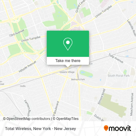
See Total Wireless, Queens, on the map
Public Transit to Total Wireless in Queens
Wondering how to get to Total Wireless in Queens? Moovit helps you find the best way to get to Total Wireless with step-by-step directions from the nearest public transit station.
Moovit provides free maps and live directions to help you navigate through your city. View schedules, routes, timetables, and find out how long does it take to get to Total Wireless in real time.
Looking for the nearest stop or station to Total Wireless? Check out this list of stops closest to your destination: Springfield Blvd/Jamaica Av; Springfield Bl / Jamaica; Queens Village.
Bus: Q110, Q27, Q88, N24, Q36.Train: HEMPSTEAD BRANCH, PORT JEFFERSON BRANCH, RONKONKOMA BRANCH.
Want to see if there’s another route that gets you there at an earlier time? Moovit helps you find alternative routes or times. Get directions from and directions to Total Wireless easily from the Moovit App or Website.
We make riding to Total Wireless easy, which is why over 1.5 million users, including users in Queens, trust Moovit as the best app for public transit. You don’t need to download an individual bus app or train app, Moovit is your all-in-one transit app that helps you find the best bus time or train time available.
For information on prices of bus and train, costs and ride fares to Total Wireless, please check the Moovit app.
Use the app to navigate to popular places including to the airport, hospital, stadium, grocery store, mall, coffee shop, school, college, and university.
Total Wireless Address: 9605 Springfield Blvd street in Queens
- Island Provisions,
- Pequa Remodeling Inc,
- Kids Land Child Care,
- Teado's House Of Suites II,
- Sassie Sa Entertainment,
- Soundkey Recording Studios,
- Towo Solutions,
- The Cross Jiu-Jitsu,
- The Braiding School,
- Empressive Staffing Agency,
- Dentist 96-09 Springfield Blvd,
- Hope Kids NY,
- Beauty by Goldberg,
- Maritza Real Estate Agent,
- Rajendr Collins Sewnauth Real Estate Associate Broker,
- S M Moheed Income Tax Service,
- MTA Bus - Q1 / Q27 / Q88 @ Springfield Blvd and Jamaica Avenue,
- Western Union,
- Stacy Bernarai-Miller,
- Fabulous Tax Consulting
Places Near Total Wireless (Queens)
- 66 John Street, Manhattan,
- Wall Street, Manhattan,
- Hudson Yards, Manhattan,
- 911 Memorial, Manhattan,
- Mountainside Hospital, Glen Ridge,
- Bellevue Hospital, Manhattan,
- Pier 83, Manhattan,
- Queens Center Mall, Queens,
- qqqq, Manhattan,
- Chinatown, Manhattan,
- 26 Federal Plaza, Manhattan,
- Katz's Deli, Manhattan,
- SoHo, Manhattan,
- 1 Police Plaza, Manhattan,
- Rockefeller Center, Manhattan,
- 3 Stone St, Manhattan,
- 376 Hudson Street, Manhattan,
- 111 Centre New York City Supreme Court, Manhattan,
- San Gennaro Feast, Manhattan,
- Times Square, Manhattan
How to get to popular places in New York - New Jersey with public transit
Get around Queens by public transit!
Traveling around Queens has never been so easy. See step by step directions as you travel to any attraction, street or major public transit station. View bus and train schedules, arrival times, service alerts and detailed routes on a map, so you know exactly how to get to anywhere in Queens.
When traveling to any destination around Queens use Moovit's Live Directions with Get Off Notifications to know exactly where and how far to walk, how long to wait for your line, and how many stops are left. Moovit will alert you when it's time to get off — no need to constantly re-check whether yours is the next stop.
Wondering how to use public transit in Queens or how to pay for public transit in Queens? Moovit public transit app can help you navigate your way with public transit easily, and at minimum cost. It includes public transit fees, ticket prices, and costs. Looking for a map of Queens public transit lines? Moovit public transit app shows all public transit maps in Queens with all Bus, Train, Subway, Light Rail, Ferry and Cable Car routes and stops on an interactive map.
New York - New Jersey has 6 transit type(s), including: Bus, Train, Subway, Light Rail, Ferry and Cable Car, operated by several transit agencies, including MTA Subway, Metro-North Railroad, LIRR, PATH, MTA New York City Transit - Express routes, MTA Bus, NJ Transit, NYC Ferry, NICE bus, Bee-Line Bus, NJ Transit Rail, Norwalk Transit District, Hartford Line, River Valley Transit and HART