Directions to Total Wireless (Queens) with public transportation
The following transit lines have routes that pass near Total Wireless
 Bus: Q43, Q44-SBS, Q8, Q1.
- Train: BABYLON BRANCH, CITY TERMINAL ZONE, FAR ROCKAWAY BRANCH, AIRTRAIN, HEMPSTEAD BRANCH.
- Subway: F, FX, J, E, Z.
How to get to Total Wireless by bus?
Click on the bus route to see step by step directions with maps, line arrival times and updated time schedules.
From President's Gate - US Open, Queens
61 minFrom Northwell - Long Island Jewish Medical Center, Queens
52 minFrom Howard Beach, Queens
52 minFrom Sunnyside, NY, Queens
71 minFrom Woodside, Queens
67 minFrom Northern Blvd, Queens
79 minFrom JFK Terminal 5/Air Train Station, Queens
83 minFrom Long Island Jewish Hospital, Queens
53 min
How to get to Total Wireless by train?
Click on the train route to see step by step directions with maps, line arrival times and updated time schedules.
How to get to Total Wireless by subway?
Click on the subway route to see step by step directions with maps, line arrival times and updated time schedules.
Bus stops near Total Wireless in Queens
Subway stations near Total Wireless in Queens
Train station near Total Wireless in Queens
- Jamaica, 14 min walk,VIEW
Bus lines to Total Wireless in Queens
- Q1, Bellerose 243 St Via Hillside Av,VIEW
- Q43, Rush Floral Park 268 St Via Hillside Av,VIEW
- Q44-SBS, Select Bus Jamaica Via Main St,VIEW
- Q40, Rush Jamaica Hillside Av,VIEW
- Q54, Willamsburg Bridge Plaza,VIEW
- Q30, Little Neck - Jamaica,VIEW
- Q31, Bayside - Jamaica,VIEW
- Q56, Broadway Junction - Jamaica,VIEW
- Q75, Jamaica - QCC,VIEW
- Q60, Jamaica LIRR Via Queens Bl,VIEW
- Q20, College Point,VIEW
- Q83, Cambria Heights 227 St,VIEW
What are the closest stations to Total Wireless?
The closest stations to Total Wireless are:
- Sutphin Blvd/Hillside Av is 60 yards away, 1 min walk.
- Sutphin Blvd/88 Av is 157 yards away, 3 min walk.
- Jamaica Av/146 St is 608 yards away, 8 min walk.
- Jamaica Av/Sutphin Bl is 609 yards away, 8 min walk.
- Jamaica Av/144 St is 618 yards away, 8 min walk.
- 153 St/88 Av is 646 yards away, 8 min walk.
- Jamaica-Van Wyck is 995 yards away, 13 min walk.
- Sutphin Blvd-Archer Av-Jfk Airport is 1049 yards away, 13 min walk.
- Jamaica is 1118 yards away, 14 min walk.
- Parsons Blvd is 2220 yards away, 27 min walk.
Which bus lines stop near Total Wireless?
These bus lines stop near Total Wireless: Q43, Q44-SBS, Q8.
Which train lines stop near Total Wireless?
These train lines stop near Total Wireless: BABYLON BRANCH, CITY TERMINAL ZONE, FAR ROCKAWAY BRANCH.
Which subway lines stop near Total Wireless?
These subway lines stop near Total Wireless: F, FX, J.
What’s the nearest subway station to Total Wireless in Queens?
The nearest subway stations to Total Wireless in Queens are Jamaica-Van Wyck and Sutphin Blvd-Archer Av-Jfk Airport. The closest one is a 13 min walk away.
What’s the nearest train station to Total Wireless in Queens?
The nearest train station to Total Wireless in Queens is Jamaica. It’s a 14 min walk away.
What’s the nearest bus station to Total Wireless in Queens?
The nearest bus station to Total Wireless in Queens is Sutphin Blvd/Hillside Av. It’s a 1 min walk away.
What time is the first light rail to Total Wireless in Queens?
The AIRTRAIN is the first light rail that goes to Total Wireless in Queens. It stops nearby at 3:00 AM.
What time is the last light rail to Total Wireless in Queens?
The AIRTRAIN is the last light rail that goes to Total Wireless in Queens. It stops nearby at 3:06 AM.
What time is the first subway to Total Wireless in Queens?
The E is the first subway that goes to Total Wireless in Queens. It stops nearby at 3:00 AM.
What time is the last subway to Total Wireless in Queens?
The F is the last subway that goes to Total Wireless in Queens. It stops nearby at 4:19 AM.
What time is the first train to Total Wireless in Queens?
The BABYLON BRANCH is the first train that goes to Total Wireless in Queens. It stops nearby at 3:07 AM.
What time is the last train to Total Wireless in Queens?
The BABYLON BRANCH is the last train that goes to Total Wireless in Queens. It stops nearby at 3:07 AM.
What time is the first bus to Total Wireless in Queens?
The Q56 is the first bus that goes to Total Wireless in Queens. It stops nearby at 3:06 AM.
What time is the last bus to Total Wireless in Queens?
The Q44-SBS is the last bus that goes to Total Wireless in Queens. It stops nearby at 3:43 AM.
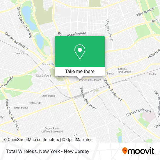
See Total Wireless, Queens, on the map
Public Transit to Total Wireless in Queens
Wondering how to get to Total Wireless in Queens? Moovit helps you find the best way to get to Total Wireless with step-by-step directions from the nearest public transit station.
Moovit provides free maps and live directions to help you navigate through your city. View schedules, routes, timetables, and find out how long does it take to get to Total Wireless in real time.
Looking for the nearest stop or station to Total Wireless? Check out this list of stops closest to your destination: Sutphin Blvd/Hillside Av; Sutphin Blvd/88 Av; Jamaica Av/146 St; Jamaica Av/Sutphin Bl; Jamaica Av/144 St; 153 St/88 Av; Jamaica-Van Wyck; Sutphin Blvd-Archer Av-Jfk Airport; Jamaica; Parsons Blvd.
Bus: Q43, Q44-SBS, Q8, Q1.Train: BABYLON BRANCH, CITY TERMINAL ZONE, FAR ROCKAWAY BRANCH, AIRTRAIN, HEMPSTEAD BRANCH.Subway: F, FX, J, E, Z.
Want to see if there’s another route that gets you there at an earlier time? Moovit helps you find alternative routes or times. Get directions from and directions to Total Wireless easily from the Moovit App or Website.
We make riding to Total Wireless easy, which is why over 1.5 million users, including users in Queens, trust Moovit as the best app for public transit. You don’t need to download an individual bus app or train app, Moovit is your all-in-one transit app that helps you find the best bus time or train time available.
For information on prices of bus, subway, train and light rail, costs and ride fares to Total Wireless, please check the Moovit app.
Use the app to navigate to popular places including to the airport, hospital, stadium, grocery store, mall, coffee shop, school, college, and university.
Total Wireless Address: 147-07 Hillside Ave street in Queens
- Best Brows Waxing & Threading Salon,
- Arman Chowdhury, Cpa, P.C.,
- Sutphin Blvd. & Hillside Ave.,
- MTA-Sutphin Blvd,
- Saints Union Deliverance Church,
- 148th and Hillside,
- Al Aqsa Party Hall Jamaica,
- Al Aqsa Restaurant | Halal Food In Jamaica,
- Sutphin Blvd (sutphin blvd hillside ave),
- 87-34 148th St,
- Vicado Guards Training School,
- Citizens Bank Atm,
- Citizens,
- Us Tax,
- Hsbc Bank,
- Adobo Mexican Grill,
- Marcia Amanta,
- Citizens,
- Osorio Multiservices Center,
- Iglesia Evangelica La Buena Semilla De Queens
Places Near Total Wireless (Queens)
- Pier 83, Manhattan,
- 3 Stone St, Manhattan,
- Rockefeller Center, Manhattan,
- San Gennaro Feast, Manhattan,
- qqqq, Manhattan,
- SoHo, Manhattan,
- 911 Memorial, Manhattan,
- 1 Police Plaza, Manhattan,
- Wall Street, Manhattan,
- Queens Center Mall, Queens,
- 111 Centre New York City Supreme Court, Manhattan,
- Times Square, Manhattan,
- Hudson Yards, Manhattan,
- 66 John Street, Manhattan,
- Katz's Deli, Manhattan,
- Mountainside Hospital, Glen Ridge,
- 376 Hudson Street, Manhattan,
- Bellevue Hospital, Manhattan,
- 26 Federal Plaza, Manhattan,
- Chinatown, Manhattan
How to get to popular places in New York - New Jersey with public transit
Get around Queens by public transit!
Traveling around Queens has never been so easy. See step by step directions as you travel to any attraction, street or major public transit station. View bus and train schedules, arrival times, service alerts and detailed routes on a map, so you know exactly how to get to anywhere in Queens.
When traveling to any destination around Queens use Moovit's Live Directions with Get Off Notifications to know exactly where and how far to walk, how long to wait for your line, and how many stops are left. Moovit will alert you when it's time to get off — no need to constantly re-check whether yours is the next stop.
Wondering how to use public transit in Queens or how to pay for public transit in Queens? Moovit public transit app can help you navigate your way with public transit easily, and at minimum cost. It includes public transit fees, ticket prices, and costs. Looking for a map of Queens public transit lines? Moovit public transit app shows all public transit maps in Queens with all Bus, Train, Subway, Light Rail, Ferry and Cable Car routes and stops on an interactive map.
New York - New Jersey has 6 transit type(s), including: Bus, Train, Subway, Light Rail, Ferry and Cable Car, operated by several transit agencies, including MTA Subway, Metro-North Railroad, LIRR, PATH, MTA New York City Transit - Express routes, MTA Bus, NJ Transit, NYC Ferry, NICE bus, Bee-Line Bus, NJ Transit Rail, Norwalk Transit District, Hartford Line, River Valley Transit and HART