How to get to Total Wireless by bus?
Click on the bus route to see step by step directions with maps, line arrival times and updated time schedules.
From H St NE (7th & H St NE), Washington
59 minFrom Other Half Brewing, Washington
50 minFrom Northwestern High School, Prince George's County
59 minFrom Trinity Washington University, Washington
44 minFrom McKinley Technology High School, Washington
48 minFrom D.C. Jail, Washington
57 minFrom The Catholic University of America (CUA), Washington
50 minFrom 645 H Street NE Service Center, Washington
59 minFrom 8th St NE (8th st and h st ne), Washington
57 minFrom Congressional Cemetery, Washington
62 min
How to get to Total Wireless by train?
Click on the train route to see step by step directions with maps, line arrival times and updated time schedules.
How to get to Total Wireless by metro?
Click on the metro route to see step by step directions with maps, line arrival times and updated time schedules.
From H St NE (7th & H St NE), Washington
79 minFrom Northwestern High School, Prince George's County
104 minFrom Trinity Washington University, Washington
95 minFrom McKinley Technology High School, Washington
85 minFrom D.C. Jail, Washington
52 minFrom The Catholic University of America (CUA), Washington
83 minFrom 645 H Street NE Service Center, Washington
78 minFrom 8th St NE (8th st and h st ne), Washington
79 minFrom Congressional Cemetery, Washington
61 min
Bus stops near Total Wireless in Prince George's County
Metro stations near Total Wireless in Prince George's County
Train station near Total Wireless in Prince George's County
- New Carrollton Amtrak Station, 53 min walk,VIEW
Bus lines to Total Wireless in Prince George's County
What are the closest stations to Total Wireless?
The closest stations to Total Wireless are:
- Annapolis Rd + 72nd Ave is 360 yards away, 5 min walk.
- Annapolis Rd+72 Av is 360 yards away, 5 min walk.
- Landover Metro Station is 2247 yards away, 27 min walk.
- New Carrollton is 4513 yards away, 53 min walk.
- New Carrollton Amtrak Station is 4513 yards away, 53 min walk.
Which bus lines stop near Total Wireless?
These bus lines stop near Total Wireless: P22, P40.
Which train lines stop near Total Wireless?
These train lines stop near Total Wireless: MARC, NORTHEAST REGIONAL.
Which metro lines stop near Total Wireless?
These metro lines stop near Total Wireless: ORANGE, SILVER.
What’s the nearest metro station to Total Wireless in Prince George's County?
The nearest metro station to Total Wireless in Prince George's County is Landover Metro Station. It’s a 27 min walk away.
What’s the nearest bus station to Total Wireless in Prince George's County?
The nearest bus stations to Total Wireless in Prince George's County are Annapolis Rd + 72nd Ave and Annapolis Rd+72 Av. The closest one is a 5 min walk away.
What time is the first metro to Total Wireless in Prince George's County?
The ORANGE is the first metro that goes to Total Wireless in Prince George's County. It stops nearby at 5:00 AM.
What time is the last metro to Total Wireless in Prince George's County?
The ORANGE is the last metro that goes to Total Wireless in Prince George's County. It stops nearby at 12:36 AM.
What time is the first train to Total Wireless in Prince George's County?
The MARC is the first train that goes to Total Wireless in Prince George's County. It stops nearby at 5:13 AM.
What time is the last train to Total Wireless in Prince George's County?
The MARC is the last train that goes to Total Wireless in Prince George's County. It stops nearby at 10:17 PM.
What time is the first bus to Total Wireless in Prince George's County?
The P40 is the first bus that goes to Total Wireless in Prince George's County. It stops nearby at 4:49 AM.
What time is the last bus to Total Wireless in Prince George's County?
The P40 is the last bus that goes to Total Wireless in Prince George's County. It stops nearby at 2:04 AM.
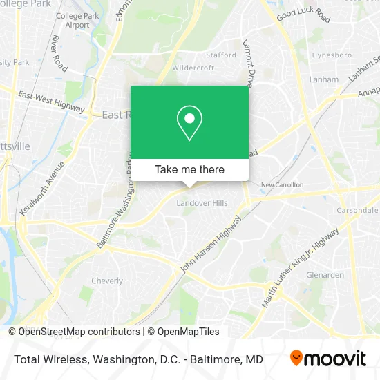
See Total Wireless, Prince George's County, on the map
Public Transit to Total Wireless in Prince George's County
Wondering how to get to Total Wireless in Prince George's County? Moovit helps you find the best way to get to Total Wireless with step-by-step directions from the nearest public transit station.
Moovit provides free maps and live directions to help you navigate through your city. View schedules, routes, timetables, and find out how long does it take to get to Total Wireless in real time.
Looking for the nearest stop or station to Total Wireless? Check out this list of stops closest to your destination: Annapolis Rd + 72nd Ave; Annapolis Rd+72 Av; Landover Metro Station; New Carrollton; New Carrollton Amtrak Station.
Bus: P22, P40.Train: MARC, NORTHEAST REGIONAL, PALMETTO, VERMONTER.Metro: ORANGE, SILVER, MARC.
Want to see if there’s another route that gets you there at an earlier time? Moovit helps you find alternative routes or times. Get directions from and directions to Total Wireless easily from the Moovit App or Website.
We make riding to Total Wireless easy, which is why over 1.7 million users, including users in Prince George's County, trust Moovit as the best app for public transit. You don’t need to download an individual bus app or train app, Moovit is your all-in-one transit app that helps you find the best bus time or train time available.
For information on prices of bus, metro and train, costs and ride fares to Total Wireless, please check the Moovit app.
Use the app to navigate to popular places including to the airport, hospital, stadium, grocery store, mall, coffee shop, school, college, and university.
Total Wireless Address: 7033 Annapolis Rd street in Prince George's County
- Value Village Thrift Store,
- Capital Plaza Carnival,
- Capitol Plaza Mall,
- Dulce Vida Bakery,
- Rogers Heights Elementary School (Rogers Heights Park),
- Holiday Inn Express Washington Dc - Bw Parkway Hotel Hyattsville,
- Walmart,
- Aldi,
- Elizabeth Seton High School,
- Carmen E. Turner Maintenance and Training Facility,
- Landover, Maryland,
- WMATA Carmen Turner Facility,
- WMATA Carmen Turner Center,
- New Carrollton Federal Building,
- L99 Shuttle,
- Wmata Landover Bus Garage,
- Ademiluyi, Femi L DC: Femi L Ademiluyi, DC,
- New Carrollton MARC,
- Riverdale 64th,
- Bladensburg High School
Places Near Total Wireless (Prince George's County)
- Westfield Montgomery Mall, Montgomery County,
- Capital One Arena, Washington,
- Rock Creek Tennis Center, Washington,
- Georgetown, Washington,
- Amazon Hq2, Arlington County,
- Washington National Cathedral, Washington,
- Basilica of the National Shrine, Washington,
- M&T Bank Stadium, Baltimore,
- Warner Theatre, Washington,
- National Zoo, Washington,
- Camden Yards, Baltimore,
- The Anthem, Washington,
- Museum Of The Bible, Washington,
- Washington DC VA Medical Center, Washington,
- National Theatre, Washington,
- National Museum of African American History and Culture, Washington,
- Pennsylvania Ave NW (3rd st and pennsylvania), Washington,
- Sibley Memorial Hospital, Washington,
- Marriott Marquis Washington, DC, Washington,
- PG Mall, Prince George's County
How to get to popular places in Washington, D.C. - Baltimore, MD with public transit
Get around Prince George's County by public transit!
Traveling around Prince George's County has never been so easy. See step by step directions as you travel to any attraction, street or major public transit station. View bus and train schedules, arrival times, service alerts and detailed routes on a map, so you know exactly how to get to anywhere in Prince George's County.
When traveling to any destination around Prince George's County use Moovit's Live Directions with Get Off Notifications to know exactly where and how far to walk, how long to wait for your line, and how many stops are left. Moovit will alert you when it's time to get off — no need to constantly re-check whether yours is the next stop.
Wondering how to use public transit in Prince George's County or how to pay for public transit in Prince George's County? Moovit public transit app can help you navigate your way with public transit easily, and at minimum cost. It includes public transit fees, ticket prices, and costs. Looking for a map of Prince George's County public transit lines? Moovit public transit app shows all public transit maps in Prince George's County with all Bus, Train, Metro, Light Rail and Ferry routes and stops on an interactive map.
Washington, D.C. - Baltimore, MD has 5 transit type(s), including: Bus, Train, Metro, Light Rail and Ferry, operated by several transit agencies, including WMATA, Montgomery County Ride On, Fairfax Connector, TheBus, PRTC, DASH - Alexandria, Arlington Transit (ART), RTA of Central Maryland, MDOT MTA, MDOT MTA Light RailLink, MDOT MTA Commuter Bus, MDOT MTA Local Bus, FXBGO!, Virginia Railway Express (VRE) and MARC