How to get to Total Wireless Store by bus?
Click on the bus route to see step by step directions with maps, line arrival times and updated time schedules.
From Gracie Mansion, Manhattan
60 minFrom E 87th St, Manhattan
45 minFrom Harlem Hospital, Manhattan
53 minFrom St. Raymond's Cemetery, Bronx
63 minFrom 31st St (astoria blvd & 31st street), Queens
78 minFrom 45th & Broadway, Manhattan
62 minFrom Metro North - Harlem - 125th Street Station, Manhattan
36 minFrom Astoria, Queens
79 minFrom Guggenheim Museum, Manhattan
47 minFrom Holy Name Hospital, Teaneck
65 min
How to get to Total Wireless Store by train?
Click on the train route to see step by step directions with maps, line arrival times and updated time schedules.
How to get to Total Wireless Store by subway?
Click on the subway route to see step by step directions with maps, line arrival times and updated time schedules.
From Gracie Mansion, Manhattan
50 minFrom E 87th St, Manhattan
39 minFrom Harlem Hospital, Manhattan
32 minFrom 31st St (astoria blvd & 31st street), Queens
55 minFrom 45th & Broadway, Manhattan
24 minFrom Metro North - Harlem - 125th Street Station, Manhattan
35 minFrom Astoria, Queens
53 minFrom Guggenheim Museum, Manhattan
43 min
Bus stops near Total Wireless Store in Bronx
Subway stations near Total Wireless Store in Bronx
Train station near Total Wireless Store in Bronx
- Fordham, 9 min walk,VIEW
Bus lines to Total Wireless Store in Bronx
What are the closest stations to Total Wireless Store?
The closest stations to Total Wireless Store are:
- Grand Concourse/E 187 St is 51 yards away, 1 min walk.
- East Fordham Rd/Valentine Av is 136 yards away, 3 min walk.
- Fordham Rd is 138 yards away, 2 min walk.
- 183 St is 153 yards away, 2 min walk.
- Grand Concourse/East Fordham Rd is 170 yards away, 3 min walk.
- Jerome Av/East Fordham Rd is 417 yards away, 6 min walk.
- Fordham is 689 yards away, 9 min walk.
Which bus lines stop near Total Wireless Store?
These bus lines stop near Total Wireless Store: BX1, BX12, BX2, BXM4.
Which train lines stop near Total Wireless Store?
These train lines stop near Total Wireless Store: 2, 3.
Which subway lines stop near Total Wireless Store?
These subway lines stop near Total Wireless Store: 4, B, D.
What’s the nearest subway station to Total Wireless Store in Bronx?
The nearest subway stations to Total Wireless Store in Bronx are Fordham Rd and 183 St. The closest one is a 2 min walk away.
What’s the nearest train station to Total Wireless Store in Bronx?
The nearest train station to Total Wireless Store in Bronx is Fordham. It’s a 9 min walk away.
What’s the nearest bus station to Total Wireless Store in Bronx?
The nearest bus station to Total Wireless Store in Bronx is Grand Concourse/E 187 St. It’s a 1 min walk away.
What time is the first subway to Total Wireless Store in Bronx?
The 4 is the first subway that goes to Total Wireless Store in Bronx. It stops nearby at 3:04 AM.
What time is the last subway to Total Wireless Store in Bronx?
The D is the last subway that goes to Total Wireless Store in Bronx. It stops nearby at 4:26 AM.
What time is the first train to Total Wireless Store in Bronx?
The 2 is the first train that goes to Total Wireless Store in Bronx. It stops nearby at 5:18 AM.
What time is the last train to Total Wireless Store in Bronx?
The 2 is the last train that goes to Total Wireless Store in Bronx. It stops nearby at 2:14 AM.
What time is the first bus to Total Wireless Store in Bronx?
The BX12 is the first bus that goes to Total Wireless Store in Bronx. It stops nearby at 3:01 AM.
What time is the last bus to Total Wireless Store in Bronx?
The BX12 is the last bus that goes to Total Wireless Store in Bronx. It stops nearby at 3:16 AM.
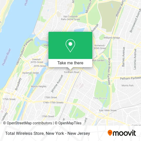
See Total Wireless Store, Bronx, on the map
Public Transit to Total Wireless Store in Bronx
Wondering how to get to Total Wireless Store in Bronx? Moovit helps you find the best way to get to Total Wireless Store with step-by-step directions from the nearest public transit station.
Moovit provides free maps and live directions to help you navigate through your city. View schedules, routes, timetables, and find out how long does it take to get to Total Wireless Store in real time.
Looking for the nearest stop or station to Total Wireless Store? Check out this list of stops closest to your destination: Grand Concourse/E 187 St; East Fordham Rd/Valentine Av; Fordham Rd; 183 St; Grand Concourse/East Fordham Rd; Jerome Av/East Fordham Rd; Fordham.
Bus: BX1, BX12, BX2, BXM4, BX12-SBS.Train: 2, 3, 4.Subway: 4, B, D.
Want to see if there’s another route that gets you there at an earlier time? Moovit helps you find alternative routes or times. Get directions from and directions to Total Wireless Store easily from the Moovit App or Website.
We make riding to Total Wireless Store easy, which is why over 1.5 million users, including users in Bronx, trust Moovit as the best app for public transit. You don’t need to download an individual bus app or train app, Moovit is your all-in-one transit app that helps you find the best bus time or train time available.
For information on prices of subway, bus and train, costs and ride fares to Total Wireless Store, please check the Moovit app.
Use the app to navigate to popular places including to the airport, hospital, stadium, grocery store, mall, coffee shop, school, college, and university.
Total Wireless Store Address: 2415 Grand Concourse street in Bronx
- Delicias Restaurant & Seafood,
- Parador Finix Express Consuelo,
- Total by Verizon,
- Delicias Dominican Restaurant,
- Ariadnis Rooms,
- Cricket Wireless Authorized Retailer,
- 2417 Grand Boulevard and Concourse,
- Angelia Bakery Corporation,
- 187,
- Moms Bakery Corporation,
- World Changers Church - New York,
- E 187 Grand Concourse,
- Flycap,
- Ajhairpalace,
- Ups Access Point Location,
- Advanced Dermatology,
- Reginald Asiedu, P.C. Attorneys at Law,
- Takout NY,
- Bronxcare Medical and Dental at Poe,
- Rse Management Group
Places Near Total Wireless Store (Bronx)
- San Gennaro Feast, Manhattan,
- Chinatown, Manhattan,
- Katz's Deli, Manhattan,
- Hudson Yards, Manhattan,
- Times Square, Manhattan,
- 376 Hudson Street, Manhattan,
- Rockefeller Center, Manhattan,
- 111 Centre New York City Supreme Court, Manhattan,
- Queens Center Mall, Queens,
- 3 Stone St, Manhattan,
- Mountainside Hospital, Glen Ridge,
- 911 Memorial, Manhattan,
- 26 Federal Plaza, Manhattan,
- 1 Police Plaza, Manhattan,
- Pier 83, Manhattan,
- Wall Street, Manhattan,
- qqqq, Manhattan,
- Bellevue Hospital, Manhattan,
- SoHo, Manhattan,
- 66 John Street, Manhattan
How to get to popular places in New York - New Jersey with public transit
Get around Bronx by public transit!
Traveling around Bronx has never been so easy. See step by step directions as you travel to any attraction, street or major public transit station. View bus and train schedules, arrival times, service alerts and detailed routes on a map, so you know exactly how to get to anywhere in Bronx.
When traveling to any destination around Bronx use Moovit's Live Directions with Get Off Notifications to know exactly where and how far to walk, how long to wait for your line, and how many stops are left. Moovit will alert you when it's time to get off — no need to constantly re-check whether yours is the next stop.
Wondering how to use public transit in Bronx or how to pay for public transit in Bronx? Moovit public transit app can help you navigate your way with public transit easily, and at minimum cost. It includes public transit fees, ticket prices, and costs. Looking for a map of Bronx public transit lines? Moovit public transit app shows all public transit maps in Bronx with all Bus, Train, Subway, Light Rail, Ferry and Cable Car routes and stops on an interactive map.
New York - New Jersey has 6 transit type(s), including: Bus, Train, Subway, Light Rail, Ferry and Cable Car, operated by several transit agencies, including MTA Subway, Metro-North Railroad, LIRR, PATH, MTA New York City Transit - Express routes, MTA Bus, NJ Transit, NYC Ferry, NICE bus, Bee-Line Bus, NJ Transit Rail, Norwalk Transit District, Hartford Line, River Valley Transit and HART