How to get to Total Wireless Store by bus?
Click on the bus route to see step by step directions with maps, line arrival times and updated time schedules.
From Zhong Hua Flushing-Chinatown Shuttle Van Service, Manhattan
58 minFrom New York Supreme Court, Manhattan
80 minFrom The Shops at SkyView Center, Queens
81 minFrom Pier 35 Park, Manhattan
78 minFrom Inmigration 26 Federal Plaza, Manhattan
66 minFrom Lincoln Tunnel, Manhattan
59 minFrom The Shed, Manhattan
63 minFrom US Open Tennis, Queens
105 minFrom 26 Federal Plaza, Manhattan
66 minFrom Long Island City, Queens
61 min
How to get to Total Wireless Store by train?
Click on the train route to see step by step directions with maps, line arrival times and updated time schedules.
From Zhong Hua Flushing-Chinatown Shuttle Van Service, Manhattan
180 minFrom New York Supreme Court, Manhattan
176 minFrom The Shops at SkyView Center, Queens
76 minFrom Inmigration 26 Federal Plaza, Manhattan
177 minFrom Lincoln Tunnel, Manhattan
103 minFrom The Shed, Manhattan
90 minFrom US Open Tennis, Queens
97 minFrom 26 Federal Plaza, Manhattan
175 minFrom Long Island City, Queens
91 min
How to get to Total Wireless Store by subway?
Click on the subway route to see step by step directions with maps, line arrival times and updated time schedules.
From Zhong Hua Flushing-Chinatown Shuttle Van Service, Manhattan
44 minFrom New York Supreme Court, Manhattan
39 minFrom The Shops at SkyView Center, Queens
56 minFrom Pier 35 Park, Manhattan
51 minFrom Inmigration 26 Federal Plaza, Manhattan
39 minFrom Lincoln Tunnel, Manhattan
53 minFrom The Shed, Manhattan
40 minFrom US Open Tennis, Queens
55 minFrom 26 Federal Plaza, Manhattan
39 minFrom Long Island City, Queens
35 min
Bus stops near Total Wireless Store in Manhattan
Subway stations near Total Wireless Store in Manhattan
Bus lines to Total Wireless Store in Manhattan
What are the closest stations to Total Wireless Store?
The closest stations to Total Wireless Store are:
- 3 Av/E 104 St is 92 yards away, 2 min walk.
- 103 St is 215 yards away, 3 min walk.
- E 106 St/3 Av is 245 yards away, 3 min walk.
- 3 Av/E 106 St is 280 yards away, 4 min walk.
- 2 Av/E 111 St is 431 yards away, 6 min walk.
- 96 St is 720 yards away, 9 min walk.
- 110 St-Malcolm X Plaza is 1160 yards away, 14 min walk.
Which bus lines stop near Total Wireless Store?
These bus lines stop near Total Wireless Store: M101, M103, M15, M15-SBS.
Which train lines stop near Total Wireless Store?
These train lines stop near Total Wireless Store: 1, 2, 3.
Which subway line stops near Total Wireless Store?
6 (Uptown & The Bronx)
What’s the nearest subway station to Total Wireless Store in Manhattan?
The nearest subway station to Total Wireless Store in Manhattan is 103 St. It’s a 3 min walk away.
What’s the nearest bus station to Total Wireless Store in Manhattan?
The nearest bus station to Total Wireless Store in Manhattan is 3 Av/E 104 St. It’s a 2 min walk away.
What time is the first subway to Total Wireless Store in Manhattan?
The 6 is the first subway that goes to Total Wireless Store in Manhattan. It stops nearby at 3:00 AM.
What time is the last subway to Total Wireless Store in Manhattan?
The 2 is the last subway that goes to Total Wireless Store in Manhattan. It stops nearby at 3:58 AM.
What time is the first bus to Total Wireless Store in Manhattan?
The M103 is the first bus that goes to Total Wireless Store in Manhattan. It stops nearby at 3:00 AM.
What time is the last bus to Total Wireless Store in Manhattan?
The M103 is the last bus that goes to Total Wireless Store in Manhattan. It stops nearby at 3:15 AM.
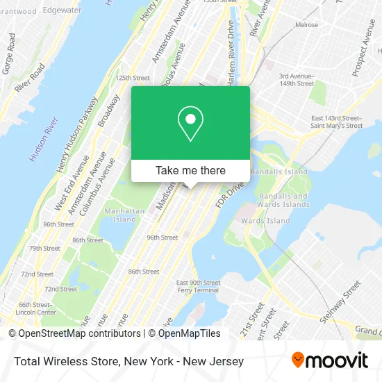
See Total Wireless Store, Manhattan, on the map
Public Transit to Total Wireless Store in Manhattan
Wondering how to get to Total Wireless Store in Manhattan? Moovit helps you find the best way to get to Total Wireless Store with step-by-step directions from the nearest public transit station.
Moovit provides free maps and live directions to help you navigate through your city. View schedules, routes, timetables, and find out how long does it take to get to Total Wireless Store in real time.
Looking for the nearest stop or station to Total Wireless Store? Check out this list of stops closest to your destination: 3 Av/E 104 St; 103 St; E 106 St/3 Av; 3 Av/E 106 St; 2 Av/E 111 St; 96 St; 110 St-Malcolm X Plaza.
Bus: M101, M103, M15, M15-SBS, M102, M106, M98.Train: 1, 2, 3.Subway: 6, 4, 5, 6X, N, Q, R, W, 2, 3.
Want to see if there’s another route that gets you there at an earlier time? Moovit helps you find alternative routes or times. Get directions from and directions to Total Wireless Store easily from the Moovit App or Website.
We make riding to Total Wireless Store easy, which is why over 1.5 million users, including users in Manhattan, trust Moovit as the best app for public transit. You don’t need to download an individual bus app or train app, Moovit is your all-in-one transit app that helps you find the best bus time or train time available.
For information on prices of subway, train and bus, costs and ride fares to Total Wireless Store, please check the Moovit app.
Use the app to navigate to popular places including to the airport, hospital, stadium, grocery store, mall, coffee shop, school, college, and university.
Total Wireless Store Address: 1972 3rd Ave street in Manhattan
- Sab Ninety Nine Cent Plus,
- Corporate Auto Lease,
- Adhum,
- 109 Pizzeria,
- 109 Street,
- Fromer Susan Md,
- Nicholas Cultural,
- Zen Paradise Spa,
- Nails_Citygirls,
- Anne Mary's Place,
- Friends Of Tamika Mapp,
- Citi Bike 109th & 3rd,
- Dance Notation Bureau,
- Uptown Physician Associates,
- Petland Discounts - East Harlem,
- Minister Etoty Community Advocate,
- Play Up Studio,
- Kultiv8 Studios,
- Medical Waste Pros,
- Madrag
Places Near Total Wireless Store (Manhattan)
- 1 Police Plaza, Manhattan,
- Rockefeller Center, Manhattan,
- Hudson Yards, Manhattan,
- Bellevue Hospital, Manhattan,
- 911 Memorial, Manhattan,
- Katz's Deli, Manhattan,
- SoHo, Manhattan,
- Times Square, Manhattan,
- Pier 83, Manhattan,
- Queens Center Mall, Queens,
- Chinatown, Manhattan,
- qqqq, Manhattan,
- 111 Centre New York City Supreme Court, Manhattan,
- Mountainside Hospital, Glen Ridge,
- 26 Federal Plaza, Manhattan,
- San Gennaro Feast, Manhattan,
- 376 Hudson Street, Manhattan,
- Wall Street, Manhattan,
- 3 Stone St, Manhattan,
- 66 John Street, Manhattan
How to get to popular places in New York - New Jersey with public transit
Get around Manhattan by public transit!
Traveling around Manhattan has never been so easy. See step by step directions as you travel to any attraction, street or major public transit station. View bus and train schedules, arrival times, service alerts and detailed routes on a map, so you know exactly how to get to anywhere in Manhattan.
When traveling to any destination around Manhattan use Moovit's Live Directions with Get Off Notifications to know exactly where and how far to walk, how long to wait for your line, and how many stops are left. Moovit will alert you when it's time to get off — no need to constantly re-check whether yours is the next stop.
Wondering how to use public transit in Manhattan or how to pay for public transit in Manhattan? Moovit public transit app can help you navigate your way with public transit easily, and at minimum cost. It includes public transit fees, ticket prices, and costs. Looking for a map of Manhattan public transit lines? Moovit public transit app shows all public transit maps in Manhattan with all Bus, Train, Subway, Light Rail, Ferry and Cable Car routes and stops on an interactive map.
New York - New Jersey has 6 transit type(s), including: Bus, Train, Subway, Light Rail, Ferry and Cable Car, operated by several transit agencies, including MTA Subway, Metro-North Railroad, LIRR, PATH, MTA New York City Transit - Express routes, MTA Bus, NJ Transit, NYC Ferry, NICE bus, Bee-Line Bus, NJ Transit Rail, Norwalk Transit District, Hartford Line, River Valley Transit and HART