How to get to Toxic by bus?
Click on the bus route to see step by step directions with maps, line arrival times and updated time schedules.
From CENTRAL CAMIONERA, Aguascalientes
56 minFrom Plaza Canteras, Aguascalientes
45 minFrom Yonke El Abuelo, Aguascalientes
34 minFrom Dispensario Medico del Templo del Señor de los Rayos, Aguascalientes
35 minFrom Aeropuerto de Aguascalientes S.A. de C.V., Aguascalientes
61 minFrom Plaza del Mariachi, Aguascalientes
32 minFrom Centro De Convenciones De La Isla San Marcos, Aguascalientes
53 minFrom Monumento al Papa Juan Pablo II, Aguascalientes
52 min
Bus stops near Toxic in Aguascalientes
Bus lines to Toxic in Aguascalientes
What are the closest stations to Toxic?
The closest stations to Toxic are:
- Hacienda De Ojocaliente, 249 is 50 meters away, 1 min walk.
- Avenida Siglo Xxi, 5129 is 558 meters away, 8 min walk.
Which bus lines stop near Toxic?
These bus lines stop near Toxic: RUTA 48, RUTA 50.
What’s the nearest bus station to Toxic in Aguascalientes?
The nearest bus station to Toxic in Aguascalientes is Hacienda De Ojocaliente, 249. It’s a 1 min walk away.
What time is the first bus to Toxic in Aguascalientes?
The RUTA 45 is the first bus that goes to Toxic in Aguascalientes. It stops nearby at 5:58 AM.
What time is the last bus to Toxic in Aguascalientes?
The RUTA 45 is the last bus that goes to Toxic in Aguascalientes. It stops nearby at 10:33 PM.
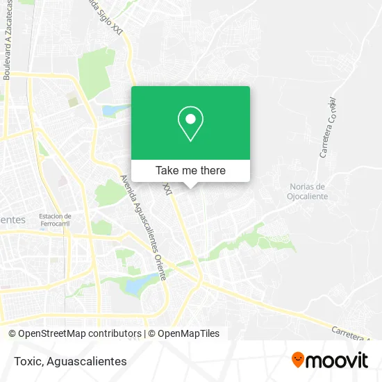
See Toxic, Aguascalientes, on the map
Public Transit to Toxic in Aguascalientes
Wondering how to get to Toxic in Aguascalientes? Moovit helps you find the best way to get to Toxic with step-by-step directions from the nearest public transit station.
Moovit provides free maps and live directions to help you navigate through your city. View schedules, routes, timetables, and find out how long does it take to get to Toxic in real time.
Looking for the nearest stop or station to Toxic? Check out this list of stops closest to your destination: Hacienda De Ojocaliente; Avenida Siglo Xxi.
Bus: RUTA 48, RUTA 50, RUTA 42, RUTA 45.
Want to see if there’s another route that gets you there at an earlier time? Moovit helps you find alternative routes or times. Get directions from and directions to Toxic easily from the Moovit App or Website.
We make riding to Toxic easy, which is why over 1.5 million users, including users in Aguascalientes, trust Moovit as the best app for public transit. You don’t need to download an individual bus app or train app, Moovit is your all-in-one transit app that helps you find the best bus time or train time available.
For information on prices of bus, costs and ride fares to Toxic, please check the Moovit app.
Use the app to navigate to popular places including to the airport, hospital, stadium, grocery store, mall, coffee shop, school, college, and university.
Toxic Address: Avenida Hacienda de Ojocaliente, Fracc Haciendas de Aguascalientes, 20196 Aguascalientes, Aguascali street in Aguascalientes
- Papeleria y Regalos,
- Consultorio Dental Jaha,
- Muebles Berao,
- Dra. Jennifer hernández-Dentist,
- Restaurante y Micheladas Arrecife Dorado Suc. Haciendas,
- Almacén del Hogar Haciendas,
- mecánica en General Lion's,
- Trattoria o Sole Mío,
- clínica Vet. Jeijer,
- Clínica Dental Ángeles,
- Laboratorio Clínico,
- dulcería y Desechables Russell,
- Hidromuebles,
- Crepería Madi,
- Venta de Mole Casero,
- Minisuper Luna,
- Barbería Hidrocalifas,
- Semillas Dulces y Cereales Ron,
- Productos de Belleza Yazmin,
- Óptica Cavi
Places Near Toxic (Aguascalientes)
- Villas de Nuestra Señora de la Asunción, Aguascalientes,
- Terminal De Combis, Aguascalientes,
- Centro Comercial Altaria, Aguascalientes,
- Central De Autobuses, Aguascalientes,
- Ciudad industrial, Aguascalientes,
- Universidad Autónoma de Aguascalientes, Aguascalientes,
- Blvd. Luis Donaldo Colosio, Aguascalientes,
- Jesús María, Aguascalientes,
- Agropecuario, Aguascalientes,
- Imss Clinica 1, Aguascalientes,
- La Isla San Marcos, Aguascalientes,
- Villasuncion, Aguascalientes,
- Hospital Imss No. 3, Aguascalientes,
- ESPACIOS, Aguascalientes,
- Aeropuerto de Aguascalientes S.A. de C.V., Aguascalientes,
- Nuevo Hospital Hidalgo, Aguascalientes,
- clinica 3 uaa, Aguascalientes,
- Isla San Marcos, Aguascalientes,
- Centro, Aguascalientes,
- Parque Las Tres Centurias, Aguascalientes
How to get to popular places in Aguascalientes with public transit
Get around Aguascalientes by public transit!
Traveling around Aguascalientes has never been so easy. See step by step directions as you travel to any attraction, street or major public transit station. View bus and train schedules, arrival times, service alerts and detailed routes on a map, so you know exactly how to get to anywhere in Aguascalientes.
When traveling to any destination around Aguascalientes use Moovit's Live Directions with Get Off Notifications to know exactly where and how far to walk, how long to wait for your line, and how many stops are left. Moovit will alert you when it's time to get off — no need to constantly re-check whether yours is the next stop.
Wondering how to use public transit in Aguascalientes or how to pay for public transit in Aguascalientes? Moovit public transit app can help you navigate your way with public transit easily, and at minimum cost. It includes public transit fees, ticket prices, and costs. Looking for a map of Aguascalientes public transit lines? Moovit public transit app shows all public transit maps in Aguascalientes with all bus routes and stops on an interactive map.
Aguascalientes has 1 transit type(s), including: bus, operated by several transit agencies, including Coordinación General de Movilidad