How to get to Tpmg Physical Therapy by bus?
Click on the bus route to see step by step directions with maps, line arrival times and updated time schedules.
Bus stop near Tpmg Physical Therapy in Newport News
- J Clyde Morris & Thimble Shoals, 9 min walk,VIEW
Bus lines to Tpmg Physical Therapy in Newport News
- 111, Woodside & Old Denbigh,VIEW
What are the closest stations to Tpmg Physical Therapy?
The closest stations to Tpmg Physical Therapy are:
- J Clyde Morris & Thimble Shoals is 656 yards away, 9 min walk.
Which bus lines stop near Tpmg Physical Therapy?
These bus lines stop near Tpmg Physical Therapy: 108, 111.
What’s the nearest bus station to Tpmg Physical Therapy in Newport News?
The nearest bus station to Tpmg Physical Therapy in Newport News is J Clyde Morris & Thimble Shoals. It’s a 9 min walk away.
What time is the first bus to Tpmg Physical Therapy in Newport News?
The 111 is the first bus that goes to Tpmg Physical Therapy in Newport News. It stops nearby at 6:56 AM.
What time is the last bus to Tpmg Physical Therapy in Newport News?
The 111 is the last bus that goes to Tpmg Physical Therapy in Newport News. It stops nearby at 11:10 PM.
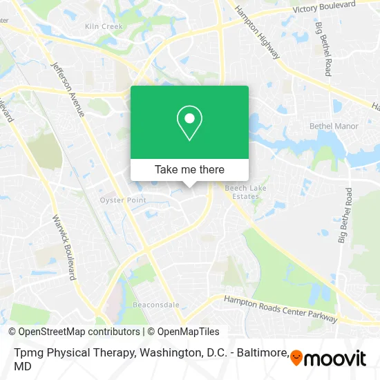
See Tpmg Physical Therapy, Newport News, on the map
Public Transit to Tpmg Physical Therapy in Newport News
Wondering how to get to Tpmg Physical Therapy in Newport News? Moovit helps you find the best way to get to Tpmg Physical Therapy with step-by-step directions from the nearest public transit station.
Moovit provides free maps and live directions to help you navigate through your city. View schedules, routes, timetables, and find out how long does it take to get to Tpmg Physical Therapy in real time.
Looking for the nearest stop or station to Tpmg Physical Therapy? Check out this list of stops closest to your destination: J Clyde Morris & Thimble Shoals.
Bus: 108, 111.
Want to see if there’s another route that gets you there at an earlier time? Moovit helps you find alternative routes or times. Get directions from and directions to Tpmg Physical Therapy easily from the Moovit App or Website.
We make riding to Tpmg Physical Therapy easy, which is why over 1.7 million users, including users in Newport News, trust Moovit as the best app for public transit. You don’t need to download an individual bus app or train app, Moovit is your all-in-one transit app that helps you find the best bus time or train time available.
For information on prices of bus and train, costs and ride fares to Tpmg Physical Therapy, please check the Moovit app.
Use the app to navigate to popular places including to the airport, hospital, stadium, grocery store, mall, coffee shop, school, college, and university.
Tpmg Physical Therapy Address: 11751 Rock Landing Dr street in Newport News
- Strayer University - Newport News Campus,
- Enterprise Academy,
- Johnson Francum-Re / Max Peninsula,
- Childrens Hospital Of the Kings Daughters,
- TPMG Orthopedics,
- Memory Of Green,
- Intelligent Decision Systems, Inc.,
- Tower Park Clock,
- Dr Hecker and Associates,
- Lollipop Lane Education Childcare,
- Arcamax Publishing,
- United States Government,
- Bridging the Gap Learning Center,
- Thimble Shoals & Diligence,
- Warwick Substation,
- Walter Baker Shore Park,
- Reinvented,
- Stepping Stones CDC,
- Holiday Inn Newport News - Hampton,
- Burger King
Places Near Tpmg Physical Therapy (Newport News)
- National Museum of African American History and Culture, Washington,
- National Zoo, Washington,
- Amazon Hq2, Arlington County,
- Pennsylvania Ave NW (3rd st and pennsylvania), Washington,
- PG Mall, Prince George's County,
- Washington DC VA Medical Center, Washington,
- Washington National Cathedral, Washington,
- Sibley Memorial Hospital, Washington,
- Camden Yards, Baltimore,
- Westfield Montgomery Mall, Montgomery County,
- Marriott Marquis Washington, DC, Washington,
- M&T Bank Stadium, Baltimore,
- Georgetown, Washington,
- Warner Theatre, Washington,
- Museum Of The Bible, Washington,
- National Theatre, Washington,
- Capital One Arena, Washington,
- Rock Creek Tennis Center, Washington,
- The Anthem, Washington,
- Basilica of the National Shrine, Washington
How to get to popular places in Washington, D.C. - Baltimore, MD with public transit
Get around Newport News by public transit!
Traveling around Newport News has never been so easy. See step by step directions as you travel to any attraction, street or major public transit station. View bus and train schedules, arrival times, service alerts and detailed routes on a map, so you know exactly how to get to anywhere in Newport News.
When traveling to any destination around Newport News use Moovit's Live Directions with Get Off Notifications to know exactly where and how far to walk, how long to wait for your line, and how many stops are left. Moovit will alert you when it's time to get off — no need to constantly re-check whether yours is the next stop.
Wondering how to use public transit in Newport News or how to pay for public transit in Newport News? Moovit public transit app can help you navigate your way with public transit easily, and at minimum cost. It includes public transit fees, ticket prices, and costs. Looking for a map of Newport News public transit lines? Moovit public transit app shows all public transit maps in Newport News with all Bus, Train, Metro, Light Rail and Ferry routes and stops on an interactive map.
Washington, D.C. - Baltimore, MD has 5 transit type(s), including: Bus, Train, Metro, Light Rail and Ferry, operated by several transit agencies, including WMATA, Montgomery County Ride On, Fairfax Connector, TheBus, PRTC, DASH - Alexandria, Arlington Transit (ART), RTA of Central Maryland, MDOT MTA, MDOT MTA Light RailLink, MDOT MTA Commuter Bus, MDOT MTA Local Bus, FXBGO!, Virginia Railway Express (VRE) and MARC