Directions to Trailblazer Learning Center (Waynesboro) with public transportation
The following transit lines have routes that pass near Trailblazer Learning Center
 Bus: WAYNESBORO CIRCULATOR.
How to get to Trailblazer Learning Center by bus?
Click on the bus route to see step by step directions with maps, line arrival times and updated time schedules.
Bus stop near Trailblazer Learning Center in Waynesboro
- Walmart (Downtown Waynesboro), 5 min walk,VIEW
Bus lines to Trailblazer Learning Center in Waynesboro
- WAYNESBORO CIRCULATOR, Waynesboro Circulator,VIEW
What are the closest stations to Trailblazer Learning Center?
The closest stations to Trailblazer Learning Center are:
- Walmart (Downtown Waynesboro) is 341 yards away, 5 min walk.
Which bus line stops near Trailblazer Learning Center?
WAYNESBORO CIRCULATOR (Waynesboro Circulator)
What’s the nearest bus station to Trailblazer Learning Center in Waynesboro?
The nearest bus station to Trailblazer Learning Center in Waynesboro is Walmart (Downtown Waynesboro). It’s a 5 min walk away.
What time is the first bus to Trailblazer Learning Center in Waynesboro?
The WAYNESBORO CIRCULATOR is the first bus that goes to Trailblazer Learning Center in Waynesboro. It stops nearby at 6:42 AM.
What time is the last bus to Trailblazer Learning Center in Waynesboro?
The WAYNESBORO CIRCULATOR is the last bus that goes to Trailblazer Learning Center in Waynesboro. It stops nearby at 6:16 PM.
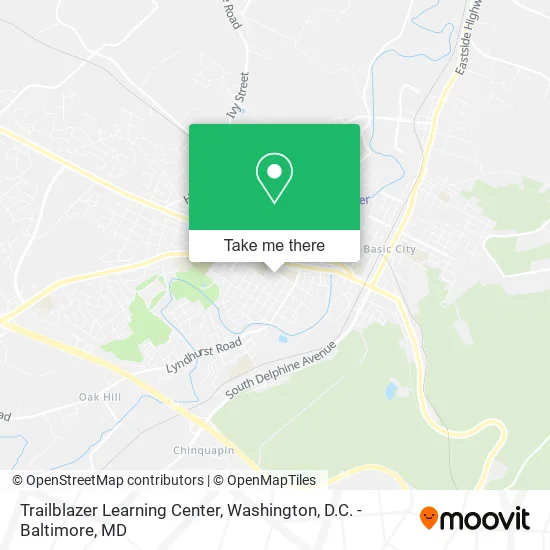
See Trailblazer Learning Center, Waynesboro, on the map
Public Transit to Trailblazer Learning Center in Waynesboro
Wondering how to get to Trailblazer Learning Center in Waynesboro? Moovit helps you find the best way to get to Trailblazer Learning Center with step-by-step directions from the nearest public transit station.
Moovit provides free maps and live directions to help you navigate through your city. View schedules, routes, timetables, and find out how long does it take to get to Trailblazer Learning Center in real time.
Looking for the nearest stop or station to Trailblazer Learning Center? Check out this list of stops closest to your destination: Walmart (Downtown Waynesboro).
Bus: WAYNESBORO CIRCULATOR.
Want to see if there’s another route that gets you there at an earlier time? Moovit helps you find alternative routes or times. Get directions from and directions to Trailblazer Learning Center easily from the Moovit App or Website.
We make riding to Trailblazer Learning Center easy, which is why over 1.5 million users, including users in Waynesboro, trust Moovit as the best app for public transit. You don’t need to download an individual bus app or train app, Moovit is your all-in-one transit app that helps you find the best bus time or train time available.
For information on prices of bus, costs and ride fares to Trailblazer Learning Center, please check the Moovit app.
Use the app to navigate to popular places including to the airport, hospital, stadium, grocery store, mall, coffee shop, school, college, and university.
Trailblazer Learning Center Address: 320 Maple Ave Waynesboro, VA 22980 street in Waynesboro
- Acs Home About US,
- Appalachian Christian School,
- St. John the Evangelist Catholic Church,
- Saint Johns School,
- Saint Johns Roman Catholic Church,
- Tree Streets of Waynesboro,
- Dicicco Dr Jay,
- Bethany Evangelical Lutheran Church,
- Wayne Hills United Methodist Church,
- Farmhaus Coffee Co.,
- Farmhaus Coffee,
- Stone Soup Books & Cafe,
- Tree Streets Inn,
- Reynolds Funeral Service,
- Cantongate Management,
- Patch Boys of Central Virginia,
- Sharpest Cut Lawn Care,
- Hero Mold Removal - Waynesboro,
- SOS Consulting,
- Waynesboro Senior Center
Places Near Trailblazer Learning Center (Waynesboro)
- Warner Theatre, Washington,
- Museum Of The Bible, Washington,
- Rock Creek Tennis Center, Washington,
- Capital One Arena, Washington,
- Camden Yards, Baltimore,
- Washington National Cathedral, Washington,
- Amazon Hq2, Arlington County,
- Marriott Marquis Washington, DC, Washington,
- M&T Bank Stadium, Baltimore,
- National Zoo, Washington,
- Washington DC VA Medical Center, Washington,
- Basilica of the National Shrine, Washington,
- The Anthem, Washington,
- National Mall, Washington,
- Georgetown, Washington,
- Sibley Memorial Hospital, Washington,
- Pennsylvania Ave NW (3rd st and pennsylvania), Washington,
- Westfield Montgomery Mall, Montgomery County,
- National Museum of African American History and Culture, Washington,
- PG Mall, Prince George's County
How to get to popular places in Washington, D.C. - Baltimore, MD with public transit
Get around Waynesboro by public transit!
Traveling around Waynesboro has never been so easy. See step by step directions as you travel to any attraction, street or major public transit station. View bus and train schedules, arrival times, service alerts and detailed routes on a map, so you know exactly how to get to anywhere in Waynesboro.
When traveling to any destination around Waynesboro use Moovit's Live Directions with Get Off Notifications to know exactly where and how far to walk, how long to wait for your line, and how many stops are left. Moovit will alert you when it's time to get off — no need to constantly re-check whether yours is the next stop.
Wondering how to use public transit in Waynesboro or how to pay for public transit in Waynesboro? Moovit public transit app can help you navigate your way with public transit easily, and at minimum cost. It includes public transit fees, ticket prices, and costs. Looking for a map of Waynesboro public transit lines? Moovit public transit app shows all public transit maps in Waynesboro with all Bus, Train, Metro, Light Rail and Ferry routes and stops on an interactive map.
Washington, D.C. - Baltimore, MD has 5 transit type(s), including: Bus, Train, Metro, Light Rail and Ferry, operated by several transit agencies, including WMATA, Montgomery County Ride On, Fairfax Connector, TheBus, PRTC, DASH - Alexandria, Arlington Transit (ART), RTA of Central Maryland, MDOT MTA, MDOT MTA Light RailLink, MDOT MTA Commuter Bus, MDOT MTA Local Bus, FXBGO!, Virginia Railway Express (VRE) and MARC