Directions to Train Fitness Center (Baltimore County) with public transportation
The following transit lines have routes that pass near Train Fitness Center
 Bus: 93, CITYLINK RED, TOWSON ORANGE.
- Light Rail: LIGHT RAILLINK.
How to get to Train Fitness Center by bus?
Click on the bus route to see step by step directions with maps, line arrival times and updated time schedules.
From Baltimore Museum Of Art, Baltimore
62 minFrom Good Samaritan Hospital, Baltimore
52 minFrom Giant Food Stores, Baltimore
49 minFrom Cockeysville, Maryland, Baltimore County
49 minFrom Medstar Union Memorial Hospital, Baltimore
54 minFrom Hampden, Baltimore
74 minFrom Morgan State University, Baltimore
65 minFrom Baltimore Polytechnic Institute, Baltimore
62 minFrom Loyola University Maryland, Baltimore
57 minFrom Johns Hopkins University, Baltimore
64 min
Bus stops near Train Fitness Center in Baltimore County
Light Rail stations near Train Fitness Center in Baltimore County
- Fairgrounds, 9 min walk,VIEW
Bus lines to Train Fitness Center in Baltimore County
What are the closest stations to Train Fitness Center?
The closest stations to Train Fitness Center are:
- Kenilworth Drive at the Exchange Eb 0046 (West) is 425 yards away, 6 min walk.
- Fairgrounds is 729 yards away, 9 min walk.
- Lutherville Light Rail Station Bay 2 is 1353 yards away, 16 min walk.
- Lutherville Light Rail Station Bay 1 is 1375 yards away, 17 min walk.
Which bus lines stop near Train Fitness Center?
These bus lines stop near Train Fitness Center: 93, CITYLINK RED.
Which light rail line stops near Train Fitness Center?
LIGHT RAILLINK (Northbound)
What’s the nearest light rail station to Train Fitness Center in Baltimore County?
The nearest light rail station to Train Fitness Center in Baltimore County is Fairgrounds. It’s a 9 min walk away.
What’s the nearest bus station to Train Fitness Center in Baltimore County?
The nearest bus station to Train Fitness Center in Baltimore County is Kenilworth Drive at the Exchange Eb 0046 (West). It’s a 6 min walk away.
What time is the first light rail to Train Fitness Center in Baltimore County?
The LIGHT RAILLINK is the first light rail that goes to Train Fitness Center in Baltimore County. It stops nearby at 4:40 AM.
What time is the last light rail to Train Fitness Center in Baltimore County?
The LIGHT RAILLINK is the last light rail that goes to Train Fitness Center in Baltimore County. It stops nearby at 1:02 AM.
What time is the first bus to Train Fitness Center in Baltimore County?
The 93 is the first bus that goes to Train Fitness Center in Baltimore County. It stops nearby at 4:13 AM.
What time is the last bus to Train Fitness Center in Baltimore County?
The CITYLINK RED is the last bus that goes to Train Fitness Center in Baltimore County. It stops nearby at 2:39 AM.
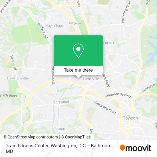
See Train Fitness Center, Baltimore County, on the map
Public Transit to Train Fitness Center in Baltimore County
Wondering how to get to Train Fitness Center in Baltimore County? Moovit helps you find the best way to get to Train Fitness Center with step-by-step directions from the nearest public transit station.
Moovit provides free maps and live directions to help you navigate through your city. View schedules, routes, timetables, and find out how long does it take to get to Train Fitness Center in real time.
Looking for the nearest stop or station to Train Fitness Center? Check out this list of stops closest to your destination: Kenilworth Drive at the Exchange Eb 0046 (West); Fairgrounds; Lutherville Light Rail Station Bay 2; Lutherville Light Rail Station Bay 1.
Bus: 93, CITYLINK RED, TOWSON ORANGE.Light Rail: LIGHT RAILLINK.
Want to see if there’s another route that gets you there at an earlier time? Moovit helps you find alternative routes or times. Get directions from and directions to Train Fitness Center easily from the Moovit App or Website.
We make riding to Train Fitness Center easy, which is why over 1.7 million users, including users in Baltimore County, trust Moovit as the best app for public transit. You don’t need to download an individual bus app or train app, Moovit is your all-in-one transit app that helps you find the best bus time or train time available.
For information on prices of bus and light rail, costs and ride fares to Train Fitness Center, please check the Moovit app.
Use the app to navigate to popular places including to the airport, hospital, stadium, grocery store, mall, coffee shop, school, college, and university.
Train Fitness Center Address: 1412 Railroad Ave street in Baltimore County
- Country Club Park, Maryland,
- Lutherville Light Rail Station,
- Movement Timonium,
- I-83 Exit 16 (Timonium Road),
- The Shops at Kenilworth,
- Rheb's Candies,
- Blakehurst Retirement Community,
- Kaiser Permanente Towson Medical Center,
- Forward Moda,
- Sky Zone Trampoline Park,
- Church Nativity (Church of the Nativity),
- Columbia MD,
- I-695 @ Exit 26 (York Rd / MD 45),
- Pickersgill Retirement Community,
- Timonium, MD,
- Lutherville Timonium, Maryland,
- Loyola Blakefield High School,
- 2118 Greenspring Dr,
- Play It Again Sports,
- Carver Center For Arts And Technology
Places Near Train Fitness Center (Baltimore County)
- National Zoo, Washington,
- National Museum of African American History and Culture, Washington,
- The Anthem, Washington,
- Capital One Arena, Washington,
- National Theatre, Washington,
- Warner Theatre, Washington,
- Washington DC VA Medical Center, Washington,
- Museum Of The Bible, Washington,
- Pennsylvania Ave NW (3rd st and pennsylvania), Washington,
- Marriott Marquis Washington, DC, Washington,
- Camden Yards, Baltimore,
- Georgetown, Washington,
- Washington National Cathedral, Washington,
- PG Mall, Prince George's County,
- Sibley Memorial Hospital, Washington,
- Amazon Hq2, Arlington County,
- Rock Creek Tennis Center, Washington,
- Basilica of the National Shrine, Washington,
- M&T Bank Stadium, Baltimore,
- Westfield Montgomery Mall, Montgomery County
How to get to popular places in Washington, D.C. - Baltimore, MD with public transit
Get around Baltimore County by public transit!
Traveling around Baltimore County has never been so easy. See step by step directions as you travel to any attraction, street or major public transit station. View bus and train schedules, arrival times, service alerts and detailed routes on a map, so you know exactly how to get to anywhere in Baltimore County.
When traveling to any destination around Baltimore County use Moovit's Live Directions with Get Off Notifications to know exactly where and how far to walk, how long to wait for your line, and how many stops are left. Moovit will alert you when it's time to get off — no need to constantly re-check whether yours is the next stop.
Wondering how to use public transit in Baltimore County or how to pay for public transit in Baltimore County? Moovit public transit app can help you navigate your way with public transit easily, and at minimum cost. It includes public transit fees, ticket prices, and costs. Looking for a map of Baltimore County public transit lines? Moovit public transit app shows all public transit maps in Baltimore County with all Bus, Train, Metro, Light Rail and Ferry routes and stops on an interactive map.
Washington, D.C. - Baltimore, MD has 5 transit type(s), including: Bus, Train, Metro, Light Rail and Ferry, operated by several transit agencies, including WMATA, Montgomery County Ride On, Fairfax Connector, TheBus, PRTC, DASH - Alexandria, Arlington Transit (ART), RTA of Central Maryland, MDOT MTA, MDOT MTA Light RailLink, MDOT MTA Commuter Bus, MDOT MTA Local Bus, FXBGO!, Virginia Railway Express (VRE) and MARC