How to get to Traiteur Chastel by bus?
Click on the bus route to see step by step directions with maps, line arrival times and updated time schedules.
How to get to Traiteur Chastel by train?
Click on the train route to see step by step directions with maps, line arrival times and updated time schedules.
How to get to Traiteur Chastel by metro?
Click on the metro route to see step by step directions with maps, line arrival times and updated time schedules.
Bus stops near Traiteur Chastel in Loos
Train stations near Traiteur Chastel in Loos
Metro station near Traiteur Chastel in Loos
- Chu - Eurasanté, 33 min walk,VIEW
Bus lines to Traiteur Chastel in Loos
What are the closest stations to Traiteur Chastel?
The closest stations to Traiteur Chastel are:
- Nd De Grace is 211 meters away, 3 min walk.
- Dhainaut is 568 meters away, 8 min walk.
- Longchamp is 657 meters away, 9 min walk.
- Haubourdin is 1434 meters away, 19 min walk.
- Chu - Eurasanté is 2539 meters away, 33 min walk.
- Lille Centre Hospitalier Régional is 4767 meters away, 61 min walk.
Which bus lines stop near Traiteur Chastel?
These bus lines stop near Traiteur Chastel: 58, 61R, 921.
Which train lines stop near Traiteur Chastel?
These train lines stop near Traiteur Chastel: C50, C51.
Which metro line stops near Traiteur Chastel?
M1 (Lille Chu Eurasanté)
What’s the nearest train station to Traiteur Chastel in Loos?
The nearest train station to Traiteur Chastel in Loos is Haubourdin. It’s a 19 min walk away.
What’s the nearest bus station to Traiteur Chastel in Loos?
The nearest bus station to Traiteur Chastel in Loos is Nd De Grace. It’s a 3 min walk away.
What time is the first metro to Traiteur Chastel in Loos?
The M1 is the first metro that goes to Traiteur Chastel in Loos. It stops nearby at 5:00 AM.
What time is the last metro to Traiteur Chastel in Loos?
The M1 is the last metro that goes to Traiteur Chastel in Loos. It stops nearby at 12:39 AM.
What time is the first train to Traiteur Chastel in Loos?
The K51 is the first train that goes to Traiteur Chastel in Loos. It stops nearby at 6:25 AM.
What time is the last train to Traiteur Chastel in Loos?
The K50 is the last train that goes to Traiteur Chastel in Loos. It stops nearby at 9:17 PM.
What time is the first bus to Traiteur Chastel in Loos?
The 931 is the first bus that goes to Traiteur Chastel in Loos. It stops nearby at 7:27 AM.
What time is the last bus to Traiteur Chastel in Loos?
The 931 is the last bus that goes to Traiteur Chastel in Loos. It stops nearby at 6:10 PM.
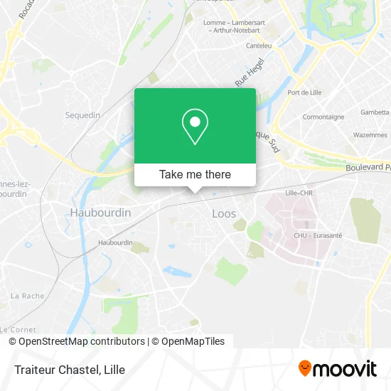
See Traiteur Chastel, Loos, on the map
Public Transit to Traiteur Chastel in Loos
Wondering how to get to Traiteur Chastel in Loos? Moovit helps you find the best way to get to Traiteur Chastel with step-by-step directions from the nearest public transit station.
Moovit provides free maps and live directions to help you navigate through your city. View schedules, routes, timetables, and find out how long does it take to get to Traiteur Chastel in real time.
Looking for the nearest stop or station to Traiteur Chastel? Check out this list of stops closest to your destination: Nd De Grace; Dhainaut; Longchamp; Haubourdin; Chu - Eurasanté; Lille Centre Hospitalier Régional.
Bus: 58, 61R, 921, 916, 931, 934, 914.Train: C50, C51, K50, K51.Metro: M1.
Want to see if there’s another route that gets you there at an earlier time? Moovit helps you find alternative routes or times. Get directions from and directions to Traiteur Chastel easily from the Moovit App or Website.
We make riding to Traiteur Chastel easy, which is why over 1.5 million users, including users in Loos, trust Moovit as the best app for public transit. You don’t need to download an individual bus app or train app, Moovit is your all-in-one transit app that helps you find the best bus time or train time available.
For information on prices of train, bus, metro and light rail, costs and ride fares to Traiteur Chastel, please check the Moovit app.
Use the app to navigate to popular places including to the airport, hospital, stadium, grocery store, mall, coffee shop, school, college, and university.
Traiteur Chastel Address: Rue du Docteur Calmette 59120 Loos street in Loos
- Confiserie Femina,
- Rue Camille Guérin,
- P.N. De Loos,
- Rue du Docteur Calmette 116,
- Commissariat de Sécurité Publique,
- Caisse D'Allocations Familiales (Caf) Du Nord - Accueil De Loos,
- Rue Georges Clemenceau 20,
- Arrêt Clemenceau,
- Lidl,
- Groupe Hospitalier Loos Haubourdin,
- 73 Rue Lucien Pickaert Parking,
- Rue Georges Potié 66,
- Boulevard de la République 55,
- Rue Henri Barbusse 20,
- Café le Populaire Chambres,
- Centre Hospitalier De Loos,
- Taleux Hélène,
- Sape,
- Résidence Pasteur,
- Maaf Assurances
Places Near Traiteur Chastel (Loos)
- Zénith Arena, Lille,
- L'Usine, Roubaix,
- Université Catholique, Lille,
- Clinique du Bois, Lille,
- Théâtre Sébastopol, Lille,
- Hôpital Claude Huriez, Lille,
- Hôpital Salengro, Lille,
- Centre Commercial V2, Villeneuve-D'Ascq,
- Rue de la Porte d'Ypres 1, Lille,
- Auchan Englos, Englos,
- Hôpital Saint-Vincent De Paul, Lille,
- Saint-André-Lez-Lille, Saint-André-Lez-Lille,
- Zoo De Lille, Lille,
- Kinepolis Lomme, Lille,
- Ikea, Lille,
- Ffffff, Lezennes,
- Champ De Mars, Lille,
- Marché De Wazemmes, Lille,
- Euratechnologies, Lille,
- Consulat General D'Algerie, Lille
How to get to popular places in Lille with public transit
Get around Loos by public transit!
Traveling around Loos has never been so easy. See step by step directions as you travel to any attraction, street or major public transit station. View bus and train schedules, arrival times, service alerts and detailed routes on a map, so you know exactly how to get to anywhere in Loos.
When traveling to any destination around Loos use Moovit's Live Directions with Get Off Notifications to know exactly where and how far to walk, how long to wait for your line, and how many stops are left. Moovit will alert you when it's time to get off — no need to constantly re-check whether yours is the next stop.
Wondering how to use public transit in Loos or how to pay for public transit in Loos? Moovit public transit app can help you navigate your way with public transit easily, and at minimum cost. It includes public transit fees, ticket prices, and costs. Looking for a map of Loos public transit lines? Moovit public transit app shows all public transit maps in Loos with all Bus, Train, Metro and Light Rail routes and stops on an interactive map.
Lille has 4 transit type(s), including: Bus, Train, Metro and Light Rail, operated by several transit agencies, including TRANSPOLE and SNCF VOYAGEURS