How to get to Transimisiones Automaticas by bus?
Click on the bus route to see step by step directions with maps, line arrival times and updated time schedules.
From Clínica 11, Aguascalientes
42 minFrom La Soledad, Aguascalientes
44 minFrom Fraccionamiento Villa Gernika, Aguascalientes
59 minFrom Unitec, Aguascalientes
49 minFrom Avenida Poliducto, Aguascalientes
35 minFrom Fracc . Trojes del Sur, Aguascalientes
37 minFrom Blvd. Juan Pablo II, Aguascalientes
51 minFrom Los Juarez, Aguascalientes
37 minFrom Potreros del Oeste, Aguascalientes
38 minFrom Universidad Tecnologica De Aguascalientes, Aguascalientes
50 min
Bus stops near Transimisiones Automaticas in Aguascalientes
Bus lines to Transimisiones Automaticas in Aguascalientes
- RUTA 43, Utma,VIEW
- RUTA 43, San Antonio Via Lomas De New York,VIEW
- RUTA 51, Casa Blanca,VIEW
- RUTA 16, Bellavista,VIEW
- RUTA 08, UTMA - Centro (Rivero y Gutiérrez),VIEW
- RUTA 09, Cumbres III - Mahatma Gandhi,VIEW
- RUTA 09, Mahatma Gandhi - Los Laureles,VIEW
- RUTA 20N, Terminal Oriente - Terminal Oriente (N),VIEW
- RUTA 35, Lunaria - UAA,VIEW
- RUTA 20S, Terminal Oriente - Terminal Oriente (S),VIEW
- RUTA 18, Uaa,VIEW
- RUTA 45, Valle De Los Cactus - Uaa,VIEW
What are the closest stations to Transimisiones Automaticas?
The closest stations to Transimisiones Automaticas are:
- Avenida Ferrocarril, 191 is 207 meters away, 3 min walk.
- Obrero Mundial, 108c is 210 meters away, 3 min walk.
- Aguascalientes - San Francisco De Los Romo, 117 is 253 meters away, 4 min walk.
- Avenida De La Convención De 1914 Oriente, 602 is 284 meters away, 4 min walk.
- Héroe De Nacozari Norte, 2102 is 348 meters away, 5 min walk.
- Avenida Manuel Gómez Morín, Lb is 626 meters away, 9 min walk.
Which bus lines stop near Transimisiones Automaticas?
These bus lines stop near Transimisiones Automaticas: RUTA 03, RUTA 09, RUTA 16, RUTA 20S, RUTA 35.
What’s the nearest bus station to Transimisiones Automaticas in Aguascalientes?
The nearest bus stations to Transimisiones Automaticas in Aguascalientes are Avenida Ferrocarril, 191 and Obrero Mundial, 108c. The closest one is a 3 min walk away.
What time is the first bus to Transimisiones Automaticas in Aguascalientes?
The RUTA 20N is the first bus that goes to Transimisiones Automaticas in Aguascalientes. It stops nearby at 5:45 AM.
What time is the last bus to Transimisiones Automaticas in Aguascalientes?
The RUTA 43 is the last bus that goes to Transimisiones Automaticas in Aguascalientes. It stops nearby at 10:29 PM.
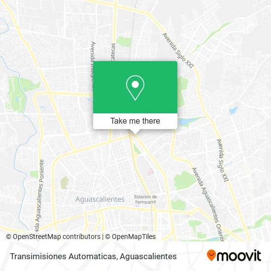
See Transimisiones Automaticas, Aguascalientes, on the map
Public Transit to Transimisiones Automaticas in Aguascalientes
Wondering how to get to Transimisiones Automaticas in Aguascalientes? Moovit helps you find the best way to get to Transimisiones Automaticas with step-by-step directions from the nearest public transit station.
Moovit provides free maps and live directions to help you navigate through your city. View schedules, routes, timetables, and find out how long does it take to get to Transimisiones Automaticas in real time.
Looking for the nearest stop or station to Transimisiones Automaticas? Check out this list of stops closest to your destination: Avenida Ferrocarril; Obrero Mundial; Aguascalientes - San Francisco De Los Romo; Avenida De La Convención De 1914 Oriente; Héroe De Nacozari Norte; Avenida Manuel Gómez Morín.
Bus: RUTA 03, RUTA 09, RUTA 16, RUTA 20S, RUTA 35, RUTA 43, RUTA 43, RUTA 51, RUTA 08, RUTA 20N, RUTA 18, RUTA 45.
Want to see if there’s another route that gets you there at an earlier time? Moovit helps you find alternative routes or times. Get directions from and directions to Transimisiones Automaticas easily from the Moovit App or Website.
We make riding to Transimisiones Automaticas easy, which is why over 1.5 million users, including users in Aguascalientes, trust Moovit as the best app for public transit. You don’t need to download an individual bus app or train app, Moovit is your all-in-one transit app that helps you find the best bus time or train time available.
For information on prices of bus, costs and ride fares to Transimisiones Automaticas, please check the Moovit app.
Use the app to navigate to popular places including to the airport, hospital, stadium, grocery store, mall, coffee shop, school, college, and university.
Transimisiones Automaticas Address: Transimisiones Automaticas, 1er Anillo Periférico, Francisco Guel Jimenez, 20160 Aguascalientes, Ag street in Aguascalientes
- Rosticerias El Pechugon,
- Avenida Paseo de La Solidaridad,
- Chatarrera Grupo Resimental,
- Birrieria Chio,
- Leonvolk's,
- Esc Secundaria General No 4,
- Tapiceria Ramírez,
- Club de Nutrición,
- Francisco Guel Jimenez,
- Gorditas Mesa,
- Casa de Empeño El Cerrito,
- Modelorama Nueva Andalucia,
- Templo De San Pedro Apostol,
- Bazar Multi Bazar,
- Pasteleria El Manjar del Rey,
- Tienda Escolar de la Secundaria General 4,
- Escuela Leyes de Reforma,
- Childrens Cup,
- Cerrajería El Puente,
- Escalante Calvillo, heriberto
Places Near Transimisiones Automaticas (Aguascalientes)
- ESPACIOS, Aguascalientes,
- Blvd. Luis Donaldo Colosio, Aguascalientes,
- Hospital Imss No. 3, Aguascalientes,
- Central De Autobuses, Aguascalientes,
- Parque Las Tres Centurias, Aguascalientes,
- Agropecuario, Aguascalientes,
- Aeropuerto de Aguascalientes S.A. de C.V., Aguascalientes,
- Nuevo Hospital Hidalgo, Aguascalientes,
- Villas de Nuestra Señora de la Asunción, Aguascalientes,
- Jesús María, Aguascalientes,
- clinica 3 uaa, Aguascalientes,
- Villasuncion, Aguascalientes,
- Centro, Aguascalientes,
- La Isla San Marcos, Aguascalientes,
- Isla San Marcos, Aguascalientes,
- Universidad Autónoma de Aguascalientes, Aguascalientes,
- Centro Comercial Altaria, Aguascalientes,
- Ciudad industrial, Aguascalientes,
- Imss Clinica 1, Aguascalientes,
- Terminal De Combis, Aguascalientes
How to get to popular places in Aguascalientes with public transit
Get around Aguascalientes by public transit!
Traveling around Aguascalientes has never been so easy. See step by step directions as you travel to any attraction, street or major public transit station. View bus and train schedules, arrival times, service alerts and detailed routes on a map, so you know exactly how to get to anywhere in Aguascalientes.
When traveling to any destination around Aguascalientes use Moovit's Live Directions with Get Off Notifications to know exactly where and how far to walk, how long to wait for your line, and how many stops are left. Moovit will alert you when it's time to get off — no need to constantly re-check whether yours is the next stop.
Wondering how to use public transit in Aguascalientes or how to pay for public transit in Aguascalientes? Moovit public transit app can help you navigate your way with public transit easily, and at minimum cost. It includes public transit fees, ticket prices, and costs. Looking for a map of Aguascalientes public transit lines? Moovit public transit app shows all public transit maps in Aguascalientes with all bus routes and stops on an interactive map.
Aguascalientes has 1 transit type(s), including: bus, operated by several transit agencies, including Coordinación General de Movilidad