How to get to Transre by bus?
Click on the bus route to see step by step directions with maps, line arrival times and updated time schedules.
From East 96th Street, Manhattan
67 minFrom Upper East Side, Manhattan
65 minFrom New Yorker A Wyndham Hotel, Manhattan
49 minFrom 63rd & Lexington, Manhattan
60 minFrom 5 E 98th St, Manhattan
44 minFrom E 70th St and 2nd, Manhattan
49 minFrom John Jay College, Manhattan
58 minFrom Hallets Point, Queens
94 minFrom Walmart, Secaucus
98 minFrom Walmart Supercenter, Secaucus
98 min
How to get to Transre by train?
Click on the train route to see step by step directions with maps, line arrival times and updated time schedules.
How to get to Transre by subway?
Click on the subway route to see step by step directions with maps, line arrival times and updated time schedules.
From East 96th Street, Manhattan
39 minFrom Upper East Side, Manhattan
31 minFrom New Yorker A Wyndham Hotel, Manhattan
24 minFrom 63rd & Lexington, Manhattan
31 minFrom 5 E 98th St, Manhattan
43 minFrom E 70th St and 2nd, Manhattan
33 minFrom John Jay College, Manhattan
34 minFrom Hallets Point, Queens
69 min
Bus stops near Transre in Manhattan
Ferry stations near Transre in Manhattan
Bus lines to Transre in Manhattan
- DOWNTOWN CONNECTION, Downtown Connection,VIEW
- BM1, Mill Basin - Downtown/Midtown,VIEW
- BM2, Canarsie/Spring Creek - Downtown/Midtown,VIEW
- BM3, Sheepshead Bay - Downtown/Midtown,VIEW
- BM4, Gerritsen Beach - Downtown/Midtown,VIEW
- SIM5, Eltvlle Trans Ctr Via F Cap Bl Via Gfrds,VIEW
- SIM15, Eltingville Transit Center Via Richmond,VIEW
- SIM35, Port Richmond Via Clove Rd,VIEW
- QM7, Downtown,VIEW
- QM8, Super Express Glen Oaks 260 St Via Fresh Meadows,VIEW
- QM65, Laurelton,VIEW
- M15-SBS, Select Bus Service South Ferry Via 2 Av,VIEW
- M15, East Harlem 125 St Via 1 Av,VIEW
- QM11, Forest Hills,VIEW
- QM25, Downtown Via Church St Via Water St,VIEW
What are the closest stations to Transre?
The closest stations to Transre are:
- Water St/Pine St is 23 yards away, 1 min walk.
- Water St/Maiden Ln is 24 yards away, 1 min walk.
- Wall St is 49 yards away, 1 min walk.
- Broad St is 110 yards away, 2 min walk.
- Water St/Wall St is 117 yards away, 2 min walk.
- Water St/John St is 199 yards away, 3 min walk.
- Wall St/Pier 11 is 480 yards away, 7 min walk.
- Pier 11 / Wall Street is 540 yards away, 7 min walk.
Which bus lines stop near Transre?
These bus lines stop near Transre: BXM18, M15, M15-SBS.
Which train lines stop near Transre?
These train lines stop near Transre: GRE, YEL.
Which subway lines stop near Transre?
These subway lines stop near Transre: 2, 3, 4, 5, A.
What’s the nearest subway station to Transre in Manhattan?
The nearest subway station to Transre in Manhattan is Wall St. It’s a 1 min walk away.
What’s the nearest bus station to Transre in Manhattan?
The nearest bus stations to Transre in Manhattan are Water St/Pine St and Water St/Maiden Ln. The closest one is a 1 min walk away.
What’s the nearest ferry station to Transre in Manhattan?
The nearest ferry stations to Transre in Manhattan are Wall St/Pier 11 and Pier 11 / Wall Street. The closest one is a 7 min walk away.
What time is the first subway to Transre in Manhattan?
The J is the first subway that goes to Transre in Manhattan. It stops nearby at 3:01 AM.
What time is the last subway to Transre in Manhattan?
The 2 is the last subway that goes to Transre in Manhattan. It stops nearby at 4:12 AM.
What time is the first bus to Transre in Manhattan?
The M15 is the first bus that goes to Transre in Manhattan. It stops nearby at 3:02 AM.
What time is the last bus to Transre in Manhattan?
The M15 is the last bus that goes to Transre in Manhattan. It stops nearby at 3:14 AM.
What time is the first ferry to Transre in Manhattan?
The RS is the first ferry that goes to Transre in Manhattan. It stops nearby at 6:05 AM.
What time is the last ferry to Transre in Manhattan?
The SG is the last ferry that goes to Transre in Manhattan. It stops nearby at 10:08 PM.
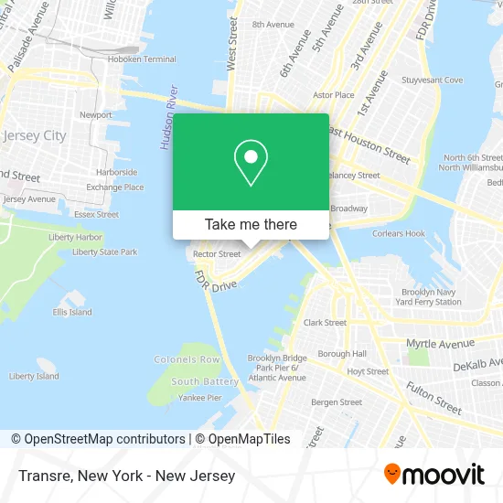
See Transre, Manhattan, on the map
Public Transit to Transre in Manhattan
Wondering how to get to Transre in Manhattan? Moovit helps you find the best way to get to Transre with step-by-step directions from the nearest public transit station.
Moovit provides free maps and live directions to help you navigate through your city. View schedules, routes, timetables, and find out how long does it take to get to Transre in real time.
Looking for the nearest stop or station to Transre? Check out this list of stops closest to your destination: Water St/Pine St; Water St/Maiden Ln; Wall St; Broad St; Water St/Wall St; Water St/John St; Wall St/Pier 11; Pier 11 / Wall Street.
Bus: BXM18, M15, M15-SBS, DOWNTOWN CONNECTION, BM1, BM2, BM3, BM4, SIM5, SIM15, SIM35.Train: GRE, YEL.Subway: 2, 3, 4, 5, A, J, M, Z.Ferry: AS, ER, GI, RS, SB.
Want to see if there’s another route that gets you there at an earlier time? Moovit helps you find alternative routes or times. Get directions from and directions to Transre easily from the Moovit App or Website.
We make riding to Transre easy, which is why over 1.5 million users, including users in Manhattan, trust Moovit as the best app for public transit. You don’t need to download an individual bus app or train app, Moovit is your all-in-one transit app that helps you find the best bus time or train time available.
For information on prices of subway, bus and train, costs and ride fares to Transre, please check the Moovit app.
Use the app to navigate to popular places including to the airport, hospital, stadium, grocery store, mall, coffee shop, school, college, and university.
Transre Address: 165 Broadway street in Manhattan
- Ambrosi Food Usa Corporation,
- Amazon Go,
- Healthpass,
- Katjes Usa,
- January Digital,
- Rudin Management Co.,
- Curemd,
- Ffa Sports Management,
- 80 Pine Street,
- Amnon Beniaminovitz,
- Corporate Power Inc.,
- New York | Financial District,
- Kirie Firie,
- Dr. Amnon Beniaminovitz,
- Nuru Binghamton Downtown,
- Beauty by Jennlee,
- Holborn Corporation,
- Wall Street and Water St,
- Avs,
- Yushi Asian Kitchen
Places Near Transre (Manhattan)
- Chinatown, Manhattan,
- Wall Street, Manhattan,
- 111 Centre New York City Supreme Court, Manhattan,
- Pier 83, Manhattan,
- Queens Center Mall, Queens,
- Bellevue Hospital, Manhattan,
- 911 Memorial, Manhattan,
- 3 Stone St, Manhattan,
- Mountainside Hospital, Glen Ridge,
- Hudson Yards, Manhattan,
- Times Square, Manhattan,
- Katz's Deli, Manhattan,
- 1 Police Plaza, Manhattan,
- 66 John Street, Manhattan,
- 26 Federal Plaza, Manhattan,
- Rockefeller Center, Manhattan,
- 376 Hudson Street, Manhattan,
- qqqq, Manhattan,
- San Gennaro Feast, Manhattan,
- SoHo, Manhattan
How to get to popular places in New York - New Jersey with public transit
Get around Manhattan by public transit!
Traveling around Manhattan has never been so easy. See step by step directions as you travel to any attraction, street or major public transit station. View bus and train schedules, arrival times, service alerts and detailed routes on a map, so you know exactly how to get to anywhere in Manhattan.
When traveling to any destination around Manhattan use Moovit's Live Directions with Get Off Notifications to know exactly where and how far to walk, how long to wait for your line, and how many stops are left. Moovit will alert you when it's time to get off — no need to constantly re-check whether yours is the next stop.
Wondering how to use public transit in Manhattan or how to pay for public transit in Manhattan? Moovit public transit app can help you navigate your way with public transit easily, and at minimum cost. It includes public transit fees, ticket prices, and costs. Looking for a map of Manhattan public transit lines? Moovit public transit app shows all public transit maps in Manhattan with all Bus, Train, Subway, Light Rail, Ferry and Cable Car routes and stops on an interactive map.
New York - New Jersey has 6 transit type(s), including: Bus, Train, Subway, Light Rail, Ferry and Cable Car, operated by several transit agencies, including MTA Subway, Metro-North Railroad, LIRR, PATH, MTA New York City Transit - Express routes, MTA Bus, NJ Transit, NYC Ferry, NICE bus, Bee-Line Bus, NJ Transit Rail, Norwalk Transit District, Hartford Line, River Valley Transit and HART