Directions to Travessa Primor (Niterói) with public transportation
The following transit lines have routes that pass near Travessa Primor
 Bus: 2146D (EXECUTIVO), 430M, 26, 62, 580M.
How to get to Travessa Primor by bus?
Click on the bus route to see step by step directions with maps, line arrival times and updated time schedules.
From Forum, Centro
36 minFrom Castelo, Centro
36 minFrom Avenida Presidente Vargas, Centro
40 minFrom Santa Casa de Misericórdia do Rio de Janeiro, Centro
41 minFrom Bossa Nova Mall, Centro
39 minFrom Shopping São Gonçalo., São Gonçalo
53 minFrom Tribunal De Justiça, Centro
37 minFrom Praça Senador Salgado Filho s/n - Centro, Centro
33 minFrom VLT Carioca - Estação Praça XV, Centro
41 min
Bus stops near Travessa Primor in Niterói
- Alameda São Boaventura 1215-1223 - Fonseca Niterói - Rj Brasil, 5 min walk,VIEW
- Rua Altineu Cortes Pires Fonseca Niterói - Rio De Janeiro 24140 Brasil, 6 min walk,VIEW
- Rua São José Próximo Ao 12 - Fonseca Niterói - Rj 24120-325 Brasil, 7 min walk,VIEW
- Rua São José Fonseca Niterói - Rio De Janeiro 24120 Brasil, 8 min walk,VIEW
- Rua Soares De Miranda 9, 9 min walk,VIEW
- Rodovia Rj-104 (Sentido Manilha) | Subida Da Caixa D'Água, 9 min walk,VIEW
Bus lines to Travessa Primor in Niterói
- 26, Florária X Centro,VIEW
- 62, Santa Bárbara X Charitas,VIEW
- 580M, Tribobó X Niterói (Via Santa Bárbara),VIEW
- 534A, Jaconé - Niterói (Via Manoel Ribeiro / Ponta Negra),VIEW
- 534R, Jaconé - Niterói (via Ponta Negra),VIEW
- 535R, Várzea das Moças - Niterói (Via Tribobó),VIEW
- 536R, Várzea das Moças - Niterói (Via Maria Paula),VIEW
- 537R, Itaipu - Niterói (Via Tribobó),VIEW
- 538R, Itaipu - Niterói (Via Av. Central),VIEW
- 540R, Jóquei - Niterói (Via Tribobó / Oásis),VIEW
- 541R, Jóquei - Niterói (Via Arsenal),VIEW
- 542R, Anaia - Niterói,VIEW
- M548, Maricá - Niterói,VIEW
- 571R, Engenho do Roçado - Niterói,VIEW
- 590M, Amendoeira - Niterói (Via Tribobó),VIEW
- 2144R (EXECUTIVO), Maricá - Niterói,VIEW
- 4144R (EXECUTIVO), Itaipuaçu (Recanto) - Niterói,VIEW
- 6144R (EXECUTIVO), Rua 128 - Niterói (Via Barroco),VIEW
- MB18, Niterói - Rio Bonito ( Via Duques ),VIEW
- 2MB10, Rio Bonito x Niteroi ( Via Alameda ),VIEW
What are the closest stations to Travessa Primor?
The closest stations to Travessa Primor are:
- Alameda São Boaventura 1215-1223 - Fonseca Niterói - Rj Brasil is 357 meters away, 5 min walk.
- Rua Altineu Cortes Pires Fonseca Niterói - Rio De Janeiro 24140 Brasil is 442 meters away, 6 min walk.
- Rua São José Próximo Ao 12 - Fonseca Niterói - Rj 24120-325 Brasil is 490 meters away, 7 min walk.
- Rua São José Fonseca Niterói - Rio De Janeiro 24120 Brasil is 552 meters away, 8 min walk.
- Rua Soares De Miranda 9 is 628 meters away, 9 min walk.
- Rodovia Rj-104 (Sentido Manilha) | Subida Da Caixa D'Água is 632 meters away, 9 min walk.
Which bus lines stop near Travessa Primor?
These bus lines stop near Travessa Primor: 2146D (EXECUTIVO), 430M.
What’s the nearest bus station to Travessa Primor in Niterói?
The nearest bus station to Travessa Primor in Niterói is Alameda São Boaventura 1215-1223 - Fonseca Niterói - Rj Brasil. It’s a 5 min walk away.
What time is the first bus to Travessa Primor in Niterói?
The 549M is the first bus that goes to Travessa Primor in Niterói. It stops nearby at 3:09 AM.
What time is the last bus to Travessa Primor in Niterói?
The 535R is the last bus that goes to Travessa Primor in Niterói. It stops nearby at 3:28 AM.
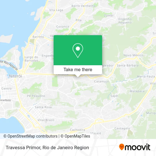
See Travessa Primor, Niterói, on the map
Public Transit to Travessa Primor in Niterói
Wondering how to get to Travessa Primor in Niterói? Moovit helps you find the best way to get to Travessa Primor with step-by-step directions from the nearest public transit station.
Moovit provides free maps and live directions to help you navigate through your city. View schedules, routes, timetables, and find out how long does it take to get to Travessa Primor in real time.
Looking for the nearest stop or station to Travessa Primor? Check out this list of stops closest to your destination: Alameda São Boaventura 1215-1223 - Fonseca Niterói - Rj Brasil; Rua Altineu Cortes Pires Fonseca Niterói - Rio De Janeiro 24140 Brasil; Rua São José Próximo Ao 12 - Fonseca Niterói - Rj 24120-325 Brasil; Rua São José Fonseca Niterói - Rio De Janeiro 24120 Brasil; Rua Soares De Miranda 9; Rodovia Rj-104 (Sentido Manilha) | Subida Da Caixa D'Água.
Bus: 2146D (EXECUTIVO), 430M, 26, 62, 580M, 534A, 534R, 21, 22, 49.1, 725D, 730D, 26A, 45, 49.2, 34B, EXECUTIVO, EXECUTIVO, MB21, MB26, 543D.
Want to see if there’s another route that gets you there at an earlier time? Moovit helps you find alternative routes or times. Get directions from and directions to Travessa Primor easily from the Moovit App or Website.
We make riding to Travessa Primor easy, which is why over 1.5 million users, including users in Niterói, trust Moovit as the best app for public transit. You don’t need to download an individual bus app or train app, Moovit is your all-in-one transit app that helps you find the best bus time or train time available.
For information on prices of bus, costs and ride fares to Travessa Primor, please check the Moovit app.
Use the app to navigate to popular places including to the airport, hospital, stadium, grocery store, mall, coffee shop, school, college, and university.
Travessa Primor Address: Fonseca Niterói-RJ street in Niterói
- Escritório Contábil,
- Simônica Acabamentos-Materiais de Construção,
- Nayla Lanches,
- Ponto Final do 49,
- Kivideo Locadora,
- Caminhada Comunidade Castro Alves,
- Descida da Caixa d'Água,
- Lions Clube Niteroi Fonseca,
- Umei Alberto Brandão,
- Rua Teixeira de Freitas / RJ-104,
- Colegio da Policia Militar - Alameda,
- Hospital Getúlio Vargas Filho,
- Igreja Batista do Calvário no Fonseca,
- Hospital Estadual Azevedo Lima,
- Getulinho B,
- Rptm Padaria Confeitaria e Lanchonete,
- Igreja Apostólica Altar de Deus,
- Vitoria Floricultura e Assistencia Funeral,
- Auto Pecas Aguiar,
- Hospital Azevedo Lima
Places Near Travessa Primor (Niterói)
- Rua Licínio Cardoso, São Francisco Xavier,
- Rodoviária Novo Rio (Rodoviária do Rio de Janeiro), Santo Cristo,
- Shopping Nova América, Del Castilho,
- Avenida Venezuela 134, Saúde,
- Museu Do Amanhã, Centro,
- Rua Ulysses Guimarães 16, Cidade Nova,
- Feira Livre da Gloria, Glória,
- Niterói, Niterói,
- Shopping Rio Sul, Botafogo,
- Shopping RioSul, Botafogo,
- Rio De Janeiro,
- Hospital Federal Cardoso Fontes, Jacarepaguá,
- Feirão De Malhas, Duque De Caxias,
- Hospital Federal Do Andaraí, Andaraí,
- Norte Shopping, Cachambi,
- Hospital Pedro Ernesto, Vila Isabel,
- Avenida Rio Branco, Centro,
- Praia do Arpoador, Ipanema,
- Shopping Downtown, Barra Da Tijuca,
- Hospital Municipal Ronaldo Gazolla, Acari
How to get to popular places in Rio de Janeiro Region with public transit
Get around Niterói by public transit!
Traveling around Niterói has never been so easy. See step by step directions as you travel to any attraction, street or major public transit station. View bus and train schedules, arrival times, service alerts and detailed routes on a map, so you know exactly how to get to anywhere in Niterói.
When traveling to any destination around Niterói use Moovit's Live Directions with Get Off Notifications to know exactly where and how far to walk, how long to wait for your line, and how many stops are left. Moovit will alert you when it's time to get off — no need to constantly re-check whether yours is the next stop.
Wondering how to use public transit in Niterói or how to pay for public transit in Niterói? Moovit public transit app can help you navigate your way with public transit easily, and at minimum cost. It includes public transit fees, ticket prices, and costs. Looking for a map of Niterói public transit lines? Moovit public transit app shows all public transit maps in Niterói with all Bus, Train, Metro, Light Rail, Ferry, Cable Car, Gondola and Funicular routes and stops on an interactive map.
Rio de Janeiro Region has 8 transit type(s), including: Bus, Train, Metro, Light Rail, Ferry, Cable Car, Gondola and Funicular, operated by several transit agencies, including TrensRJ, Metrô Rio, VLT Carioca, Barcas Rio, BRT MOBI-Rio, Auto Viação Alpha, Auto Viação Tijuca, Gire Transportes, Transurb, Viação Nossa Senhora das Graças, Consórcio INTERSUL, Braso Lisboa (Municipal), Caprichosa Auto Ônibus, Auto Viação Três Amigos and Rodoviária Âncora Matias