How to get to Travessa da Amizade 34 by bus?
Click on the bus route to see step by step directions with maps, line arrival times and updated time schedules.
From Rua Ana Néri, Benfica
47 minFrom Av Marechal Rondon,, São Francisco Xavier
50 minFrom Praça Das Nações, Bonsucesso
35 minFrom Policlínica Piquet Carneiro (Uerj), São Francisco Xavier
51 minFrom Hospital Central do Exército (HCE), Benfica
49 minFrom Hospital Estadual Melchiades Calazans, Nilópolis
57 minFrom CS 32 - Vila Militar alistamento, Deodoro
43 minFrom Bento Ribeiro, Bento Ribeiro
37 minFrom HTO Baixada - Melchiades Calazans, Nilópolis
57 minFrom Avenida Marechal Rondon 381, São Francisco Xavier
52 min
How to get to Travessa da Amizade 34 by train?
Click on the train route to see step by step directions with maps, line arrival times and updated time schedules.
From Rua Ana Néri, Benfica
67 minFrom Av Marechal Rondon,, São Francisco Xavier
70 minFrom Praça Das Nações, Bonsucesso
46 minFrom Policlínica Piquet Carneiro (Uerj), São Francisco Xavier
71 minFrom Hospital Central do Exército (HCE), Benfica
60 minFrom Hospital Estadual Melchiades Calazans, Nilópolis
117 minFrom CS 32 - Vila Militar alistamento, Deodoro
80 minFrom Bento Ribeiro, Bento Ribeiro
88 minFrom HTO Baixada - Melchiades Calazans, Nilópolis
117 minFrom Avenida Marechal Rondon 381, São Francisco Xavier
71 min
How to get to Travessa da Amizade 34 by metro?
Click on the metro route to see step by step directions with maps, line arrival times and updated time schedules.
Bus stops near Travessa da Amizade 34 in Vila Da Penha
Metro station near Travessa da Amizade 34 in Vila Da Penha
- Irajá, 25 min walk,VIEW
Train station near Travessa da Amizade 34 in Vila Da Penha
- Brás De Pina, 41 min walk,VIEW
Bus lines to Travessa da Amizade 34 in Vila Da Penha
- 350, Castelo,VIEW
- 428L, Nova Aurora,VIEW
- 910, Bananal,VIEW
- 918, Bangu (Jardim Violeta),VIEW
- 919, Maré (via Bonsucesso),VIEW
- SN 919, Pavuna (via Saída 7),VIEW
- 920, Bonsucesso,VIEW
- 926, Penha,VIEW
- 928, Marechal Hermes,VIEW
- 560L, Méier (Via Norte Shopping),VIEW
- 564, Carrefour (Vicente De Carvalho),VIEW
- 775, Jardim América ↔ Madureira,VIEW
- 940, Ramos,VIEW
- 951, Vicente De Carvalho ↔ Terminal Margaridas (via Vista Alegre - Circular),VIEW
- 629, Saens Peña,VIEW
- SN 629, Saens Peña,VIEW
- 950, Vicente De Carvalho ↔ Vista Alegre,VIEW
What are the closest stations to Travessa da Amizade 34?
The closest stations to Travessa da Amizade 34 are:
- Largo Do Bicão (Sentido Penha) is 106 meters away, 2 min walk.
- Avenida Merití, 2486-2582 | Habib's Largo Do Bicão is 251 meters away, 4 min walk.
- Avenida Braz De Pina, 1673 is 372 meters away, 6 min walk.
- Irajá is 1918 meters away, 25 min walk.
- Brás De Pina is 3152 meters away, 41 min walk.
Which bus lines stop near Travessa da Amizade 34?
These bus lines stop near Travessa da Amizade 34: 428L, 918, 926, 928.
Which metro line stops near Travessa da Amizade 34?
L2 (Pavuna)
Which train line stops near Travessa da Amizade 34?
RAMAL SARACURUNA (Gramacho)
What’s the nearest metro station to Travessa da Amizade 34 in Vila Da Penha?
The nearest metro station to Travessa da Amizade 34 in Vila Da Penha is Irajá. It’s a 25 min walk away.
What’s the nearest bus station to Travessa da Amizade 34 in Vila Da Penha?
The nearest bus station to Travessa da Amizade 34 in Vila Da Penha is Largo Do Bicão (Sentido Penha). It’s a 2 min walk away.
What time is the first metro to Travessa da Amizade 34 in Vila Da Penha?
The L2 is the first metro that goes to Travessa da Amizade 34 in Vila Da Penha. It stops nearby at 5:08 AM.
What time is the last metro to Travessa da Amizade 34 in Vila Da Penha?
The L2 is the last metro that goes to Travessa da Amizade 34 in Vila Da Penha. It stops nearby at 12:43 AM.
What time is the first train to Travessa da Amizade 34 in Vila Da Penha?
The RAMAL SARACURUNA is the first train that goes to Travessa da Amizade 34 in Vila Da Penha. It stops nearby at 4:41 AM.
What time is the last train to Travessa da Amizade 34 in Vila Da Penha?
The RAMAL SARACURUNA is the last train that goes to Travessa da Amizade 34 in Vila Da Penha. It stops nearby at 11:04 PM.
What time is the first bus to Travessa da Amizade 34 in Vila Da Penha?
The SN 629 is the first bus that goes to Travessa da Amizade 34 in Vila Da Penha. It stops nearby at 3:11 AM.
What time is the last bus to Travessa da Amizade 34 in Vila Da Penha?
The SN 629 is the last bus that goes to Travessa da Amizade 34 in Vila Da Penha. It stops nearby at 2:47 AM.
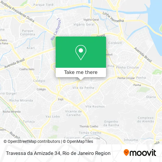
See Travessa da Amizade 34, Vila Da Penha, on the map
Public Transit to Travessa da Amizade 34 in Vila Da Penha
Wondering how to get to Travessa da Amizade 34 in Vila Da Penha? Moovit helps you find the best way to get to Travessa da Amizade 34 with step-by-step directions from the nearest public transit station.
Moovit provides free maps and live directions to help you navigate through your city. View schedules, routes, timetables, and find out how long does it take to get to Travessa da Amizade 34 in real time.
Looking for the nearest stop or station to Travessa da Amizade 34? Check out this list of stops closest to your destination: Largo Do Bicão (Sentido Penha); Avenida Merití; Avenida Braz De Pina; Irajá; Brás De Pina.
Bus: 428L, 918, 926, 928, 350, 910, 919, 560L, 564, 775, 940, 951, 629, SN 629, 950.Metro: L2.Train: RAMAL SARACURUNA.
Want to see if there’s another route that gets you there at an earlier time? Moovit helps you find alternative routes or times. Get directions from and directions to Travessa da Amizade 34 easily from the Moovit App or Website.
We make riding to Travessa da Amizade 34 easy, which is why over 1.5 million users, including users in Vila Da Penha, trust Moovit as the best app for public transit. You don’t need to download an individual bus app or train app, Moovit is your all-in-one transit app that helps you find the best bus time or train time available.
For information on prices of bus, train and metro, costs and ride fares to Travessa da Amizade 34, please check the Moovit app.
Use the app to navigate to popular places including to the airport, hospital, stadium, grocery store, mall, coffee shop, school, college, and university.
Travessa da Amizade 34 Address: Tv. da Amizade, 34 - Vila da Penha, Rio de Janeiro - RJ, 21221-370, Brasil street in Vila Da Penha
- Pacheco,
- Farmácia Natural Botica,
- Utilicasa,
- Bradesco (Banco Bradesco),
- Vila da Penha | Largo do Bicão,
- Grao da Terra Largo do Bicao,
- Centro De Medicina Nuclear Da Guanabara,
- Meditrauma,
- Yakissoba Bicon,
- Igreja Evangelica Assembleia De Deus Cidade Santa,
- Largo Do Bicão,
- Lafe Serviços Diagnósticos Largo do Bicao,
- Thais Godoy Designer de Sobrancelhas,
- Fct Investimentos,
- Skate Parque Largo do Bicão,
- Lafe Laboratório Análise Clínicas,
- Extra Supermercado,
- Travessa da Brandura 506,
- McDonald's (McDonald's-Largo do Bicao),
- Clínica Alfa Med
Places Near Travessa da Amizade 34 (Vila Da Penha)
- Praia do Arpoador, Ipanema,
- Shopping Downtown, Barra Da Tijuca,
- Hospital Federal Do Andaraí, Andaraí,
- Shopping Rio Sul, Botafogo,
- Hospital Pedro Ernesto, Vila Isabel,
- Rua Licínio Cardoso, São Francisco Xavier,
- Feirão De Malhas, Duque De Caxias,
- Hospital Federal Cardoso Fontes, Jacarepaguá,
- Rio De Janeiro,
- Niterói, Niterói,
- Rodoviária Novo Rio (Rodoviária do Rio de Janeiro), Santo Cristo,
- Shopping RioSul, Botafogo,
- Shopping Nova América, Del Castilho,
- Feira Livre da Gloria, Glória,
- Rua Ulysses Guimarães 16, Cidade Nova,
- Avenida Rio Branco, Centro,
- Norte Shopping, Cachambi,
- Hospital Municipal Ronaldo Gazolla, Acari,
- Museu Do Amanhã, Centro,
- Avenida Venezuela 134, Saúde
How to get to popular places in Rio de Janeiro Region with public transit
Get around Vila Da Penha by public transit!
Traveling around Vila Da Penha has never been so easy. See step by step directions as you travel to any attraction, street or major public transit station. View bus and train schedules, arrival times, service alerts and detailed routes on a map, so you know exactly how to get to anywhere in Vila Da Penha.
When traveling to any destination around Vila Da Penha use Moovit's Live Directions with Get Off Notifications to know exactly where and how far to walk, how long to wait for your line, and how many stops are left. Moovit will alert you when it's time to get off — no need to constantly re-check whether yours is the next stop.
Wondering how to use public transit in Vila Da Penha or how to pay for public transit in Vila Da Penha? Moovit public transit app can help you navigate your way with public transit easily, and at minimum cost. It includes public transit fees, ticket prices, and costs. Looking for a map of Vila Da Penha public transit lines? Moovit public transit app shows all public transit maps in Vila Da Penha with all Bus, Train, Metro, Light Rail, Ferry, Cable Car, Gondola and Funicular routes and stops on an interactive map.
Rio de Janeiro Region has 8 transit type(s), including: Bus, Train, Metro, Light Rail, Ferry, Cable Car, Gondola and Funicular, operated by several transit agencies, including TrensRJ, Metrô Rio, VLT Carioca, Barcas Rio, BRT MOBI-Rio, Auto Viação Alpha, Auto Viação Tijuca, Gire Transportes, Transurb, Viação Nossa Senhora das Graças, Consórcio INTERSUL, Braso Lisboa (Municipal), Caprichosa Auto Ônibus, Auto Viação Três Amigos and Rodoviária Âncora Matias