How to get to Treasury by bus?
Click on the bus route to see step by step directions with maps, line arrival times and updated time schedules.
From Lorton, VA - Amtrak Auto Train Station (LOR), Fairfax County
290 minFrom Potomac Mills Mall, Prince William County
275 minFrom Lorton, VA, Fairfax County
284 minFrom Rose Gaming Resort, Prince William County
300 minFrom Busch Gardens Williamsburg (Employee Parking Lot), James City County
298 minFrom Amazon Fulfillment Center-Ric3, Richmond
79 minFrom Woodbridge, VA, Prince William County
219 minFrom UVA Hospital Medical Center, Charlottesville
364 min
Bus stop near Treasury in Chesterfield County
- Choctaw + Forest Hill, 2 min walk,VIEW
Bus lines to Treasury in Chesterfield County
What are the closest stations to Treasury?
The closest stations to Treasury are:
- Choctaw + Forest Hill is 85 yards away, 2 min walk.
Which bus lines stop near Treasury?
These bus lines stop near Treasury: 2A, 64.
What’s the nearest bus station to Treasury in Chesterfield County?
The nearest bus station to Treasury in Chesterfield County is Choctaw + Forest Hill. It’s a 2 min walk away.
What time is the first bus to Treasury in Chesterfield County?
The 2A is the first bus that goes to Treasury in Chesterfield County. It stops nearby at 5:11 AM.
What time is the last bus to Treasury in Chesterfield County?
The 2A is the last bus that goes to Treasury in Chesterfield County. It stops nearby at 11:57 PM.
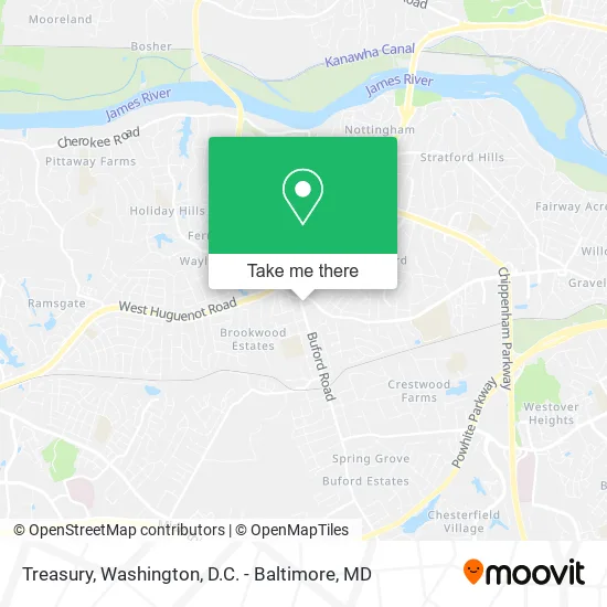
See Treasury, Chesterfield County, on the map
Public Transit to Treasury in Chesterfield County
Wondering how to get to Treasury in Chesterfield County? Moovit helps you find the best way to get to Treasury with step-by-step directions from the nearest public transit station.
Moovit provides free maps and live directions to help you navigate through your city. View schedules, routes, timetables, and find out how long does it take to get to Treasury in real time.
Looking for the nearest stop or station to Treasury? Check out this list of stops closest to your destination: Choctaw + Forest Hill.
Bus: 2A, 64.
Want to see if there’s another route that gets you there at an earlier time? Moovit helps you find alternative routes or times. Get directions from and directions to Treasury easily from the Moovit App or Website.
We make riding to Treasury easy, which is why over 1.5 million users, including users in Chesterfield County, trust Moovit as the best app for public transit. You don’t need to download an individual bus app or train app, Moovit is your all-in-one transit app that helps you find the best bus time or train time available.
For information on prices of bus and train, costs and ride fares to Treasury, please check the Moovit app.
Use the app to navigate to popular places including to the airport, hospital, stadium, grocery store, mall, coffee shop, school, college, and university.
Treasury Address: 2611 Buford Rd Richmond, VA 23235 street in Chesterfield County
- Kitchen Crafters & Bath,
- Appliance Solutions,
- Bon Air Branch Richmond Post Office,
- ATM,
- Bank of America,
- Better Floors,
- BMO Harris Bank,
- Libertyx Bitcoin ATM,
- CVS/pharmacy,
- Radiology Associates of Richmond,
- Department of Alcoholic Beverage Control,
- Richmond Mech Serv,
- Bon Air Better Living Products,
- Perk,
- Buford Road Imaging,
- Brooksbright LLC,
- Buford Road Pharmacy,
- Long Term Care,
- Virginia ABC,
- McCool's of Bon Air
Places Near Treasury (Chesterfield County)
- PG Mall, Prince George's County,
- Amazon Hq2, Arlington County,
- Warner Theatre, Washington,
- Basilica of the National Shrine, Washington,
- M&T Bank Stadium, Baltimore,
- National Museum of African American History and Culture, Washington,
- Washington National Cathedral, Washington,
- Georgetown, Washington,
- National Theatre, Washington,
- The Anthem, Washington,
- Washington DC VA Medical Center, Washington,
- Capital One Arena, Washington,
- Rock Creek Tennis Center, Washington,
- Pennsylvania Ave NW (3rd st and pennsylvania), Washington,
- Marriott Marquis Washington, DC, Washington,
- Camden Yards, Baltimore,
- National Zoo, Washington,
- Westfield Montgomery Mall, Montgomery County,
- Museum Of The Bible, Washington,
- Sibley Memorial Hospital, Washington
How to get to popular places in Washington, D.C. - Baltimore, MD with public transit
Get around Chesterfield County by public transit!
Traveling around Chesterfield County has never been so easy. See step by step directions as you travel to any attraction, street or major public transit station. View bus and train schedules, arrival times, service alerts and detailed routes on a map, so you know exactly how to get to anywhere in Chesterfield County.
When traveling to any destination around Chesterfield County use Moovit's Live Directions with Get Off Notifications to know exactly where and how far to walk, how long to wait for your line, and how many stops are left. Moovit will alert you when it's time to get off — no need to constantly re-check whether yours is the next stop.
Wondering how to use public transit in Chesterfield County or how to pay for public transit in Chesterfield County? Moovit public transit app can help you navigate your way with public transit easily, and at minimum cost. It includes public transit fees, ticket prices, and costs. Looking for a map of Chesterfield County public transit lines? Moovit public transit app shows all public transit maps in Chesterfield County with all Bus, Train, Metro, Light Rail and Ferry routes and stops on an interactive map.
Washington, D.C. - Baltimore, MD has 5 transit type(s), including: Bus, Train, Metro, Light Rail and Ferry, operated by several transit agencies, including WMATA, Montgomery County Ride On, Fairfax Connector, TheBus, PRTC, DASH - Alexandria, Arlington Transit (ART), RTA of Central Maryland, MDOT MTA, MDOT MTA Light RailLink, MDOT MTA Commuter Bus, MDOT MTA Local Bus, FXBGO!, Virginia Railway Express (VRE) and MARC